Property Record
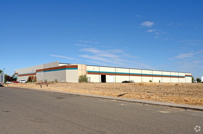
1701 Diesel Dr, Sacramento, CA 95838


NEARBY LISTINGS FOR SALE OR LEASE
Property Detail
1701 Diesel Dr
Sacramento--Roseville--Arden-Arcade, CA
Parcel Map Of 1701 Diesel Drive
238-0220-044
PARCEL MAP OF 1701 DIESEL DRIVE, LOT 1, UNIT:: 0, BLOCK:: 0, BLDG:: 0
Warehouse
Sacramento
X
California
06067C0068H
1
2024
7.22 AC
2025
McClellan
006400
Sacramento
121,204 SF
DEMOGRAPHICS near 1701 Diesel Dr
1 Mile
3 Mile
5 Mile
2024 Total Population
8,589
96,629
330,073
2029 Population
8,691
97,137
331,961
Pop Growth 2024-2029
+ 1.19%
+ 0.53%
+ 0.57%
Average Age
35
36
37
2024 Total Households
2,472
30,787
115,175
HH Growth 2024-2029
+ 1.21%
+ 0.49%
+ 0.56%
Median Household Inc
$61,454
$50,927
$63,373
Avg Household Size
3.30
3.00
2.70
2024 Avg HH Vehicles
2.00
2.00
2.00
Median Home Value
$314,802
$350,231
$404,457
Median Year Built
1980
1968
1974
Nearby Places
Map Layers
Map Styles
 Street
 Aerial
- Restaurants
- Banks
- Shops
- Fitness
- Groceries
PUBLIC TRANSPORTATION
COMMUTER RAIL
DRIVE
WALK
Distance
14 min
7.2 mi
AIRPORT
Sacramento International
DRIVE
WALK
Distance
Sacramento International
20 min
13.3 mi
Freight Ports
Port of Stockton
DRIVE
WALK
Distance
Port of Stockton
66 min
55.3 mi
Nearby Properties
Address
Land Use
TOTAL SIZE
Lot Size
Zoning
Address
Land Use
TOTAL SIZE
Lot Size
Zoning
224,595 SF
42.03 AC
SPA
Address
Land Use
TOTAL SIZE
Lot Size
Zoning
43,200 SF
38.55 AC
SPA
Address
Land Use
TOTAL SIZE
Lot Size
Zoning
152,000 SF
12.88 AC
SPA
Address
Land Use
TOTAL SIZE
Lot Size
Zoning
417,214 SF
23.66 AC
SPA
Address
Land Use
TOTAL SIZE
Lot Size
Zoning
15.83 AC
MRD-SPD
Address
Land Use
TOTAL SIZE
Lot Size
Zoning
170,556 SF
8.41 AC
SPA
Address
Land Use
TOTAL SIZE
Lot Size
Zoning
1,221,441 SF
36.86 AC
SPA
Address
Land Use
TOTAL SIZE
Lot Size
Zoning
136,483 SF
3.77 AC
BP
Address
Land Use
TOTAL SIZE
Lot Size
Zoning
106,700 SF
5.38 AC
RD-30
Address
Land Use
TOTAL SIZE
Lot Size
Zoning
263,792 SF
7.27 AC
SPA
Address
Land Use
TOTAL SIZE
Lot Size
Zoning
108,400 SF
5.51 AC
M-1S-R
Address
Land Use
TOTAL SIZE
Lot Size
Zoning
316,754 SF
21.68 AC
C-2
Address
Land Use
TOTAL SIZE
Lot Size
Zoning
123,622 SF
5.93 AC
RD-20
Address
Land Use
TOTAL SIZE
Lot Size
Zoning
148,576 SF
4.84 AC
RD-30
Address
Land Use
TOTAL SIZE
Lot Size
Zoning
9.81 AC
SPA
Address
Land Use
TOTAL SIZE
Lot Size
Zoning
Address
Land Use
TOTAL SIZE
Lot Size
Zoning
81,538 SF
17.65 AC
A
Address
Land Use
TOTAL SIZE
Lot Size
Zoning
33,355 SF
2.76 AC
H
Address
Land Use
TOTAL SIZE
Lot Size
Zoning
117,288 SF
6.14 AC
M-1S-R
Address
Land Use
TOTAL SIZE
Lot Size
Zoning
100,462 SF
5.02 AC
RD-30
Address
Land Use
TOTAL SIZE
Lot Size
Zoning
164,000 SF
8.32 AC
SPA
Address
Land Use
TOTAL SIZE
Lot Size
Zoning
89,613 SF
4.48 AC
SPA
Address
Land Use
TOTAL SIZE
Lot Size
Zoning
158,315 SF
7.59 AC
M-1-PUD
Address
Land Use
TOTAL SIZE
Lot Size
Zoning
116,926 SF
7.23 AC
SPA
Address
Land Use
TOTAL SIZE
Lot Size
Zoning
171,021 SF
13 AC
M-1
Address
Land Use
TOTAL SIZE
Lot Size
Zoning
73,342 SF
4.88 AC
C-4-PUD
Address
Land Use
TOTAL SIZE
Lot Size
Zoning
56,668 SF
4.01 AC
SPA
Address
Land Use
TOTAL SIZE
Lot Size
Zoning
2.76 AC
SPA
Address
Land Use
TOTAL SIZE
Lot Size
Zoning
90,112 SF
4.44 AC
RD-30
Address
Land Use
TOTAL SIZE
Lot Size
Zoning
576,506 SF
21.22 AC
SPA
The World's #1 Commercial Real Estate Marketplace
Connect with us
© 2026 CoStar Group
The information above has been obtained from sources believed reliable. While we do not doubt its accuracy we have not verified it and make no guarantee, warranty or representation about it. It is your responsibility to independently confirm its accuracy and completeness. Any projections, opinions, assumptions, or estimates used are for example only and do not represent the current or future performance of the property. The value of this transaction to you depends on tax and other factors which should be evaluated by your tax, financial, and legal advisors. You and your advisors should conduct a careful, independent investigation of the property to determine to your satisfaction the suitability of the property for your needs.