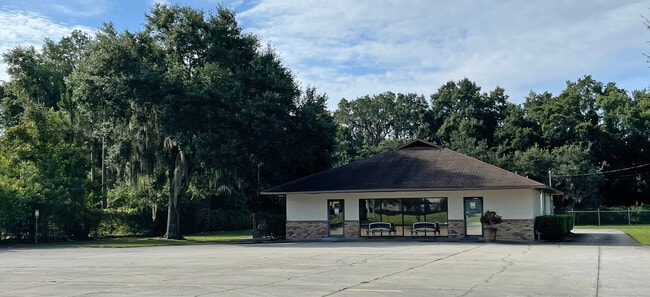
Property Record
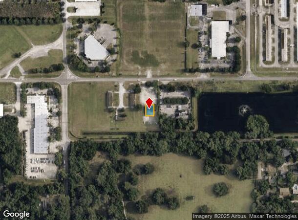
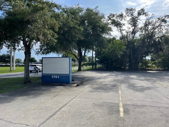
1701 E Airport Blvd, Sanford, FL 32773
Current Lease Availabilities
NEARBY LISTINGS FOR SALE OR LEASE
Property Detail
1701 E Airport Blvd
07-20-31-503-0300-4400
Palm Park Sanford
Officebuilding
SEC 07 TWP 20S RGE 31E BLDG 440 SANFORD AIRPORT
X
Seminole
12069C0450E
Florida
2024
0.10 AC
2024
E Seminole Outlying
021000
Orlando
2,684 SF
Orlando-Kissimmee-Sanford, FL
DEMOGRAPHICS near 1701 E Airport Blvd
1 Mile
3 Mile
5 Mile
2024 Total Population
4,547
53,147
90,115
2029 Population
4,727
55,788
94,333
Pop Growth 2024-2029
+ 3.96%
+ 4.97%
+ 4.68%
Average Age
39
39
39
2024 Total Households
1,670
19,332
33,428
HH Growth 2024-2029
+ 4.07%
+ 4.99%
+ 4.76%
Median Household Inc
$59,602
$53,892
$60,782
Avg Household Size
2.60
2.60
2.60
2024 Avg HH Vehicles
2.00
2.00
2.00
Median Home Value
$193,462
$227,500
$268,305
Median Year Built
1977
1986
1990
Nearby Places
- Restaurants
- Banks
- Shops
- Fitness
- Groceries
PUBLIC TRANSPORTATION
COMMUTER RAIL
DRIVE
WALK
Distance
11 min
4.7 mi
DRIVE
WALK
Distance
10 min
4.9 mi
AIRPORT
Orlando Sanford International
DRIVE
WALK
Distance
Orlando Sanford International
3 min
1.2 mi
Orlando International
DRIVE
WALK
Distance
Orlando International
40 min
31.6 mi
Daytona Beach International
DRIVE
WALK
Distance
Daytona Beach International
52 min
38.9 mi
Freight Ports
Port Canaveral
DRIVE
WALK
Distance
Port Canaveral
77 min
64.6 mi
Nearby Properties
Address
Land Use
TOTAL SIZE
Lot Size
Zoning
Address
Land Use
TOTAL SIZE
Lot Size
Zoning
413,982 SF
0.05 AC
RI1
Address
Land Use
TOTAL SIZE
Lot Size
Zoning
615.80 AC
RI1
Address
Land Use
TOTAL SIZE
Lot Size
Zoning
377.80 AC
C2
Address
Land Use
TOTAL SIZE
Lot Size
Zoning
864 SF
9.99 AC
A1
Address
Land Use
TOTAL SIZE
Lot Size
Zoning
209,424 SF
12.93 AC
MR2
Address
Land Use
TOTAL SIZE
Lot Size
Zoning
362,876 SF
22.06 AC
MR3
Address
Land Use
TOTAL SIZE
Lot Size
Zoning
216,071 SF
77 AC
A1
Address
Land Use
TOTAL SIZE
Lot Size
Zoning
365,961 SF
18.41 AC
MR3
Address
Land Use
TOTAL SIZE
Lot Size
Zoning
428,525 SF
20.81 AC
A1
Address
Land Use
TOTAL SIZE
Lot Size
Zoning
10,900 SF
38.31 AC
RI1
Address
Land Use
TOTAL SIZE
Lot Size
Zoning
138,513 SF
14.95 AC
GC2
Address
Land Use
TOTAL SIZE
Lot Size
Zoning
101.53 AC
PUD
Address
Land Use
TOTAL SIZE
Lot Size
Zoning
112,946 SF
37.72 AC
PD
Address
Land Use
TOTAL SIZE
Lot Size
Zoning
19.06 AC
A1
Address
Land Use
TOTAL SIZE
Lot Size
Zoning
209,331 SF
18.73 AC
GC2
Address
Land Use
TOTAL SIZE
Lot Size
Zoning
158,656 SF
17.80 AC
GC2
Address
Land Use
TOTAL SIZE
Lot Size
Zoning
121,720 SF
7.20 AC
GC2
Address
Land Use
TOTAL SIZE
Lot Size
Zoning
Address
Land Use
TOTAL SIZE
Lot Size
Zoning
286,491 SF
13.96 AC
R1A
Address
Land Use
TOTAL SIZE
Lot Size
Zoning
115,431 SF
61 AC
PLI
Address
Land Use
TOTAL SIZE
Lot Size
Zoning
480 SF
20.56 AC
GC2
Address
Land Use
TOTAL SIZE
Lot Size
Zoning
480 SF
16.38 AC
MR3
Address
Land Use
TOTAL SIZE
Lot Size
Zoning
57,712 SF
10.98 AC
Address
Land Use
TOTAL SIZE
Lot Size
Zoning
176,946 SF
24 AC
MI2
Address
Land Use
TOTAL SIZE
Lot Size
Zoning
75,481 SF
7.08 AC
M1
Address
Land Use
TOTAL SIZE
Lot Size
Zoning
97.58 AC
AG
Address
Land Use
TOTAL SIZE
Lot Size
Zoning
260,950 SF
11.85 AC
MI2
Address
Land Use
TOTAL SIZE
Lot Size
Zoning
5,150 SF
17.30 AC
SC3
Address
Land Use
TOTAL SIZE
Lot Size
Zoning
125,618 SF
9.07 AC
MR3
Address
Land Use
TOTAL SIZE
Lot Size
Zoning
The World's #1 Commercial Real Estate Marketplace
Connect with us
© 2025 CoStar Group
The information above has been obtained from sources believed reliable. While we do not doubt its accuracy we have not verified it and make no guarantee, warranty or representation about it. It is your responsibility to independently confirm its accuracy and completeness. Any projections, opinions, assumptions, or estimates used are for example only and do not represent the current or future performance of the property. The value of this transaction to you depends on tax and other factors which should be evaluated by your tax, financial, and legal advisors. You and your advisors should conduct a careful, independent investigation of the property to determine to your satisfaction the suitability of the property for your needs.