Property Record
1701 E Highway 264, Springdale, AR 72764
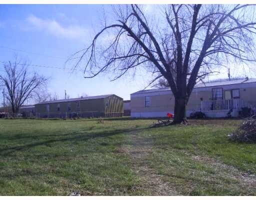


Property Detail
1701 E Highway 264
Fayetteville-Springdale-Rogers, AR
AKA PARCELS 1, 2, 3 & 4, IN A SUBDIVISION OF PART OF THE NW1/4 OF THE NE1/4 AND A PART OF THE NE1/4 OF THE NW1/4, ALL IN SECTION 19, T-18-N, R-29-W, AS DESIGNATED IN PLAT RECORD G AT PAGE 45. LESS & EXCEPT: A PART OF THE NW1/4 OF THE NE1/4 BEGINNING
21-00021-000
BENTON
Commercialnec
Arkansas
B and X Area of moderate flood hazard, usually the area between the limits of the 100-year and 500-year floods.
1-4
2025
7.77 AC
2025
Outer Central Benton County
010307
Fayetteville/Springdale/Rogers
NEARBY LISTINGS FOR SALE OR LEASE
DEMOGRAPHICS near 1701 E Highway 264
1 mile
3 mile
5 mile
2025 Total Population
3,218
32,253
97,691
2030 Population
3,549
34,977
105,489
Pop Growth 2025-2030
+ 10.29%
+ 8.45%
+ 7.98%
Average Age
33
34
35
2025 Total Households
907
9,691
30,840
HH Growth 2025-2030
+ 10.47%
+ 8.70%
+ 8.25%
Median Household Inc
$90,908
$66,553
$70,326
Avg Household Size
3.50
3.20
3.00
2025 Avg HH Vehicles
2.00
2.00
2.00
Median Home Value
$286,904
$266,800
$272,528
Median Year Built
1997
1995
1995
Nearby Places
Map Layers
Map Styles
 Street
 Aerial
Layers
 Traffic
 Biking
Places
Listings with unknown addresses are not visible on the map
- Restaurants
- Banks
- Shops
- Fitness
- Groceries
PUBLIC TRANSPORTATION
AIRPORT
Northwest Arkansas Ntl
Drive
Walk
Distance
Northwest Arkansas Ntl
31 min
15.7 mi
Freight Ports
Tulsa Port of Inola
Drive
Walk
Distance
Tulsa Port of Inola
109 min
91.3 mi
Nearby Properties
Address
Land Use
TOTAL SIZE
Lot Size
Zoning
Address
Land Use
TOTAL SIZE
Lot Size
Zoning
367,076 SF
57.31 AC
Address
Land Use
TOTAL SIZE
Lot Size
Zoning
132,494 SF
21.56 AC
Address
Land Use
TOTAL SIZE
Lot Size
Zoning
191,100 SF
10.03 AC
Address
Land Use
TOTAL SIZE
Lot Size
Zoning
75,610 SF
5.62 AC
Address
Land Use
TOTAL SIZE
Lot Size
Zoning
292,470 SF
17.27 AC
Address
Land Use
TOTAL SIZE
Lot Size
Zoning
174,333 SF
25 AC
I1I2
Address
Land Use
TOTAL SIZE
Lot Size
Zoning
348,916 SF
24.69 AC
Address
Land Use
TOTAL SIZE
Lot Size
Zoning
224,408 SF
9.80 AC
I1
Address
Land Use
TOTAL SIZE
Lot Size
Zoning
206,446 SF
17.14 AC
Address
Land Use
TOTAL SIZE
Lot Size
Zoning
182,415 SF
68.93 AC
Address
Land Use
TOTAL SIZE
Lot Size
Zoning
182,415 SF
12.04 AC
Address
Land Use
TOTAL SIZE
Lot Size
Zoning
80,475 SF
0.45 AC
C3
Address
Land Use
TOTAL SIZE
Lot Size
Zoning
73,711 SF
3.59 AC
Address
Land Use
TOTAL SIZE
Lot Size
Zoning
147,762 SF
Address
Land Use
TOTAL SIZE
Lot Size
Zoning
352,195 SF
15 AC
Address
Land Use
TOTAL SIZE
Lot Size
Zoning
54,460 SF
6.38 AC
Address
Land Use
TOTAL SIZE
Lot Size
Zoning
153,968 SF
21 AC
Address
Land Use
TOTAL SIZE
Lot Size
Zoning
364,696 SF
4.49 AC
Address
Land Use
TOTAL SIZE
Lot Size
Zoning
189,244 SF
11.16 AC
I2
Address
Land Use
TOTAL SIZE
Lot Size
Zoning
55,663 SF
2.54 AC
Address
Land Use
TOTAL SIZE
Lot Size
Zoning
51,376 SF
5.86 AC
Address
Land Use
TOTAL SIZE
Lot Size
Zoning
81,121 SF
10.99 AC
Address
Land Use
TOTAL SIZE
Lot Size
Zoning
64,308 SF
8.71 AC
Address
Land Use
TOTAL SIZE
Lot Size
Zoning
38,058 SF
9.13 AC
Address
Land Use
TOTAL SIZE
Lot Size
Zoning
62,351 SF
4.75 AC
I2
Address
Land Use
TOTAL SIZE
Lot Size
Zoning
49,059 SF
2.42 AC
Address
Land Use
TOTAL SIZE
Lot Size
Zoning
83,998 SF
3.58 AC
C2
Address
Land Use
TOTAL SIZE
Lot Size
Zoning
85,560 SF
6.38 AC
Address
Land Use
TOTAL SIZE
Lot Size
Zoning
44,944 SF
9.59 AC
Address
Land Use
TOTAL SIZE
Lot Size
Zoning
141,862 SF
8 AC
The World's #1 Commercial Real Estate Marketplace
Connect with us
© 2026 CoStar Group
The information above has been obtained from sources believed reliable. While we do not doubt its accuracy we have not verified it and make no guarantee, warranty or representation about it. It is your responsibility to independently confirm its accuracy and completeness. Any projections, opinions, assumptions, or estimates used are for example only and do not represent the current or future performance of the property. The value of this transaction to you depends on tax and other factors which should be evaluated by your tax, financial, and legal advisors. You and your advisors should conduct a careful, independent investigation of the property to determine to your satisfaction the suitability of the property for your needs.