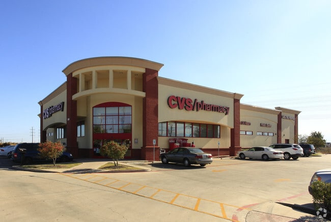
Property Record
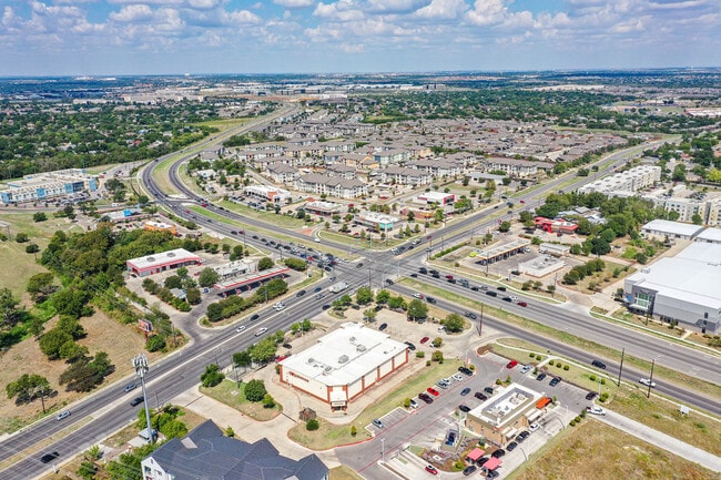
1701 E Parmer Ln, Austin, TX 78754

Property Detail
1701 E Parmer Ln
Austin-Round Rock-San Marcos, TX
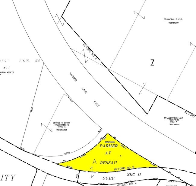
LOT 1 BLK A DESSAU CORNER SUBD
478048
Travis
Storebuilding
Texas
B and X Area of moderate flood hazard, usually the area between the limits of the 100-year and 500-year floods.
1
2025
1.51 AC
2025
Northeast
043500
Austin
14,863 SF
NEARBY LISTINGS FOR SALE OR LEASE
DEMOGRAPHICS near 1701 E Parmer Ln
1 mile
3 mile
5 mile
2024 Total Population
16,390
90,846
257,541
2029 Population
17,272
95,792
269,603
Pop Growth 2024-2029
+ 5.38%
+ 5.44%
+ 4.68%
Average Age
35
36
37
2024 Total Households
6,388
33,608
103,199
HH Growth 2024-2029
+ 6.07%
+ 5.93%
+ 5.22%
Median Household Inc
$80,580
$85,219
$77,037
Avg Household Size
2.50
2.60
2.40
2024 Avg HH Vehicles
2.00
2.00
2.00
Median Home Value
$364,491
$382,598
$401,897
Median Year Built
2007
2004
1997
Nearby Places
Map Layers
Map Styles
 Street
 Aerial
Transit
 Traffic
 Biking
Places
Listings with unknown addresses are not visible on the map
- Restaurants
- Banks
- Shops
- Fitness
- Groceries
PUBLIC TRANSPORTATION
AIRPORT
Austin-Bergstrom International
Drive
Walk
Distance
Austin-Bergstrom International
34 min
22.6 mi
SALE & LEASE HISTORY
LISTING DATE
SALE/LEASE

Oct 21, 2016
For Sale
Nov 01, 2023
For Sale
Feb 27, 2024
For Sale
Feb 27, 2017
For Sale
Feb 16, 2017
For Sale
Nearby Properties
Address
Land Use
TOTAL SIZE
Lot Size
Zoning
Address
Land Use
TOTAL SIZE
Lot Size
Zoning
4,355 SF
263.17 AC
Address
Land Use
TOTAL SIZE
Lot Size
Zoning
368,100 SF
38.07 AC
Address
Land Use
TOTAL SIZE
Lot Size
Zoning
491,412 SF
25.66 AC
Address
Land Use
TOTAL SIZE
Lot Size
Zoning
287,272 SF
17.68 AC
Address
Land Use
TOTAL SIZE
Lot Size
Zoning
348,496 SF
17.59 AC
Address
Land Use
TOTAL SIZE
Lot Size
Zoning
398,475 SF
35.14 AC
Address
Land Use
TOTAL SIZE
Lot Size
Zoning
379,500 SF
17.99 AC
Address
Land Use
TOTAL SIZE
Lot Size
Zoning
381,495 SF
13.54 AC
Address
Land Use
TOTAL SIZE
Lot Size
Zoning
6,498 SF
236.84 AC
Address
Land Use
TOTAL SIZE
Lot Size
Zoning
709,789 SF
52.90 AC
Address
Land Use
TOTAL SIZE
Lot Size
Zoning
307,036 SF
21.64 AC
Address
Land Use
TOTAL SIZE
Lot Size
Zoning
459,304 SF
28.36 AC
Address
Land Use
TOTAL SIZE
Lot Size
Zoning
752,804 SF
180.91 AC
Address
Land Use
TOTAL SIZE
Lot Size
Zoning
401,976 SF
38.07 AC
Address
Land Use
TOTAL SIZE
Lot Size
Zoning
311,850 SF
18.09 AC
Address
Land Use
TOTAL SIZE
Lot Size
Zoning
270,780 SF
18.17 AC
Address
Land Use
TOTAL SIZE
Lot Size
Zoning
237,600 SF
14.10 AC
Address
Land Use
TOTAL SIZE
Lot Size
Zoning
323,425 SF
14.20 AC
Address
Land Use
TOTAL SIZE
Lot Size
Zoning
384,776 SF
22.88 AC
Address
Land Use
TOTAL SIZE
Lot Size
Zoning
313,414 SF
37.71 AC
Address
Land Use
TOTAL SIZE
Lot Size
Zoning
264,401 SF
10.48 AC
Address
Land Use
TOTAL SIZE
Lot Size
Zoning
374,432 SF
14.28 AC
Address
Land Use
TOTAL SIZE
Lot Size
Zoning
341,480 SF
16.35 AC
Address
Land Use
TOTAL SIZE
Lot Size
Zoning
439,312 SF
30.08 AC
Address
Land Use
TOTAL SIZE
Lot Size
Zoning
335,856 SF
18.55 AC
Address
Land Use
TOTAL SIZE
Lot Size
Zoning
272,250 SF
15.31 AC
Address
Land Use
TOTAL SIZE
Lot Size
Zoning
7,260 SF
93.05 AC
Address
Land Use
TOTAL SIZE
Lot Size
Zoning
297,000 SF
16.01 AC
Address
Land Use
TOTAL SIZE
Lot Size
Zoning
242,484 SF
15.50 AC
Address
Land Use
TOTAL SIZE
Lot Size
Zoning
330,841 SF
16.48 AC
The World's #1 Commercial Real Estate Marketplace
Connect with us
© 2026 CoStar Group
The information above has been obtained from sources believed reliable. While we do not doubt its accuracy we have not verified it and make no guarantee, warranty or representation about it. It is your responsibility to independently confirm its accuracy and completeness. Any projections, opinions, assumptions, or estimates used are for example only and do not represent the current or future performance of the property. The value of this transaction to you depends on tax and other factors which should be evaluated by your tax, financial, and legal advisors. You and your advisors should conduct a careful, independent investigation of the property to determine to your satisfaction the suitability of the property for your needs.