Property Record
1701 N General Bruce Dr, Temple, TX 76504

Property Detail
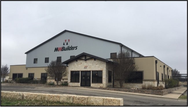
1701 N General Bruce Dr
Killeen-Temple, TX
MW BUILDERS SUBDIVISION, BLOCK 001, LOT PT 1, (1, LESS SW STRIP), ACRES 9.114
421365
BELL
Commercialnec
Texas
B and X Area of moderate flood hazard, usually the area between the limits of the 100-year and 500-year floods.
1
0
9.11 AC
2025
Temple
020702
Killeen/Temple/Fort Hood
24,771 SF
NEARBY LISTINGS FOR SALE OR LEASE
DEMOGRAPHICS near 1701 N General Bruce Dr
1 mile
3 mile
5 mile
2025 Total Population
5,048
38,486
78,025
2030 Population
5,394
40,998
83,379
Pop Growth 2025-2030
+ 6.85%
+ 6.53%
+ 6.86%
Average Age
38
38
38
2025 Total Households
2,004
15,939
31,761
HH Growth 2025-2030
+ 6.94%
+ 6.55%
+ 6.90%
Median Household Inc
$66,346
$56,278
$64,459
Avg Household Size
2.50
2.30
2.40
2025 Avg HH Vehicles
2.00
2.00
2.00
Median Home Value
$201,338
$186,616
$239,911
Median Year Built
1976
1978
1987
Nearby Places
Map Layers
Map Styles
 Street
 Aerial
Transit
 Traffic
 Biking
Places
Listings with unknown addresses are not visible on the map
- Restaurants
- Banks
- Shops
- Fitness
- Groceries
PUBLIC TRANSPORTATION
AIRPORT
Killeen Municipal
Drive
Walk
Distance
Killeen Municipal
31 min
24.0 mi
Robert Gray AAF
Drive
Walk
Distance
Robert Gray AAF
50 min
37.9 mi
Waco Regional
Drive
Walk
Distance
Waco Regional
55 min
41.4 mi
SALE & LEASE HISTORY
LISTING DATE
SALE/LEASE

Mar 08, 2019
For Lease
Nearby Properties
Address
Land Use
TOTAL SIZE
Lot Size
Zoning
Address
Land Use
TOTAL SIZE
Lot Size
Zoning
1,656,661 SF
194.39 AC
Address
Land Use
TOTAL SIZE
Lot Size
Zoning
274,710 SF
38.05 AC
C
Address
Land Use
TOTAL SIZE
Lot Size
Zoning
1,546,481 SF
111.97 AC
MF2
Address
Land Use
TOTAL SIZE
Lot Size
Zoning
86,326 SF
8.70 AC
MF1
Address
Land Use
TOTAL SIZE
Lot Size
Zoning
77,450 SF
16.51 AC
Address
Land Use
TOTAL SIZE
Lot Size
Zoning
Address
Land Use
TOTAL SIZE
Lot Size
Zoning
180,360 SF
9.66 AC
Address
Land Use
TOTAL SIZE
Lot Size
Zoning
208,941 SF
9.23 AC
Address
Land Use
TOTAL SIZE
Lot Size
Zoning
Address
Land Use
TOTAL SIZE
Lot Size
Zoning
71,378 SF
13.75 AC
Address
Land Use
TOTAL SIZE
Lot Size
Zoning
71,378 SF
14.37 AC
A
Address
Land Use
TOTAL SIZE
Lot Size
Zoning
214,028 SF
14.37 AC
Address
Land Use
TOTAL SIZE
Lot Size
Zoning
Address
Land Use
TOTAL SIZE
Lot Size
Zoning
188,072 SF
9.51 AC
C
Address
Land Use
TOTAL SIZE
Lot Size
Zoning
Address
Land Use
TOTAL SIZE
Lot Size
Zoning
168,754 SF
10.36 AC
LI
Address
Land Use
TOTAL SIZE
Lot Size
Zoning
612,900 SF
38.68 AC
Address
Land Use
TOTAL SIZE
Lot Size
Zoning
41,630 SF
11.85 AC
Address
Land Use
TOTAL SIZE
Lot Size
Zoning
195,291 SF
36.30 AC
Address
Land Use
TOTAL SIZE
Lot Size
Zoning
153,043 SF
12.61 AC
Address
Land Use
TOTAL SIZE
Lot Size
Zoning
85,860 SF
4.26 AC
Address
Land Use
TOTAL SIZE
Lot Size
Zoning
71,931 SF
8.64 AC
Address
Land Use
TOTAL SIZE
Lot Size
Zoning
261,265 SF
17.50 AC
C
Address
Land Use
TOTAL SIZE
Lot Size
Zoning
1,088 SF
Address
Land Use
TOTAL SIZE
Lot Size
Zoning
159,250 SF
0.85 AC
CA
Address
Land Use
TOTAL SIZE
Lot Size
Zoning
81,608 SF
11.15 AC
2F
Address
Land Use
TOTAL SIZE
Lot Size
Zoning
206,897 SF
12.51 AC
COMB
Address
Land Use
TOTAL SIZE
Lot Size
Zoning
155,262 SF
10 AC
MF2
Address
Land Use
TOTAL SIZE
Lot Size
Zoning
176,542 SF
11.50 AC
COMB
Address
Land Use
TOTAL SIZE
Lot Size
Zoning
71,382 SF
59.32 AC
The World's #1 Commercial Real Estate Marketplace
Connect with us
© 2026 CoStar Group
The information above has been obtained from sources believed reliable. While we do not doubt its accuracy we have not verified it and make no guarantee, warranty or representation about it. It is your responsibility to independently confirm its accuracy and completeness. Any projections, opinions, assumptions, or estimates used are for example only and do not represent the current or future performance of the property. The value of this transaction to you depends on tax and other factors which should be evaluated by your tax, financial, and legal advisors. You and your advisors should conduct a careful, independent investigation of the property to determine to your satisfaction the suitability of the property for your needs.