Property Record
1701 Pinehurst Rd, Dunedin, FL 34698
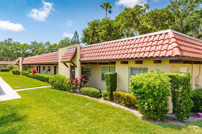
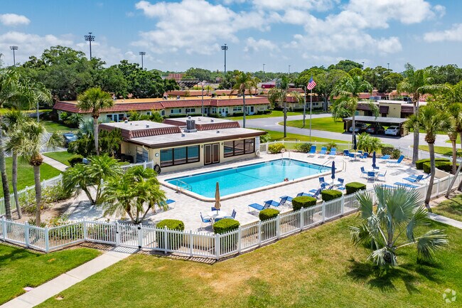
Property Detail
1701 Pinehurst Rd
Tampa-St. Petersburg-Clearwater, FL
PINEHURST VILLAGE UNIT VII CONDO BLDG 33, APT A
23-28-15-69477-000-0001
Pinellas
Commercialacreage
Florida
C and X Area of minimal flood hazard, usually depicted on FIRMs as above the 500-year flood level.
25.87 AC
2024
Dunedin
2025
Tampa/St Petersburg
026908
NEARBY LISTINGS FOR SALE OR LEASE
DEMOGRAPHICS near 1701 Pinehurst Rd
1 mile
3 mile
5 mile
2025 Total Population
10,372
87,716
199,790
2030 Population
10,362
87,854
199,720
Pop Growth 2025-2030
(0.10%)
+ 0.16%
(0.04%)
Average Age
52
50
48
2025 Total Households
4,977
42,167
90,976
HH Growth 2025-2030
(0.36%)
+ 0.08%
(0.13%)
Median Household Inc
$82,097
$70,887
$70,875
Avg Household Size
2.00
2.00
2.10
2025 Avg HH Vehicles
2.00
2.00
2.00
Median Home Value
$449,584
$385,815
$393,642
Median Year Built
1974
1978
1979
Nearby Places
Map Layers
Map Styles
 Street
 Aerial
Layers
 Traffic
 Biking
Places
Listings with unknown addresses are not visible on the map
- Restaurants
- Banks
- Shops
- Fitness
- Groceries
PUBLIC TRANSPORTATION
AIRPORT
St Pete-Clearwater International
Drive
Walk
Distance
St Pete-Clearwater International
24 min
13.1 mi
Tampa International
Drive
Walk
Distance
Tampa International
37 min
21.1 mi
Freight Ports
Port of Tampa Bay
Drive
Walk
Distance
Port of Tampa Bay
50 min
29.6 mi
Nearby Properties
Address
Land Use
TOTAL SIZE
Lot Size
Zoning
Address
Land Use
TOTAL SIZE
Lot Size
Zoning
675,202 SF
43.24 AC
Address
Land Use
TOTAL SIZE
Lot Size
Zoning
724,220 SF
22.95 AC
Address
Land Use
TOTAL SIZE
Lot Size
Zoning
460,041 SF
44.28 AC
Address
Land Use
TOTAL SIZE
Lot Size
Zoning
384,016 SF
12.06 AC
Address
Land Use
TOTAL SIZE
Lot Size
Zoning
167,201 SF
63.11 AC
AE
Address
Land Use
TOTAL SIZE
Lot Size
Zoning
406,729 SF
29.79 AC
CP1
Address
Land Use
TOTAL SIZE
Lot Size
Zoning
412,099 SF
49.21 AC
Address
Land Use
TOTAL SIZE
Lot Size
Zoning
278,505 SF
38.67 AC
Address
Land Use
TOTAL SIZE
Lot Size
Zoning
242,708 SF
26.17 AC
RPD10
Address
Land Use
TOTAL SIZE
Lot Size
Zoning
362,238 SF
13.80 AC
Address
Land Use
TOTAL SIZE
Lot Size
Zoning
239,480 SF
18.89 AC
RPD5
Address
Land Use
TOTAL SIZE
Lot Size
Zoning
215,081 SF
16.60 AC
Address
Land Use
TOTAL SIZE
Lot Size
Zoning
117,024 SF
56.52 AC
Address
Land Use
TOTAL SIZE
Lot Size
Zoning
241,170 SF
17.23 AC
Address
Land Use
TOTAL SIZE
Lot Size
Zoning
161,404 SF
18.48 AC
CP2
Address
Land Use
TOTAL SIZE
Lot Size
Zoning
191,375 SF
13.58 AC
AE
Address
Land Use
TOTAL SIZE
Lot Size
Zoning
186,967 SF
16.86 AC
Address
Land Use
TOTAL SIZE
Lot Size
Zoning
199,825 SF
22.75 AC
R2
Address
Land Use
TOTAL SIZE
Lot Size
Zoning
250,113 SF
39.50 AC
Address
Land Use
TOTAL SIZE
Lot Size
Zoning
196,808 SF
12.70 AC
Address
Land Use
TOTAL SIZE
Lot Size
Zoning
220,640 SF
9.02 AC
Address
Land Use
TOTAL SIZE
Lot Size
Zoning
201,208 SF
2.16 AC
Address
Land Use
TOTAL SIZE
Lot Size
Zoning
173,160 SF
5.39 AC
Address
Land Use
TOTAL SIZE
Lot Size
Zoning
107,766 SF
25.15 AC
Address
Land Use
TOTAL SIZE
Lot Size
Zoning
158,400 SF
9.80 AC
Address
Land Use
TOTAL SIZE
Lot Size
Zoning
396,841 SF
9.73 AC
Address
Land Use
TOTAL SIZE
Lot Size
Zoning
130,628 SF
10.26 AC
Address
Land Use
TOTAL SIZE
Lot Size
Zoning
94,029 SF
19.67 AC
RPD75
Address
Land Use
TOTAL SIZE
Lot Size
Zoning
415,593 SF
29.66 AC
Address
Land Use
TOTAL SIZE
Lot Size
Zoning
236,952 SF
14.48 AC
The World's #1 Commercial Real Estate Marketplace
Connect with us
© 2026 CoStar Group
The information above has been obtained from sources believed reliable. While we do not doubt its accuracy we have not verified it and make no guarantee, warranty or representation about it. It is your responsibility to independently confirm its accuracy and completeness. Any projections, opinions, assumptions, or estimates used are for example only and do not represent the current or future performance of the property. The value of this transaction to you depends on tax and other factors which should be evaluated by your tax, financial, and legal advisors. You and your advisors should conduct a careful, independent investigation of the property to determine to your satisfaction the suitability of the property for your needs.