Property Record
1701 Rockride Ln, Georgetown, TX 78626

Property Detail
1701 Rockride Ln
Austin-Round Rock-San Marcos, TX
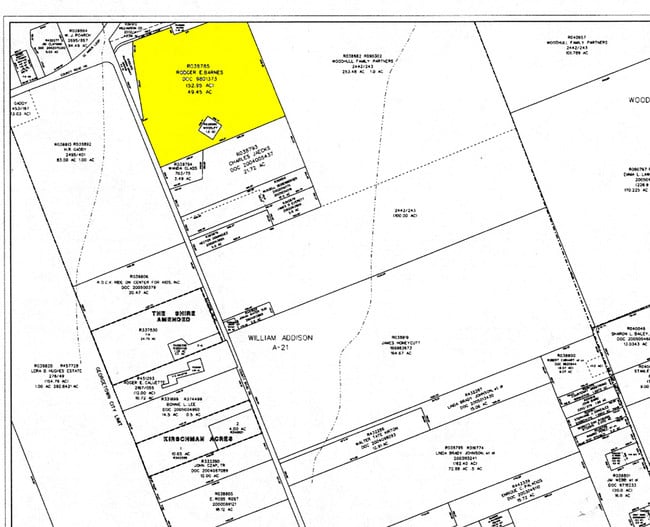
AW0021 AW0021 - ADDISON, WM. SUR., ACRES 49.3917
R038785
WILLIAMSON
Taxexempt
Texas
B and X Area of moderate flood hazard, usually the area between the limits of the 100-year and 500-year floods.
49.39 AC
2023
Georgetown
2025
Austin
020821
NEARBY LISTINGS FOR SALE OR LEASE
DEMOGRAPHICS near 1701 Rockride Ln
1 mile
3 mile
5 mile
2025 Total Population
7,914
44,004
109,669
2030 Population
9,292
51,276
127,627
Pop Growth 2025-2030
+ 17.41%
+ 16.53%
+ 16.37%
Average Age
37
37
38
2025 Total Households
2,639
15,538
41,063
HH Growth 2025-2030
+ 18.08%
+ 17.11%
+ 17.01%
Median Household Inc
$116,424
$100,815
$105,393
Avg Household Size
3.00
2.70
2.60
2025 Avg HH Vehicles
2.00
2.00
2.00
Median Home Value
$415,812
$407,688
$446,607
Median Year Built
2010
2010
2010
Nearby Places
Map Layers
Map Styles
 Street
 Aerial
Transit
 Traffic
 Biking
Places
Listings with unknown addresses are not visible on the map
- Restaurants
- Banks
- Shops
- Fitness
- Groceries
PUBLIC TRANSPORTATION
AIRPORT
Austin-Bergstrom International
Drive
Walk
Distance
Austin-Bergstrom International
51 min
42.1 mi
Freight Ports
Calhoun Port
Drive
Walk
Distance
Calhoun Port
211 min
185.1 mi
Nearby Properties
Address
Land Use
TOTAL SIZE
Lot Size
Zoning
Address
Land Use
TOTAL SIZE
Lot Size
Zoning
71.65 AC
1-RS
Address
Land Use
TOTAL SIZE
Lot Size
Zoning
145,000 SF
147.12 AC
Address
Land Use
TOTAL SIZE
Lot Size
Zoning
334,021 SF
50.48 AC
3-OF
Address
Land Use
TOTAL SIZE
Lot Size
Zoning
354,066 SF
40.51 AC
Address
Land Use
TOTAL SIZE
Lot Size
Zoning
331,518 SF
21.88 AC
Address
Land Use
TOTAL SIZE
Lot Size
Zoning
450,880 SF
54.28 AC
Address
Land Use
TOTAL SIZE
Lot Size
Zoning
294,214 SF
18.34 AC
Address
Land Use
TOTAL SIZE
Lot Size
Zoning
228,685 SF
10.32 AC
Address
Land Use
TOTAL SIZE
Lot Size
Zoning
252,492 SF
15.35 AC
Address
Land Use
TOTAL SIZE
Lot Size
Zoning
314,240 SF
16.03 AC
Address
Land Use
TOTAL SIZE
Lot Size
Zoning
238,704 SF
19.85 AC
Address
Land Use
TOTAL SIZE
Lot Size
Zoning
205,554 SF
12.13 AC
3-C-3
Address
Land Use
TOTAL SIZE
Lot Size
Zoning
288,312 SF
11.51 AC
Address
Land Use
TOTAL SIZE
Lot Size
Zoning
216,190 SF
15.09 AC
Address
Land Use
TOTAL SIZE
Lot Size
Zoning
184,400 SF
14.89 AC
Address
Land Use
TOTAL SIZE
Lot Size
Zoning
610,222 SF
10.16 AC
Address
Land Use
TOTAL SIZE
Lot Size
Zoning
176,875 SF
14.75 AC
3-C-1
Address
Land Use
TOTAL SIZE
Lot Size
Zoning
246,708 SF
11.56 AC
Address
Land Use
TOTAL SIZE
Lot Size
Zoning
96,760 SF
9.04 AC
2-I
Address
Land Use
TOTAL SIZE
Lot Size
Zoning
Address
Land Use
TOTAL SIZE
Lot Size
Zoning
232,526 SF
18.39 AC
Address
Land Use
TOTAL SIZE
Lot Size
Zoning
155,674 SF
10.96 AC
Address
Land Use
TOTAL SIZE
Lot Size
Zoning
121,117 SF
12.04 AC
Address
Land Use
TOTAL SIZE
Lot Size
Zoning
125,100 SF
4.39 AC
Address
Land Use
TOTAL SIZE
Lot Size
Zoning
2,460 SF
21.69 AC
Address
Land Use
TOTAL SIZE
Lot Size
Zoning
116,641 SF
5.93 AC
Address
Land Use
TOTAL SIZE
Lot Size
Zoning
49,000 SF
0.67 AC
Address
Land Use
TOTAL SIZE
Lot Size
Zoning
168,572 SF
10.73 AC
Address
Land Use
TOTAL SIZE
Lot Size
Zoning
103,176 SF
23.33 AC
The World's #1 Commercial Real Estate Marketplace
Connect with us
© 2026 CoStar Group
The information above has been obtained from sources believed reliable. While we do not doubt its accuracy we have not verified it and make no guarantee, warranty or representation about it. It is your responsibility to independently confirm its accuracy and completeness. Any projections, opinions, assumptions, or estimates used are for example only and do not represent the current or future performance of the property. The value of this transaction to you depends on tax and other factors which should be evaluated by your tax, financial, and legal advisors. You and your advisors should conduct a careful, independent investigation of the property to determine to your satisfaction the suitability of the property for your needs.