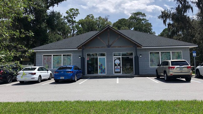
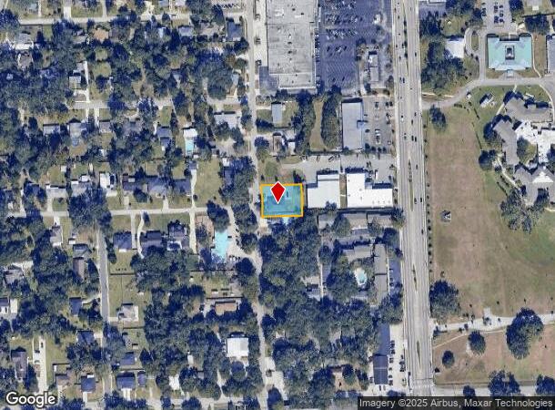
Property Record
1701 Smith St, Orange Park, FL 32073
NEARBY LISTINGS FOR SALE OR LEASE
Property Detail
1701 Smith St
Jacksonville, FL
Orange Park Sec 01
41-04-26-018763-000-00
PT OF LOT 43 SEC 1 O.P. AS REC OR 3980 PG 988
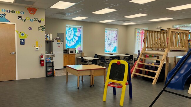
Officebuilding
Clay
X
Florida
12019C0087E
43
2024
0.34 AC
2025
Orange Park/Clay County
030600
Jacksonville (Florida)
2,400 SF
DEMOGRAPHICS near 1701 Smith St
1 Mile
3 Mile
5 Mile
2024 Total Population
4,880
41,800
114,331
2029 Population
5,393
45,224
122,153
Pop Growth 2024-2029
+ 10.51%
+ 8.19%
+ 6.84%
Average Age
46
41
41
2024 Total Households
2,047
16,217
44,262
HH Growth 2024-2029
+ 10.75%
+ 8.40%
+ 6.93%
Median Household Inc
$73,134
$62,487
$71,703
Avg Household Size
2.20
2.40
2.50
2024 Avg HH Vehicles
2.00
2.00
2.00
Median Home Value
$267,927
$232,833
$264,160
Median Year Built
1976
1982
1987
Nearby Places
- Restaurants
- Banks
- Shops
- Fitness
- Groceries
PUBLIC TRANSPORTATION
AIRPORT
Jacksonville International
DRIVE
WALK
Distance
Jacksonville International
43 min
30.0 mi
Freight Ports
Jacksonville Port
DRIVE
WALK
Distance
Jacksonville Port
33 min
18.5 mi
SALE & LEASE HISTORY
LISTING DATE
SALE/LEASE

Oct 07, 2022
For Lease
Apr 16, 2019
For Lease
Nearby Properties
Address
Land Use
TOTAL SIZE
Lot Size
Zoning
Address
Land Use
TOTAL SIZE
Lot Size
Zoning
721,413 SF
46.72 AC
REBS
Address
Land Use
TOTAL SIZE
Lot Size
Zoning
446,722 SF
13.26 AC
PUD
Address
Land Use
TOTAL SIZE
Lot Size
Zoning
336,253 SF
30.19 AC
PUD
Address
Land Use
TOTAL SIZE
Lot Size
Zoning
270,088 SF
18.50 AC
PUD
Address
Land Use
TOTAL SIZE
Lot Size
Zoning
250,798 SF
16.84 AC
PUD
Address
Land Use
TOTAL SIZE
Lot Size
Zoning
238,713 SF
53.48 AC
BB
Address
Land Use
TOTAL SIZE
Lot Size
Zoning
227,234 SF
19.99 AC
RD-4
Address
Land Use
TOTAL SIZE
Lot Size
Zoning
281,440 SF
17.01 AC
Address
Land Use
TOTAL SIZE
Lot Size
Zoning
278,173 SF
27.85 AC
Address
Land Use
TOTAL SIZE
Lot Size
Zoning
296,311 SF
20.07 AC
Address
Land Use
TOTAL SIZE
Lot Size
Zoning
380,002 SF
60.91 AC
RG-1
Address
Land Use
TOTAL SIZE
Lot Size
Zoning
277,912 SF
19.65 AC
Address
Land Use
TOTAL SIZE
Lot Size
Zoning
234,646 SF
18.97 AC
Address
Land Use
TOTAL SIZE
Lot Size
Zoning
281,174 SF
25.34 AC
PUD
Address
Land Use
TOTAL SIZE
Lot Size
Zoning
92,193 SF
20.65 AC
PUD
Address
Land Use
TOTAL SIZE
Lot Size
Zoning
33,237 SF
33.08 AC
Address
Land Use
TOTAL SIZE
Lot Size
Zoning
172,568 SF
13.15 AC
Address
Land Use
TOTAL SIZE
Lot Size
Zoning
168,475 SF
9.38 AC
RD-4
Address
Land Use
TOTAL SIZE
Lot Size
Zoning
159,684 SF
6.48 AC
Address
Land Use
TOTAL SIZE
Lot Size
Zoning
137,153 SF
25.85 AC
Address
Land Use
TOTAL SIZE
Lot Size
Zoning
222,038 SF
18.22 AC
RMD-C
Address
Land Use
TOTAL SIZE
Lot Size
Zoning
130,452 SF
6.50 AC
Address
Land Use
TOTAL SIZE
Lot Size
Zoning
97,584 SF
3.54 AC
CN
Address
Land Use
TOTAL SIZE
Lot Size
Zoning
84,408 SF
4.42 AC
Address
Land Use
TOTAL SIZE
Lot Size
Zoning
182,070 SF
12.73 AC
PUD
Address
Land Use
TOTAL SIZE
Lot Size
Zoning
120,529 SF
51.50 AC
Address
Land Use
TOTAL SIZE
Lot Size
Zoning
283,714 SF
35.58 AC
CI
Address
Land Use
TOTAL SIZE
Lot Size
Zoning
120,581 SF
13.29 AC
Address
Land Use
TOTAL SIZE
Lot Size
Zoning
101,208 SF
9.22 AC
CCG-1
Address
Land Use
TOTAL SIZE
Lot Size
Zoning
37,942 SF
5.58 AC
The World's #1 Commercial Real Estate Marketplace
Connect with us
© 2025 CoStar Group
The information above has been obtained from sources believed reliable. While we do not doubt its accuracy we have not verified it and make no guarantee, warranty or representation about it. It is your responsibility to independently confirm its accuracy and completeness. Any projections, opinions, assumptions, or estimates used are for example only and do not represent the current or future performance of the property. The value of this transaction to you depends on tax and other factors which should be evaluated by your tax, financial, and legal advisors. You and your advisors should conduct a careful, independent investigation of the property to determine to your satisfaction the suitability of the property for your needs.