Property Record
17015 Interstate 45 N, Willis, TX 77318

Property Detail
17015 Interstate 45 N
0025-00-06000
A0025 - LINDLEY JOSEPH, TRACT 60, ACRES 20.98
Industrialgeneral
MONTGOMERY
4
Texas
B and X Area of moderate flood hazard, usually the area between the limits of the 100-year and 500-year floods.
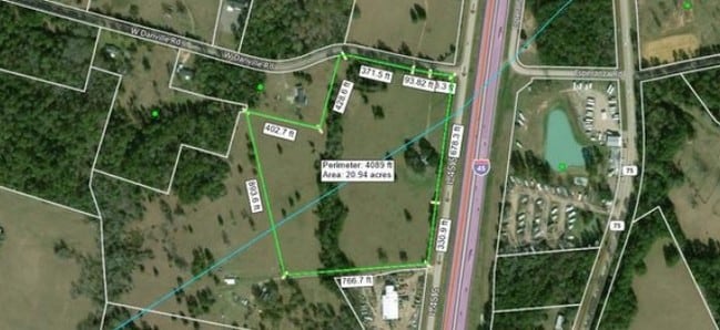
20.98 AC
2024
Outlying Montgomery Cnty
2025
Houston
694205
Houston-Pasadena-The Woodlands, TX
21,768 SF
NEARBY LISTINGS FOR SALE OR LEASE
DEMOGRAPHICS near 17015 Interstate 45 N
1 mile
3 mile
5 mile
2025 Total Population
235
5,609
26,779
2030 Population
278
6,619
31,452
Pop Growth 2025-2030
+ 18.30%
+ 18.01%
+ 17.45%
Average Age
45
39
39
2025 Total Households
91
1,964
9,649
HH Growth 2025-2030
+ 18.68%
+ 18.48%
+ 17.89%
Median Household Inc
$88,281
$80,783
$74,257
Avg Household Size
2.50
2.80
2.70
2025 Avg HH Vehicles
2.00
2.00
2.00
Median Home Value
$364,705
$379,385
$253,413
Median Year Built
2004
2003
2000
Nearby Places
Map Layers
Map Styles
 Street
 Aerial
Transit
 Traffic
 Biking
Places
Listings with unknown addresses are not visible on the map
- Restaurants
- Banks
- Shops
- Fitness
- Groceries
SALE & LEASE HISTORY
LISTING DATE
SALE/LEASE

Apr 13, 2018
For Sale
Nearby Properties
Address
Land Use
TOTAL SIZE
Lot Size
Zoning
Address
Land Use
TOTAL SIZE
Lot Size
Zoning
9,491 SF
164.51 AC
Address
Land Use
TOTAL SIZE
Lot Size
Zoning
33,867 SF
41.93 AC
4
Address
Land Use
TOTAL SIZE
Lot Size
Zoning
102,250 SF
9.60 AC
4
Address
Land Use
TOTAL SIZE
Lot Size
Zoning
4,420 SF
21.95 AC
4
Address
Land Use
TOTAL SIZE
Lot Size
Zoning
78,300 SF
10 AC
Address
Land Use
TOTAL SIZE
Lot Size
Zoning
52,896 SF
31.64 AC
4
Address
Land Use
TOTAL SIZE
Lot Size
Zoning
20,222 SF
6.38 AC
Address
Land Use
TOTAL SIZE
Lot Size
Zoning
1,184 SF
164.38 AC
4
Address
Land Use
TOTAL SIZE
Lot Size
Zoning
13,100 SF
14.03 AC
Address
Land Use
TOTAL SIZE
Lot Size
Zoning
41,296 SF
4.06 AC
4
Address
Land Use
TOTAL SIZE
Lot Size
Zoning
33,130 SF
7.40 AC
Address
Land Use
TOTAL SIZE
Lot Size
Zoning
17,236 SF
6.74 AC
4
Address
Land Use
TOTAL SIZE
Lot Size
Zoning
14,835 SF
3.78 AC
4
Address
Land Use
TOTAL SIZE
Lot Size
Zoning
512 SF
31.82 AC
4
Address
Land Use
TOTAL SIZE
Lot Size
Zoning
Address
Land Use
TOTAL SIZE
Lot Size
Zoning
9,375 SF
24 AC
4
Address
Land Use
TOTAL SIZE
Lot Size
Zoning
13,795 SF
7.92 AC
4
Address
Land Use
TOTAL SIZE
Lot Size
Zoning
5,500 SF
7.35 AC
4
Address
Land Use
TOTAL SIZE
Lot Size
Zoning
30,125 SF
10.93 AC
Address
Land Use
TOTAL SIZE
Lot Size
Zoning
6,720 SF
2.25 AC
4
Address
Land Use
TOTAL SIZE
Lot Size
Zoning
19,060 SF
6.49 AC
4
Address
Land Use
TOTAL SIZE
Lot Size
Zoning
4,652 SF
12 AC
4
Address
Land Use
TOTAL SIZE
Lot Size
Zoning
882 SF
12.02 AC
4
Address
Land Use
TOTAL SIZE
Lot Size
Zoning
13,280 SF
9.08 AC
4
Address
Land Use
TOTAL SIZE
Lot Size
Zoning
38,750 SF
2.67 AC
Address
Land Use
TOTAL SIZE
Lot Size
Zoning
7,203 SF
28.72 AC
Address
Land Use
TOTAL SIZE
Lot Size
Zoning
12,132 SF
5 AC
4
Address
Land Use
TOTAL SIZE
Lot Size
Zoning
8,968 SF
174.98 AC
Address
Land Use
TOTAL SIZE
Lot Size
Zoning
8,968 SF
154.22 AC
The World's #1 Commercial Real Estate Marketplace
Connect with us
© 2026 CoStar Group
The information above has been obtained from sources believed reliable. While we do not doubt its accuracy we have not verified it and make no guarantee, warranty or representation about it. It is your responsibility to independently confirm its accuracy and completeness. Any projections, opinions, assumptions, or estimates used are for example only and do not represent the current or future performance of the property. The value of this transaction to you depends on tax and other factors which should be evaluated by your tax, financial, and legal advisors. You and your advisors should conduct a careful, independent investigation of the property to determine to your satisfaction the suitability of the property for your needs.