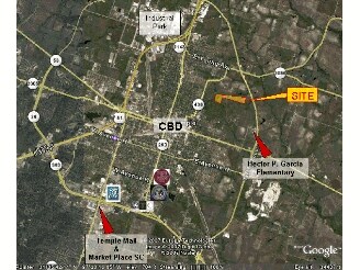
Property Record
1702 N 42Nd St, Temple, TX 76501

Property Detail
1702 N 42Nd St
78723
A0014BC M MORENO, 130 & 131-3-1, OB 868, ACRES 49.64
Agriculturalland
BELL
A
Texas
AE The base floodplain where base flood elevations are provided. AE Zones are now used on new format FIRMs instead of A1-A30 Zones.
99.28 AC
2025
Temple
2025
Killeen/Temple/Fort Hood
020402
Killeen-Temple, TX
NEARBY LISTINGS FOR SALE OR LEASE
DEMOGRAPHICS near 1702 N 42Nd St
1 mile
3 mile
5 mile
2025 Total Population
2,203
24,848
57,539
2030 Population
2,360
26,593
61,330
Pop Growth 2025-2030
+ 7.13%
+ 7.02%
+ 6.59%
Average Age
38
39
39
2025 Total Households
777
9,811
24,317
HH Growth 2025-2030
+ 7.21%
+ 7.10%
+ 6.70%
Median Household Inc
$63,853
$46,660
$58,595
Avg Household Size
2.70
2.40
2.30
2025 Avg HH Vehicles
2.00
2.00
2.00
Median Home Value
$264,705
$169,699
$204,275
Median Year Built
1988
1971
1983
Nearby Places
Map Layers
Map Styles
 Street
 Aerial
Transit
 Traffic
 Biking
Places
Listings with unknown addresses are not visible on the map
- Restaurants
- Banks
- Shops
- Fitness
- Groceries
PUBLIC TRANSPORTATION
COMMUTER RAIL
Temple (Texas Eagle - Amtrak)
Drive
Walk
Distance
Temple (Texas Eagle - Amtrak)
6 min
2.5 mi
AIRPORT
Killeen Municipal
Drive
Walk
Distance
Killeen Municipal
33 min
25.3 mi
Freight Ports
Port of Houston
Drive
Walk
Distance
Port of Houston
228 min
174.0 mi
SALE & LEASE HISTORY
LISTING DATE
SALE/LEASE

May 08, 2018
For Sale
Nearby Properties
Address
Land Use
TOTAL SIZE
Lot Size
Zoning
Address
Land Use
TOTAL SIZE
Lot Size
Zoning
274,710 SF
38.05 AC
C
Address
Land Use
TOTAL SIZE
Lot Size
Zoning
1,546,481 SF
111.97 AC
MF2
Address
Land Use
TOTAL SIZE
Lot Size
Zoning
86,326 SF
8.70 AC
MF1
Address
Land Use
TOTAL SIZE
Lot Size
Zoning
Address
Land Use
TOTAL SIZE
Lot Size
Zoning
Address
Land Use
TOTAL SIZE
Lot Size
Zoning
71,378 SF
13.75 AC
Address
Land Use
TOTAL SIZE
Lot Size
Zoning
71,378 SF
14.37 AC
A
Address
Land Use
TOTAL SIZE
Lot Size
Zoning
Address
Land Use
TOTAL SIZE
Lot Size
Zoning
612,900 SF
38.68 AC
Address
Land Use
TOTAL SIZE
Lot Size
Zoning
159,250 SF
0.85 AC
CA
Address
Land Use
TOTAL SIZE
Lot Size
Zoning
81,608 SF
11.15 AC
2F
Address
Land Use
TOTAL SIZE
Lot Size
Zoning
71,382 SF
59.32 AC
Address
Land Use
TOTAL SIZE
Lot Size
Zoning
117,017 SF
64.64 AC
Address
Land Use
TOTAL SIZE
Lot Size
Zoning
154,068 SF
11.33 AC
Address
Land Use
TOTAL SIZE
Lot Size
Zoning
150,382 SF
9.48 AC
MF2
Address
Land Use
TOTAL SIZE
Lot Size
Zoning
149,621 SF
15 AC
Address
Land Use
TOTAL SIZE
Lot Size
Zoning
45,000 SF
0.18 AC
CA
Address
Land Use
TOTAL SIZE
Lot Size
Zoning
246,008 SF
21.53 AC
Address
Land Use
TOTAL SIZE
Lot Size
Zoning
224,088 SF
21.98 AC
Address
Land Use
TOTAL SIZE
Lot Size
Zoning
28,731 SF
1.65 AC
CA
Address
Land Use
TOTAL SIZE
Lot Size
Zoning
Address
Land Use
TOTAL SIZE
Lot Size
Zoning
105,950 SF
14.26 AC
Address
Land Use
TOTAL SIZE
Lot Size
Zoning
42,786 SF
2 AC
C
Address
Land Use
TOTAL SIZE
Lot Size
Zoning
88,655 SF
2.10 AC
Address
Land Use
TOTAL SIZE
Lot Size
Zoning
34,622 SF
0.57 AC
CA
Address
Land Use
TOTAL SIZE
Lot Size
Zoning
11,813 SF
2 AC
MF2
Address
Land Use
TOTAL SIZE
Lot Size
Zoning
76,545 SF
5.29 AC
Address
Land Use
TOTAL SIZE
Lot Size
Zoning
78,247 SF
0.69 AC
Address
Land Use
TOTAL SIZE
Lot Size
Zoning
1,088 SF
Address
Land Use
TOTAL SIZE
Lot Size
Zoning
89,548 SF
10.68 AC
The World's #1 Commercial Real Estate Marketplace
Connect with us
© 2026 CoStar Group
The information above has been obtained from sources believed reliable. While we do not doubt its accuracy we have not verified it and make no guarantee, warranty or representation about it. It is your responsibility to independently confirm its accuracy and completeness. Any projections, opinions, assumptions, or estimates used are for example only and do not represent the current or future performance of the property. The value of this transaction to you depends on tax and other factors which should be evaluated by your tax, financial, and legal advisors. You and your advisors should conduct a careful, independent investigation of the property to determine to your satisfaction the suitability of the property for your needs.