Property Record
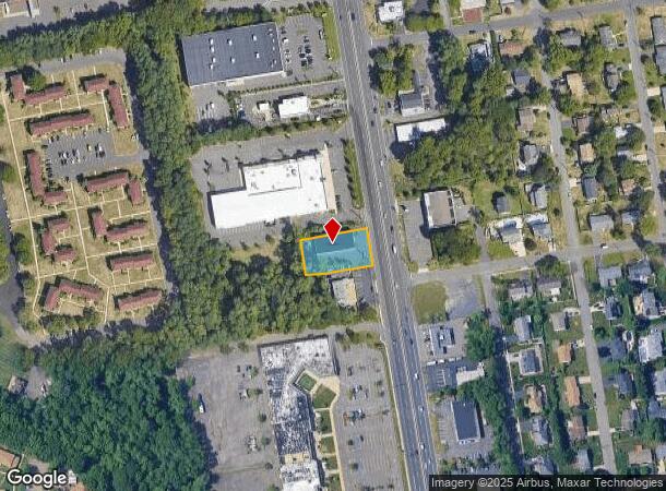
1702 State Route 35, Oakhurst, NJ 07755

NEARBY LISTINGS FOR SALE OR LEASE
-
-
-
-
No Photo
-
-
-
-
-
-
View all Oakhurst listings for lease on LoopNet.com
Property Detail
1702 State Route 35
37-00034-0000-00013
Monmouth
Servicestation
New Jersey
X
13
34025C0193F
0.42 AC
2024
Eastern Monmouth
2025
Northern New Jersey
806502
Lakewood-New Brunswick, NJ
5,400 SF
DEMOGRAPHICS near 1702 State Route 35
1 mile
3 mile
5 mile
2024 Total Population
10,344
71,812
168,116
2029 Population
10,216
71,973
168,812
Pop Growth 2024-2029
(1.24%)
+ 0.22%
+ 0.41%
Average Age
42
42
42
2024 Total Households
4,451
28,308
69,183
HH Growth 2024-2029
(1.64%)
(0.19%)
+ 0.37%
Median Household Inc
$84,044
$92,962
$85,001
Avg Household Size
2.30
2.40
2.30
2024 Avg HH Vehicles
2.00
2.00
2.00
Median Home Value
$497,944
$499,814
$485,242
Median Year Built
1975
1971
1969
Nearby Places
Map Layers
Map Styles
 Street
 Aerial
Transit
 Traffic
 Biking
Places
Listings with unknown addresses are not visible on the map
- Restaurants
- Banks
- Shops
- Fitness
- Groceries
PUBLIC TRANSPORTATION
COMMUTER RAIL
Allenhurst (North Jersey Coast Line - NJ Transit Commuter Rail (NJ Transit))
Drive
Walk
Distance
Allenhurst (North Jersey Coast Line - NJ Transit Commuter Rail (NJ Transit))
7 min
3.1 mi
Elberon (North Jersey Coast Line - NJ Transit Commuter Rail (NJ Transit))
Drive
Walk
Distance
Elberon (North Jersey Coast Line - NJ Transit Commuter Rail (NJ Transit))
8 min
3.7 mi
Freight Ports
New York Container Terminal
Drive
Walk
Distance
New York Container Terminal
53 min
40.6 mi
SALE & LEASE HISTORY
LISTING DATE
SALE/LEASE

Feb 25, 2021
For Sale
Aug 27, 2021
For Lease
Nearby Properties
Address
Land Use
TOTAL SIZE
Lot Size
Zoning
Address
Land Use
TOTAL SIZE
Lot Size
Zoning
4,289 SF
94.37 AC
CCRC
Address
Land Use
TOTAL SIZE
Lot Size
Zoning
75.16 AC
R-7
Address
Land Use
TOTAL SIZE
Lot Size
Zoning
7,819 SF
28.41 AC
R-1
Address
Land Use
TOTAL SIZE
Lot Size
Zoning
89,939 SF
51.49 AC
I
Address
Land Use
TOTAL SIZE
Lot Size
Zoning
65,668 SF
111.60 AC
C50
Address
Land Use
TOTAL SIZE
Lot Size
Zoning
35.50 AC
R-7
Address
Land Use
TOTAL SIZE
Lot Size
Zoning
22,877 SF
10.35 AC
IC
Address
Land Use
TOTAL SIZE
Lot Size
Zoning
293,262 SF
28.40 AC
HC
Address
Land Use
TOTAL SIZE
Lot Size
Zoning
1,100 SF
37.83 AC
C-2
Address
Land Use
TOTAL SIZE
Lot Size
Zoning
32.19 AC
R-7
Address
Land Use
TOTAL SIZE
Lot Size
Zoning
14,067 SF
7.37 AC
R-1
Address
Land Use
TOTAL SIZE
Lot Size
Zoning
194,812 SF
55.01 AC
R-4
Address
Land Use
TOTAL SIZE
Lot Size
Zoning
35.98 AC
R10A
Address
Land Use
TOTAL SIZE
Lot Size
Zoning
8,000 SF
3.58 AC
R-1
Address
Land Use
TOTAL SIZE
Lot Size
Zoning
16.49 AC
R-2
Address
Land Use
TOTAL SIZE
Lot Size
Zoning
7,268 SF
1.53 AC
14
Address
Land Use
TOTAL SIZE
Lot Size
Zoning
27 AC
R10A
Address
Land Use
TOTAL SIZE
Lot Size
Zoning
201,455 SF
79.34 AC
R-1
Address
Land Use
TOTAL SIZE
Lot Size
Zoning
20.62 AC
AR3P
Address
Land Use
TOTAL SIZE
Lot Size
Zoning
153,160 SF
10.12 AC
BP2
Address
Land Use
TOTAL SIZE
Lot Size
Zoning
5,432 SF
1.44 AC
R-1
Address
Land Use
TOTAL SIZE
Lot Size
Zoning
8,988 SF
1.59 AC
R-1
Address
Land Use
TOTAL SIZE
Lot Size
Zoning
3,162 SF
0.48 AC
R-1
Address
Land Use
TOTAL SIZE
Lot Size
Zoning
7,213 SF
0.96 AC
1
Address
Land Use
TOTAL SIZE
Lot Size
Zoning
2,756 SF
1.61 AC
R-1
Address
Land Use
TOTAL SIZE
Lot Size
Zoning
5,880 SF
1.86 AC
R-1
Address
Land Use
TOTAL SIZE
Lot Size
Zoning
5,407 SF
25.60 AC
C-3
Address
Land Use
TOTAL SIZE
Lot Size
Zoning
9,445 SF
1.31 AC
R-1
Address
Land Use
TOTAL SIZE
Lot Size
Zoning
1,178 SF
21.78 AC
R-7
Address
Land Use
TOTAL SIZE
Lot Size
Zoning
258,088 SF
27.90 AC
IO20
The World's #1 Commercial Real Estate Marketplace
Connect with us
© 2026 CoStar Group
The information above has been obtained from sources believed reliable. While we do not doubt its accuracy we have not verified it and make no guarantee, warranty or representation about it. It is your responsibility to independently confirm its accuracy and completeness. Any projections, opinions, assumptions, or estimates used are for example only and do not represent the current or future performance of the property. The value of this transaction to you depends on tax and other factors which should be evaluated by your tax, financial, and legal advisors. You and your advisors should conduct a careful, independent investigation of the property to determine to your satisfaction the suitability of the property for your needs.