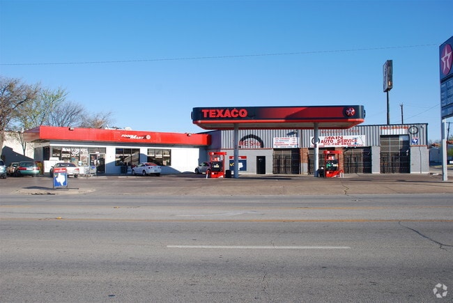
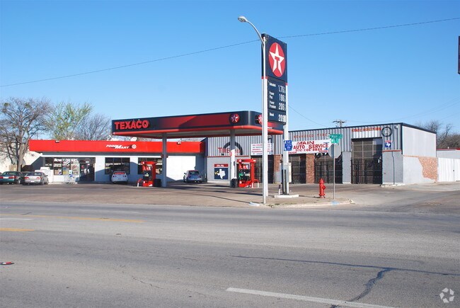
Property Record
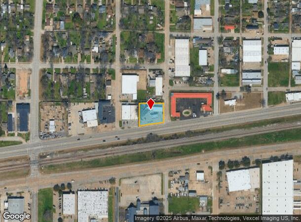
1702 W Main St, Grand Prairie, TX 75050
NEARBY LISTINGS FOR SALE OR LEASE
Property Detail
1702 W Main St
Dallas-Fort Worth-Arlington, TX
Dalworth Park
28052500800080000
DALWORTH PARK BLK 80 LOTS 8-10 VOL2001106/6417 DD012999 CO-DC 0525008000800 22805250080
Servicestationmarket
Dallas
X
Texas
48439C0360L
8-10
2024
0.48 AC
2025
Lower Great Southwest
015404
Dallas/Ft Worth
3,862 SF
DEMOGRAPHICS near 1702 W Main St
1 Mile
3 Mile
5 Mile
2024 Total Population
12,405
91,171
256,929
2029 Population
12,559
92,092
264,047
Pop Growth 2024-2029
+ 1.24%
+ 1.01%
+ 2.77%
Average Age
34
34
35
2024 Total Households
4,181
30,213
91,194
HH Growth 2024-2029
+ 0.91%
+ 0.89%
+ 3.08%
Median Household Inc
$37,610
$49,366
$52,733
Avg Household Size
2.90
2.90
2.70
2024 Avg HH Vehicles
2.00
2.00
2.00
Median Home Value
$137,223
$183,630
$198,176
Median Year Built
1980
1976
1982
Nearby Places
Map Layers
Map Styles
 Street
 Aerial
- Restaurants
- Banks
- Shops
- Fitness
- Groceries
PUBLIC TRANSPORTATION
COMMUTER RAIL
DRIVE
WALK
Distance
9 min
6.0 mi
DRIVE
WALK
Distance
14 min
7.3 mi
AIRPORT
Dallas-Fort Worth International
DRIVE
WALK
Distance
Dallas-Fort Worth International
20 min
13.4 mi
Dallas Love Field
DRIVE
WALK
Distance
Dallas Love Field
28 min
19.6 mi
Nearby Properties
Address
Land Use
TOTAL SIZE
Lot Size
Zoning
Address
Land Use
TOTAL SIZE
Lot Size
Zoning
2,395,314 SF
152.04 AC
Address
Land Use
TOTAL SIZE
Lot Size
Zoning
5,995,915 SF
248.78 AC
Address
Land Use
TOTAL SIZE
Lot Size
Zoning
1,577,320 SF
122.55 AC
Z123
Address
Land Use
TOTAL SIZE
Lot Size
Zoning
860,445 SF
50.39 AC
Z123
Address
Land Use
TOTAL SIZE
Lot Size
Zoning
703,500 SF
47.38 AC
Z236
Address
Land Use
TOTAL SIZE
Lot Size
Zoning
1,261,810 SF
80.53 AC
Address
Land Use
TOTAL SIZE
Lot Size
Zoning
450,535 SF
27.23 AC
Address
Land Use
TOTAL SIZE
Lot Size
Zoning
680,900 SF
32.25 AC
Z236
Address
Land Use
TOTAL SIZE
Lot Size
Zoning
334,057 SF
20.05 AC
Z312
Address
Land Use
TOTAL SIZE
Lot Size
Zoning
753,721 SF
42.65 AC
Address
Land Use
TOTAL SIZE
Lot Size
Zoning
358,350 SF
13.15 AC
Address
Land Use
TOTAL SIZE
Lot Size
Zoning
247,880 SF
20.93 AC
Z236
Address
Land Use
TOTAL SIZE
Lot Size
Zoning
1,054,767 SF
37.45 AC
Z123
Address
Land Use
TOTAL SIZE
Lot Size
Zoning
603,000 SF
32.80 AC
Z123
Address
Land Use
TOTAL SIZE
Lot Size
Zoning
531,072 SF
26.50 AC
Z236
Address
Land Use
TOTAL SIZE
Lot Size
Zoning
137,878 SF
189.88 AC
Address
Land Use
TOTAL SIZE
Lot Size
Zoning
816,040 SF
41.89 AC
Address
Land Use
TOTAL SIZE
Lot Size
Zoning
264,010 SF
34.50 AC
Z190
Address
Land Use
TOTAL SIZE
Lot Size
Zoning
362,847 SF
19.88 AC
Address
Land Use
TOTAL SIZE
Lot Size
Zoning
228,210 SF
12.28 AC
Z190
Address
Land Use
TOTAL SIZE
Lot Size
Zoning
283,087 SF
15.22 AC
Z236
Address
Land Use
TOTAL SIZE
Lot Size
Zoning
436,343 SF
5.36 AC
Z236
Address
Land Use
TOTAL SIZE
Lot Size
Zoning
150,000 SF
12.95 AC
Address
Land Use
TOTAL SIZE
Lot Size
Zoning
266,448 SF
17 AC
Z97
Address
Land Use
TOTAL SIZE
Lot Size
Zoning
209,751 SF
6.65 AC
Address
Land Use
TOTAL SIZE
Lot Size
Zoning
77,020 SF
22.82 AC
Address
Land Use
TOTAL SIZE
Lot Size
Zoning
224,486 SF
18.11 AC
Z236
Address
Land Use
TOTAL SIZE
Lot Size
Zoning
83,938 SF
22.46 AC
Address
Land Use
TOTAL SIZE
Lot Size
Zoning
251,392 SF
14.54 AC
Z190
Address
Land Use
TOTAL SIZE
Lot Size
Zoning
492,972 SF
24.23 AC
The World's #1 Commercial Real Estate Marketplace
Connect with us
© 2025 CoStar Group
The information above has been obtained from sources believed reliable. While we do not doubt its accuracy we have not verified it and make no guarantee, warranty or representation about it. It is your responsibility to independently confirm its accuracy and completeness. Any projections, opinions, assumptions, or estimates used are for example only and do not represent the current or future performance of the property. The value of this transaction to you depends on tax and other factors which should be evaluated by your tax, financial, and legal advisors. You and your advisors should conduct a careful, independent investigation of the property to determine to your satisfaction the suitability of the property for your needs.