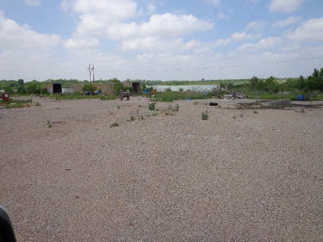
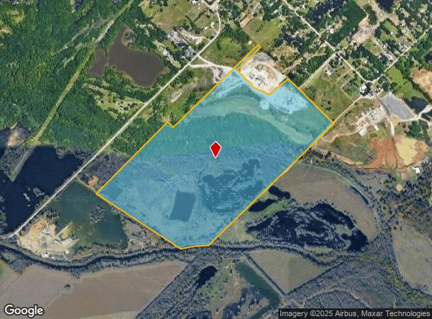
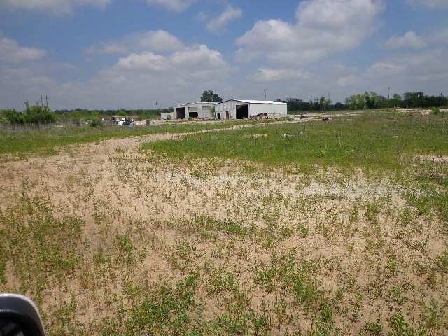
Property Record
1702 W Simonds Rd, Seagoville, TX 75159
NEARBY LISTINGS FOR SALE OR LEASE
Property Detail
1702 W Simonds Rd
Dallas-Fort Worth-Arlington, TX
S A & M G Rr
65141777010030000
S A & M G RR ABST 1417 PG 770 & ABST 179/340 TR 3 ACS 174.742 JURIS SPLIT SEE 65141777010030300 INT201500157453 DD06052015 CO-DC 1417770100300 4NT14177701
Commercialacreage
Dallas
AE
Texas
48257C0150E
174.74 AC
2024
Mesquite/Forney/Terrell
2025
Dallas/Ft Worth
017006
DEMOGRAPHICS near 1702 W Simonds Rd
1 Mile
3 Mile
5 Mile
2024 Total Population
333
13,154
53,037
2029 Population
332
13,177
53,457
Pop Growth 2024-2029
(0.30%)
+ 0.17%
+ 0.79%
Average Age
40
34
33
2024 Total Households
76
3,488
14,703
HH Growth 2024-2029
0.00%
+ 0.26%
+ 0.66%
Median Household Inc
$52,500
$53,567
$51,386
Avg Household Size
3.10
3.30
3.40
2024 Avg HH Vehicles
2.00
2.00
2.00
Median Home Value
$166,666
$174,376
$168,808
Median Year Built
1979
1989
1995
Nearby Places
Map Layers
Map Styles
 Street
 Aerial
- Restaurants
- Banks
- Shops
- Fitness
- Groceries
PUBLIC TRANSPORTATION
AIRPORT
Dallas Love Field
DRIVE
WALK
Distance
Dallas Love Field
38 min
24.7 mi
Freight Ports
Port of Shreveport
DRIVE
WALK
Distance
Port of Shreveport
206 min
186.8 mi
Nearby Properties
Address
Land Use
TOTAL SIZE
Lot Size
Zoning
Address
Land Use
TOTAL SIZE
Lot Size
Zoning
372,456 SF
17.34 AC
Z116
Address
Land Use
TOTAL SIZE
Lot Size
Zoning
106,462 SF
9.58 AC
Z236
Address
Land Use
TOTAL SIZE
Lot Size
Zoning
122,352 SF
6.05 AC
Z46
Address
Land Use
TOTAL SIZE
Lot Size
Zoning
377,133 SF
16.71 AC
Z131
Address
Land Use
TOTAL SIZE
Lot Size
Zoning
88,320 SF
4.48 AC
Z72
Address
Land Use
TOTAL SIZE
Lot Size
Zoning
216,327 SF
26.31 AC
Address
Land Use
TOTAL SIZE
Lot Size
Zoning
319 SF
37.74 AC
SUP1
Address
Land Use
TOTAL SIZE
Lot Size
Zoning
191 SF
23.10 AC
Z05
Address
Land Use
TOTAL SIZE
Lot Size
Zoning
28,126 SF
166.45 AC
Z05
Address
Land Use
TOTAL SIZE
Lot Size
Zoning
96 SF
14.18 AC
I2
Address
Land Use
TOTAL SIZE
Lot Size
Zoning
89,044 SF
5.04 AC
Z163
Address
Land Use
TOTAL SIZE
Lot Size
Zoning
83,266 SF
6.73 AC
Z131
Address
Land Use
TOTAL SIZE
Lot Size
Zoning
100,200 SF
6.93 AC
Z05
Address
Land Use
TOTAL SIZE
Lot Size
Zoning
108 SF
14.44 AC
Z31
Address
Land Use
TOTAL SIZE
Lot Size
Zoning
92 SF
11.39 AC
SUP12
Address
Land Use
TOTAL SIZE
Lot Size
Zoning
69,235 SF
4.21 AC
Z308
Address
Land Use
TOTAL SIZE
Lot Size
Zoning
27,356 SF
3.75 AC
Z05
Address
Land Use
TOTAL SIZE
Lot Size
Zoning
40,360 SF
4.16 AC
Z31
Address
Land Use
TOTAL SIZE
Lot Size
Zoning
64,420 SF
8.91 AC
Z131
Address
Land Use
TOTAL SIZE
Lot Size
Zoning
22,870 SF
1.15 AC
Z31
Address
Land Use
TOTAL SIZE
Lot Size
Zoning
43,000 SF
4.30 AC
Z05
Address
Land Use
TOTAL SIZE
Lot Size
Zoning
64 SF
9.62 AC
MFA
Address
Land Use
TOTAL SIZE
Lot Size
Zoning
0.01 AC
Z306
Address
Land Use
TOTAL SIZE
Lot Size
Zoning
60 SF
7.22 AC
Z399
Address
Land Use
TOTAL SIZE
Lot Size
Zoning
37,500 SF
3.09 AC
Z05
Address
Land Use
TOTAL SIZE
Lot Size
Zoning
56,500 SF
5.57 AC
Z31
Address
Land Use
TOTAL SIZE
Lot Size
Zoning
36,250 SF
2.52 AC
Z05
Address
Land Use
TOTAL SIZE
Lot Size
Zoning
5,600 SF
1.68 AC
Z31
Address
Land Use
TOTAL SIZE
Lot Size
Zoning
25,380 SF
10.59 AC
Z131
Address
Land Use
TOTAL SIZE
Lot Size
Zoning
10,384 SF
38.57 AC
Z05
The World's #1 Commercial Real Estate Marketplace
Connect with us
© 2025 CoStar Group
The information above has been obtained from sources believed reliable. While we do not doubt its accuracy we have not verified it and make no guarantee, warranty or representation about it. It is your responsibility to independently confirm its accuracy and completeness. Any projections, opinions, assumptions, or estimates used are for example only and do not represent the current or future performance of the property. The value of this transaction to you depends on tax and other factors which should be evaluated by your tax, financial, and legal advisors. You and your advisors should conduct a careful, independent investigation of the property to determine to your satisfaction the suitability of the property for your needs.