Property Record
17028 Washington St, Riverside, CA 92504


NEARBY LISTINGS FOR SALE OR LEASE
Property Detail
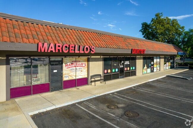
17028 Washington St
274-030-015
1.87 ACRES NET IN PAR 1 PM 069/069 PM 10641
Regionalshoppingcenterormallwithanchorstore
Riverside
D
California
06065C0740G
1
2024
1.87 AC
2025
Riverside
031300
Inland Empire (California)
13,925 SF
Riverside-San Bernardino-Ontario, CA
DEMOGRAPHICS near 17028 Washington St
1 Mile
3 Mile
5 Mile
2024 Total Population
3,907
38,700
122,797
2029 Population
4,104
40,654
129,245
Pop Growth 2024-2029
+ 5.04%
+ 5.05%
+ 5.25%
Average Age
41
39
38
2024 Total Households
1,134
11,139
36,243
HH Growth 2024-2029
+ 4.50%
+ 4.58%
+ 4.85%
Median Household Inc
$131,973
$130,220
$108,029
Avg Household Size
3.20
3.30
3.20
2024 Avg HH Vehicles
3.00
3.00
3.00
Median Home Value
$703,980
$706,649
$632,766
Median Year Built
1977
1992
1984
Nearby Places
Map Layers
Map Styles
 Street
 Aerial
- Restaurants
- Banks
- Shops
- Fitness
- Groceries
PUBLIC TRANSPORTATION
COMMUTER RAIL
DRIVE
WALK
Distance
11 min
7.0 mi
Riverside-La Sierra (91 Line - Southern California Regional Rail Authority (Metrolink), Inland Empire-Orange County Line - Southern California Regional Rail Authority (Metrolink))
DRIVE
WALK
Distance
Riverside-La Sierra (91 Line - Southern California Regional Rail Authority (Metrolink), Inland Empire-Orange County Line - Southern California Regional Rail Authority (Metrolink))
14 min
7.8 mi
AIRPORT
Ontario International
DRIVE
WALK
Distance
Ontario International
32 min
20.0 mi
John Wayne/Orange County
DRIVE
WALK
Distance
John Wayne/Orange County
52 min
41.4 mi
Freight Ports
Port of Long Beach
DRIVE
WALK
Distance
Port of Long Beach
75 min
55.5 mi
Nearby Properties
Address
Land Use
TOTAL SIZE
Lot Size
Zoning
Address
Land Use
TOTAL SIZE
Lot Size
Zoning
38,560 SF
12.04 AC
R3
Address
Land Use
TOTAL SIZE
Lot Size
Zoning
51,665 SF
10.32 AC
Address
Land Use
TOTAL SIZE
Lot Size
Zoning
47,426 SF
4.32 AC
Address
Land Use
TOTAL SIZE
Lot Size
Zoning
86,938 SF
6.94 AC
Address
Land Use
TOTAL SIZE
Lot Size
Zoning
21.60 AC
CPS
Address
Land Use
TOTAL SIZE
Lot Size
Zoning
45,503 SF
3.56 AC
Address
Land Use
TOTAL SIZE
Lot Size
Zoning
40,925 SF
2.94 AC
Address
Land Use
TOTAL SIZE
Lot Size
Zoning
18,800 SF
3.50 AC
Address
Land Use
TOTAL SIZE
Lot Size
Zoning
15,513 SF
4.86 AC
CPS
Address
Land Use
TOTAL SIZE
Lot Size
Zoning
3.91 AC
Address
Land Use
TOTAL SIZE
Lot Size
Zoning
14,479 SF
1.43 AC
Address
Land Use
TOTAL SIZE
Lot Size
Zoning
40,925 SF
2.91 AC
Address
Land Use
TOTAL SIZE
Lot Size
Zoning
124,021 SF
7.46 AC
Address
Land Use
TOTAL SIZE
Lot Size
Zoning
43,412 SF
1.81 AC
Address
Land Use
TOTAL SIZE
Lot Size
Zoning
8,201 SF
6.87 AC
Address
Land Use
TOTAL SIZE
Lot Size
Zoning
25,648 SF
2.36 AC
Address
Land Use
TOTAL SIZE
Lot Size
Zoning
5,760 SF
35 AC
RA
Address
Land Use
TOTAL SIZE
Lot Size
Zoning
17,272 SF
0.96 AC
CPS
Address
Land Use
TOTAL SIZE
Lot Size
Zoning
40,867 SF
5 AC
Address
Land Use
TOTAL SIZE
Lot Size
Zoning
2,736 SF
119.39 AC
A110
Address
Land Use
TOTAL SIZE
Lot Size
Zoning
6,040 SF
2.15 AC
Address
Land Use
TOTAL SIZE
Lot Size
Zoning
51,688 SF
4.03 AC
C1CP
Address
Land Use
TOTAL SIZE
Lot Size
Zoning
75,930 SF
4.18 AC
C3
Address
Land Use
TOTAL SIZE
Lot Size
Zoning
4,707 SF
0.87 AC
Address
Land Use
TOTAL SIZE
Lot Size
Zoning
2.36 AC
Address
Land Use
TOTAL SIZE
Lot Size
Zoning
2,879 SF
1.41 AC
Address
Land Use
TOTAL SIZE
Lot Size
Zoning
9,648 SF
26.42 AC
R1
Address
Land Use
TOTAL SIZE
Lot Size
Zoning
50.02 AC
A110
The World's #1 Commercial Real Estate Marketplace
Connect with us
© 2026 CoStar Group
The information above has been obtained from sources believed reliable. While we do not doubt its accuracy we have not verified it and make no guarantee, warranty or representation about it. It is your responsibility to independently confirm its accuracy and completeness. Any projections, opinions, assumptions, or estimates used are for example only and do not represent the current or future performance of the property. The value of this transaction to you depends on tax and other factors which should be evaluated by your tax, financial, and legal advisors. You and your advisors should conduct a careful, independent investigation of the property to determine to your satisfaction the suitability of the property for your needs.