Property Record
1703 City View Dr, Madison, WI 53718

NEARBY LISTINGS FOR SALE OR LEASE
Property Detail
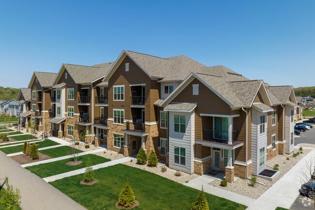
1703 City View Dr
Madison, WI
Certified Survey Map No 15073 As
0810-263-4205-6
CERTIFIED SURVEY MAP NO 15073 AS RECORDED IN DANE COUNTY REGISTER OF DEEDS IN VO L 106 PAGE 277 OF CERTIFIED SURVEYS, LOT 1.
Commercialnec
Dane
X
Wisconsin
55025C0431H
106
2024
1.65 AC
2024
East Madison
011405
Milwaukee/Madison
81,531 SF
DEMOGRAPHICS near 1703 City View Dr
1 Mile
3 Mile
5 Mile
2024 Total Population
5,434
44,445
122,505
2029 Population
5,690
46,297
127,514
Pop Growth 2024-2029
+ 4.71%
+ 4.17%
+ 4.09%
Average Age
37
39
40
2024 Total Households
2,340
19,867
55,145
HH Growth 2024-2029
+ 4.96%
+ 4.25%
+ 4.16%
Median Household Inc
$80,939
$71,607
$73,943
Avg Household Size
2.30
2.20
2.20
2024 Avg HH Vehicles
2.00
2.00
2.00
Median Home Value
$270,671
$262,571
$281,646
Median Year Built
1998
1990
1979
Nearby Places
Map Layers
Map Styles
 Street
 Aerial
- Restaurants
- Banks
- Shops
- Fitness
- Groceries
PUBLIC TRANSPORTATION
AIRPORT
Dane County Regional/Truax Field
DRIVE
WALK
Distance
Dane County Regional/Truax Field
10 min
5.1 mi
Freight Ports
Port Milwaukee
DRIVE
WALK
Distance
Port Milwaukee
91 min
74.8 mi
Nearby Properties
Address
Land Use
TOTAL SIZE
Lot Size
Zoning
Address
Land Use
TOTAL SIZE
Lot Size
Zoning
27.70 AC
SEC
Address
Land Use
TOTAL SIZE
Lot Size
Zoning
509,946 SF
40.17 AC
IL
Address
Land Use
TOTAL SIZE
Lot Size
Zoning
81,771 SF
7.76 AC
CC-T
Address
Land Use
TOTAL SIZE
Lot Size
Zoning
344,415 SF
7.45 AC
SEC
Address
Land Use
TOTAL SIZE
Lot Size
Zoning
289,884 SF
19.36 AC
SR-V2
Address
Land Use
TOTAL SIZE
Lot Size
Zoning
921,697 SF
24.28 AC
SEC
Address
Land Use
TOTAL SIZE
Lot Size
Zoning
97,580 SF
6.86 AC
TR-U1
Address
Land Use
TOTAL SIZE
Lot Size
Zoning
357,427 SF
12.77 AC
PD
Address
Land Use
TOTAL SIZE
Lot Size
Zoning
13,440 SF
10.98 AC
IL
Address
Land Use
TOTAL SIZE
Lot Size
Zoning
372,177 SF
19.47 AC
SR-V2
Address
Land Use
TOTAL SIZE
Lot Size
Zoning
1,318,936 SF
25.96 AC
SEC
Address
Land Use
TOTAL SIZE
Lot Size
Zoning
294,106 SF
29.06 AC
CC
Address
Land Use
TOTAL SIZE
Lot Size
Zoning
1,322 SF
59.57 AC
SEC
Address
Land Use
TOTAL SIZE
Lot Size
Zoning
225,108 SF
2 AC
PD
Address
Land Use
TOTAL SIZE
Lot Size
Zoning
104,000 SF
11.21 AC
CC-T
Address
Land Use
TOTAL SIZE
Lot Size
Zoning
327,302 SF
8.24 AC
PD
Address
Land Use
TOTAL SIZE
Lot Size
Zoning
316,954 SF
24.96 AC
SEC
Address
Land Use
TOTAL SIZE
Lot Size
Zoning
3.03 AC
RH-35
Address
Land Use
TOTAL SIZE
Lot Size
Zoning
101,348 SF
6.37 AC
SEC
Address
Land Use
TOTAL SIZE
Lot Size
Zoning
4,542 SF
10.01 AC
PD
Address
Land Use
TOTAL SIZE
Lot Size
Zoning
6.76 AC
SEC
Address
Land Use
TOTAL SIZE
Lot Size
Zoning
167,519 SF
4.51 AC
PD
Address
Land Use
TOTAL SIZE
Lot Size
Zoning
105,743 SF
9.50 AC
IG
Address
Land Use
TOTAL SIZE
Lot Size
Zoning
64,900 SF
4.21 AC
PD
Address
Land Use
TOTAL SIZE
Lot Size
Zoning
11.48 AC
SEC
Address
Land Use
TOTAL SIZE
Lot Size
Zoning
37,133 SF
4.71 AC
CC-T
Address
Land Use
TOTAL SIZE
Lot Size
Zoning
191,145 SF
12.24 AC
SR-V2
Address
Land Use
TOTAL SIZE
Lot Size
Zoning
149,650 SF
21.35 AC
CC
Address
Land Use
TOTAL SIZE
Lot Size
Zoning
154,403 SF
1.21 AC
PD
Address
Land Use
TOTAL SIZE
Lot Size
Zoning
217,952 SF
6.47 AC
PD
The World's #1 Commercial Real Estate Marketplace
Connect with us
© 2025 CoStar Group
The information above has been obtained from sources believed reliable. While we do not doubt its accuracy we have not verified it and make no guarantee, warranty or representation about it. It is your responsibility to independently confirm its accuracy and completeness. Any projections, opinions, assumptions, or estimates used are for example only and do not represent the current or future performance of the property. The value of this transaction to you depends on tax and other factors which should be evaluated by your tax, financial, and legal advisors. You and your advisors should conduct a careful, independent investigation of the property to determine to your satisfaction the suitability of the property for your needs.