Property Record
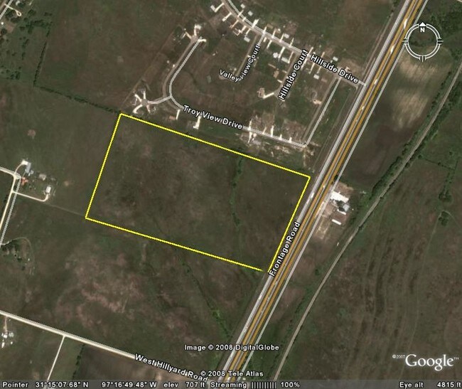
17036 N Interstate 35, Troy, TX 76579


Property Detail
17036 N Interstate 35
114643
A0285BC R EDWARDS, 7-1, ACRES 45.993
Commercialnec
BELL
B and X Area of moderate flood hazard, usually the area between the limits of the 100-year and 500-year floods.
Texas
2025
91.99 AC
2025
Outlying Bell County
020102
Killeen/Temple/Fort Hood
91,600 SF
Killeen-Temple, TX
NEARBY LISTINGS FOR SALE OR LEASE
DEMOGRAPHICS near 17036 N Interstate 35
1 mile
3 mile
5 mile
2025 Total Population
561
1,679
7,942
2030 Population
592
1,758
8,414
Pop Growth 2025-2030
+ 5.53%
+ 4.71%
+ 5.94%
Average Age
39
40
39
2025 Total Households
190
590
2,845
HH Growth 2025-2030
+ 5.79%
+ 4.75%
+ 5.98%
Median Household Inc
$70,499
$74,062
$78,892
Avg Household Size
2.90
2.80
2.80
2025 Avg HH Vehicles
2.00
2.00
2.00
Median Home Value
$279,687
$264,053
$264,123
Median Year Built
1988
1986
1988
Nearby Places
Map Layers
Map Styles
 Street
 Aerial
Layers
 Traffic
 Biking
Places
Listings with unknown addresses are not visible on the map
- Restaurants
- Banks
- Shops
- Fitness
- Groceries
PUBLIC TRANSPORTATION
AIRPORT
Waco Regional
Drive
Walk
Distance
Waco Regional
46 min
33.3 mi
Killeen Municipal
Drive
Walk
Distance
Killeen Municipal
39 min
33.9 mi
Freight Ports
Port of Houston
Drive
Walk
Distance
Port of Houston
228 min
188.4 mi
SALE & LEASE HISTORY
LISTING DATE
SALE/LEASE

Sep 24, 2016
For Sale
Nearby Properties
Address
Land Use
TOTAL SIZE
Lot Size
Zoning
Address
Land Use
TOTAL SIZE
Lot Size
Zoning
6,794 SF
240.32 AC
Address
Land Use
TOTAL SIZE
Lot Size
Zoning
10,650 SF
212.19 AC
Address
Land Use
TOTAL SIZE
Lot Size
Zoning
3,940 SF
665.48 AC
Address
Land Use
TOTAL SIZE
Lot Size
Zoning
2,168 SF
267 AC
Address
Land Use
TOTAL SIZE
Lot Size
Zoning
6,060 SF
72.50 AC
Address
Land Use
TOTAL SIZE
Lot Size
Zoning
4,861 SF
9.52 AC
Address
Land Use
TOTAL SIZE
Lot Size
Zoning
1,184 SF
680 AC
Address
Land Use
TOTAL SIZE
Lot Size
Zoning
8,206 SF
2.28 AC
R
Address
Land Use
TOTAL SIZE
Lot Size
Zoning
4,396 SF
6.03 AC
Address
Land Use
TOTAL SIZE
Lot Size
Zoning
8,000 SF
209.71 AC
Address
Land Use
TOTAL SIZE
Lot Size
Zoning
3,239 SF
23.61 AC
Address
Land Use
TOTAL SIZE
Lot Size
Zoning
200 AC
Address
Land Use
TOTAL SIZE
Lot Size
Zoning
176.62 AC
Address
Land Use
TOTAL SIZE
Lot Size
Zoning
9,000 SF
30 AC
Address
Land Use
TOTAL SIZE
Lot Size
Zoning
3,075 SF
22.47 AC
Address
Land Use
TOTAL SIZE
Lot Size
Zoning
3,403 SF
20.04 AC
Address
Land Use
TOTAL SIZE
Lot Size
Zoning
2,954 SF
26.50 AC
Address
Land Use
TOTAL SIZE
Lot Size
Zoning
3,721 SF
2.01 AC
Address
Land Use
TOTAL SIZE
Lot Size
Zoning
2,613 SF
37.23 AC
Address
Land Use
TOTAL SIZE
Lot Size
Zoning
139.95 AC
Address
Land Use
TOTAL SIZE
Lot Size
Zoning
2,646 SF
15.77 AC
Address
Land Use
TOTAL SIZE
Lot Size
Zoning
3,502 SF
106 AC
Address
Land Use
TOTAL SIZE
Lot Size
Zoning
1,034.28 AC
Address
Land Use
TOTAL SIZE
Lot Size
Zoning
3,696 SF
317.38 AC
Address
Land Use
TOTAL SIZE
Lot Size
Zoning
5,244 SF
20.11 AC
Address
Land Use
TOTAL SIZE
Lot Size
Zoning
2,980 SF
98.39 AC
R
Address
Land Use
TOTAL SIZE
Lot Size
Zoning
2,840 SF
31.29 AC
Address
Land Use
TOTAL SIZE
Lot Size
Zoning
5,410 SF
32.55 AC
The World's #1 Commercial Real Estate Marketplace
Connect with us
© 2026 CoStar Group
The information above has been obtained from sources believed reliable. While we do not doubt its accuracy we have not verified it and make no guarantee, warranty or representation about it. It is your responsibility to independently confirm its accuracy and completeness. Any projections, opinions, assumptions, or estimates used are for example only and do not represent the current or future performance of the property. The value of this transaction to you depends on tax and other factors which should be evaluated by your tax, financial, and legal advisors. You and your advisors should conduct a careful, independent investigation of the property to determine to your satisfaction the suitability of the property for your needs.