Property Record
1704 Knox Ave, North Augusta, SC 29841


Save to a Folder
{{folder.Name}}
{{folder.ListingIds.length}} Properties
{{folder.ListingIds.length}} Property
Create a New Folder
Property Detail
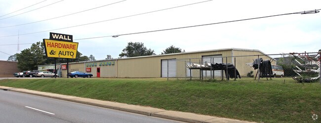
1704 Knox Ave
Augusta-Richmond County, GA-SC
W/SD HWY 25
006-20-01-004
Aiken
Storebuilding
South Carolina
B and X Area of moderate flood hazard, usually the area between the limits of the 100-year and 500-year floods.
010
2025
0.65 AC
2025
North Augusta
020702
Augusta/Richmond County
12,120 SF
NEARBY LISTINGS FOR SALE OR LEASE
DEMOGRAPHICS near 1704 Knox Ave
1 mile
3 mile
5 mile
2025 Total Population
7,258
37,089
91,002
2030 Population
7,624
38,892
94,206
Pop Growth 2025-2030
+ 5.04%
+ 4.86%
+ 3.52%
Average Age
40
41
40
2025 Total Households
3,161
16,368
39,706
HH Growth 2025-2030
+ 5.00%
+ 4.64%
+ 3.41%
Median Household Inc
$66,031
$65,741
$61,967
Avg Household Size
2.20
2.20
2.20
2025 Avg HH Vehicles
2.00
2.00
2.00
Median Home Value
$173,645
$200,612
$221,597
Median Year Built
1973
1973
1974
Nearby Places
Map Layers
Map Styles
 Street
 Aerial
Layers
 Traffic
 Biking
Places
Listings with unknown addresses are not visible on the map
- Restaurants
- Banks
- Shops
- Fitness
- Groceries
PUBLIC TRANSPORTATION
AIRPORT
Augusta Regional at Bush Field
Drive
Walk
Distance
Augusta Regional at Bush Field
24 min
11.3 mi
Freight Ports
Georgia Ports - Savannah
Drive
Walk
Distance
Georgia Ports - Savannah
162 min
121.1 mi
Nearby Properties
Address
Land Use
TOTAL SIZE
Lot Size
Zoning
Address
Land Use
TOTAL SIZE
Lot Size
Zoning
52,025 SF
6.46 AC
Address
Land Use
TOTAL SIZE
Lot Size
Zoning
87,336 SF
32.85 AC
Address
Land Use
TOTAL SIZE
Lot Size
Zoning
197,726 SF
2.93 AC
B-2
Address
Land Use
TOTAL SIZE
Lot Size
Zoning
169,662 SF
3.09 AC
B-2
Address
Land Use
TOTAL SIZE
Lot Size
Zoning
109,272 SF
16.16 AC
Address
Land Use
TOTAL SIZE
Lot Size
Zoning
Address
Land Use
TOTAL SIZE
Lot Size
Zoning
1,000 SF
4.45 AC
Address
Land Use
TOTAL SIZE
Lot Size
Zoning
267,960 SF
2.13 AC
B-2
Address
Land Use
TOTAL SIZE
Lot Size
Zoning
152,352 SF
1.51 AC
Address
Land Use
TOTAL SIZE
Lot Size
Zoning
137,062 SF
4.45 AC
B-2
Address
Land Use
TOTAL SIZE
Lot Size
Zoning
127,728 SF
1.34 AC
B-2
Address
Land Use
TOTAL SIZE
Lot Size
Zoning
109,076 SF
4.23 AC
R-3C
Address
Land Use
TOTAL SIZE
Lot Size
Zoning
106,500 SF
1.41 AC
Address
Land Use
TOTAL SIZE
Lot Size
Zoning
225,546 SF
1.28 AC
B-2
Address
Land Use
TOTAL SIZE
Lot Size
Zoning
87,453 SF
8.90 AC
Address
Land Use
TOTAL SIZE
Lot Size
Zoning
17,954 SF
6.61 AC
LI
Address
Land Use
TOTAL SIZE
Lot Size
Zoning
94,850 SF
0.90 AC
B-2
Address
Land Use
TOTAL SIZE
Lot Size
Zoning
97,846 SF
1.85 AC
B-2
Address
Land Use
TOTAL SIZE
Lot Size
Zoning
5,544 SF
3.56 AC
PUD
Address
Land Use
TOTAL SIZE
Lot Size
Zoning
142,300 SF
1.11 AC
B-2
Address
Land Use
TOTAL SIZE
Lot Size
Zoning
4,495 SF
0.50 AC
B-2
Address
Land Use
TOTAL SIZE
Lot Size
Zoning
94,562 SF
2.64 AC
B-2
Address
Land Use
TOTAL SIZE
Lot Size
Zoning
61.48 AC
Address
Land Use
TOTAL SIZE
Lot Size
Zoning
39,830 SF
2.43 AC
Address
Land Use
TOTAL SIZE
Lot Size
Zoning
163,382 SF
2.47 AC
B-2
Address
Land Use
TOTAL SIZE
Lot Size
Zoning
232,883 SF
9.66 AC
B-2
Address
Land Use
TOTAL SIZE
Lot Size
Zoning
53,022 SF
16.48 AC
R-3B
Address
Land Use
TOTAL SIZE
Lot Size
Zoning
105,175 SF
0.22 AC
B-2
Address
Land Use
TOTAL SIZE
Lot Size
Zoning
39,346 SF
3.55 AC
B-2
Address
Land Use
TOTAL SIZE
Lot Size
Zoning
170,439 SF
0.77 AC
B-2
The World's #1 Commercial Real Estate Marketplace
Connect with us
© 2026 CoStar Group
The information above has been obtained from sources believed reliable. While we do not doubt its accuracy we have not verified it and make no guarantee, warranty or representation about it. It is your responsibility to independently confirm its accuracy and completeness. Any projections, opinions, assumptions, or estimates used are for example only and do not represent the current or future performance of the property. The value of this transaction to you depends on tax and other factors which should be evaluated by your tax, financial, and legal advisors. You and your advisors should conduct a careful, independent investigation of the property to determine to your satisfaction the suitability of the property for your needs.