Property Record
1704 Nw 3Rd Ter, Homestead, FL 33034


NEARBY LISTINGS FOR SALE OR LEASE
Property Detail
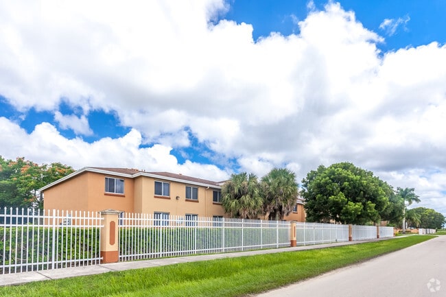
1704 Nw 3Rd Ter
16-7823-000-0030
23 57 38
Multifamilydwelling
23 57 38 10 AC SW1/4 OF NW1/4 OF SE1/4 LOT SIZE IRREGULAR FAU 30-7823-000-0030 OR 19361-1723 112000 1
AH
Miami/Dade
12086C0710L
Florida
2024
10 AC
2025
Outer Homestead/South Dade
011405
South Florida
125,800 SF
Miami-Miami Beach-Kendall, FL
DEMOGRAPHICS near 1704 Nw 3Rd Ter
1 Mile
3 Mile
5 Mile
2024 Total Population
8,802
61,979
111,455
2029 Population
8,619
60,640
109,226
Pop Growth 2024-2029
(2.08%)
(2.16%)
(2.00%)
Average Age
36
35
36
2024 Total Households
2,689
17,824
32,577
HH Growth 2024-2029
(2.45%)
(2.65%)
(2.46%)
Median Household Inc
$38,738
$44,225
$53,317
Avg Household Size
3.10
3.20
3.20
2024 Avg HH Vehicles
2.00
2.00
2.00
Median Home Value
$250,253
$277,597
$311,551
Median Year Built
1994
1991
1994
Nearby Places
Map Layers
Map Styles
 Street
 Aerial
- Restaurants
- Banks
- Shops
- Fitness
- Groceries
PUBLIC TRANSPORTATION
AIRPORT
Miami International
DRIVE
WALK
Distance
Miami International
49 min
33.9 mi
Freight Ports
Port of Miami
DRIVE
WALK
Distance
Port of Miami
59 min
41.0 mi
Nearby Properties
Address
Land Use
TOTAL SIZE
Lot Size
Zoning
Address
Land Use
TOTAL SIZE
Lot Size
Zoning
216,282 SF
20.04 AC
6300
Address
Land Use
TOTAL SIZE
Lot Size
Zoning
304,629 SF
36.34 AC
0100
Address
Land Use
TOTAL SIZE
Lot Size
Zoning
252,526 SF
29.86 AC
6000
Address
Land Use
TOTAL SIZE
Lot Size
Zoning
43,850 SF
53.86 AC
8900
Address
Land Use
TOTAL SIZE
Lot Size
Zoning
333,636 SF
77.26 AC
8900
Address
Land Use
TOTAL SIZE
Lot Size
Zoning
169,474 SF
5.76 AC
6300
Address
Land Use
TOTAL SIZE
Lot Size
Zoning
278,375 SF
20.15 AC
7000
Address
Land Use
TOTAL SIZE
Lot Size
Zoning
208,951 SF
20 AC
6300
Address
Land Use
TOTAL SIZE
Lot Size
Zoning
282,264 SF
52.46 AC
8900
Address
Land Use
TOTAL SIZE
Lot Size
Zoning
409,347 SF
33.88 AC
3000
Address
Land Use
TOTAL SIZE
Lot Size
Zoning
322,425 SF
16.40 AC
5700
Address
Land Use
TOTAL SIZE
Lot Size
Zoning
203,528 SF
3.73 AC
6000
Address
Land Use
TOTAL SIZE
Lot Size
Zoning
234,124 SF
23.35 AC
6000
Address
Land Use
TOTAL SIZE
Lot Size
Zoning
374,632 SF
23.28 AC
3000
Address
Land Use
TOTAL SIZE
Lot Size
Zoning
24.37 AC
6600
Address
Land Use
TOTAL SIZE
Lot Size
Zoning
146,483 SF
20 AC
8900
Address
Land Use
TOTAL SIZE
Lot Size
Zoning
431,236 SF
2.74 AC
9450
Address
Land Use
TOTAL SIZE
Lot Size
Zoning
84,500 SF
2.90 AC
7000
Address
Land Use
TOTAL SIZE
Lot Size
Zoning
102,707 SF
3.63 AC
9200
Address
Land Use
TOTAL SIZE
Lot Size
Zoning
126,637 SF
9.70 AC
6500
Address
Land Use
TOTAL SIZE
Lot Size
Zoning
49.95 AC
9300
Address
Land Use
TOTAL SIZE
Lot Size
Zoning
101,327 SF
0.69 AC
8000
Address
Land Use
TOTAL SIZE
Lot Size
Zoning
130,077 SF
15.01 AC
6000
Address
Land Use
TOTAL SIZE
Lot Size
Zoning
73,652 SF
37.68 AC
8000
Address
Land Use
TOTAL SIZE
Lot Size
Zoning
83,074 SF
5 AC
3000
Address
Land Use
TOTAL SIZE
Lot Size
Zoning
204,417 SF
58.19 AC
8900
Address
Land Use
TOTAL SIZE
Lot Size
Zoning
106,780 SF
1.33 AC
8000
Address
Land Use
TOTAL SIZE
Lot Size
Zoning
180,121 SF
9.27 AC
6000
The World's #1 Commercial Real Estate Marketplace
Connect with us
© 2026 CoStar Group
The information above has been obtained from sources believed reliable. While we do not doubt its accuracy we have not verified it and make no guarantee, warranty or representation about it. It is your responsibility to independently confirm its accuracy and completeness. Any projections, opinions, assumptions, or estimates used are for example only and do not represent the current or future performance of the property. The value of this transaction to you depends on tax and other factors which should be evaluated by your tax, financial, and legal advisors. You and your advisors should conduct a careful, independent investigation of the property to determine to your satisfaction the suitability of the property for your needs.