Property Record
1704 Trimble Rd, Edgewood, MD 21040
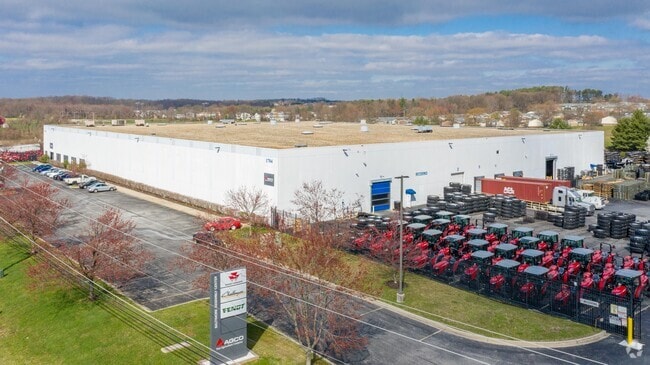
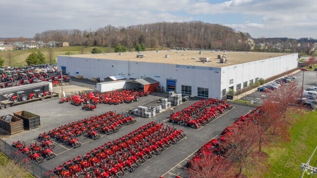
Property Detail
1704 Trimble Rd
01-327291
LOT 1 2.44 AC 1604 TRIMBLE ROAD LD SCHNEPFE PT 205/12
Manufacturinglight
Harford
LI
Maryland
B and X Area of moderate flood hazard, usually the area between the limits of the 100-year and 500-year floods.
1
2025
10.97 AC
2025
Outlying Harford Cnty
301601
Baltimore
105,000 SF
Baltimore-Columbia-Towson, MD
NEARBY LISTINGS FOR SALE OR LEASE
DEMOGRAPHICS near 1704 Trimble Rd
1 mile
3 mile
5 mile
2025 Total Population
11,626
38,977
80,554
2030 Population
11,775
39,551
81,252
Pop Growth 2025-2030
+ 1.28%
+ 1.47%
+ 0.87%
Average Age
35
39
40
2025 Total Households
4,187
14,467
30,198
HH Growth 2025-2030
+ 1.36%
+ 1.49%
+ 0.84%
Median Household Inc
$84,866
$90,329
$103,909
Avg Household Size
2.60
2.60
2.60
2025 Avg HH Vehicles
1.00
2.00
2.00
Median Home Value
$236,766
$277,789
$317,482
Median Year Built
1979
1982
1987
Nearby Places
Map Layers
Map Styles
 Street
 Aerial
Transit
 Traffic
 Biking
Places
Listings with unknown addresses are not visible on the map
- Restaurants
- Banks
- Shops
- Fitness
- Groceries
PUBLIC TRANSPORTATION
COMMUTER RAIL
Drive
Walk
Distance
4 min
1.3 mi
AIRPORT
Baltimore/Washington International Thurgood Marshall
Drive
Walk
Distance
Baltimore/Washington International Thurgood Marshall
49 min
33.0 mi
Freight Ports
Port of Baltimore
Drive
Walk
Distance
Port of Baltimore
38 min
26.4 mi
Nearby Properties
Address
Land Use
TOTAL SIZE
Lot Size
Zoning
Address
Land Use
TOTAL SIZE
Lot Size
Zoning
5,501.68 AC
R1
Address
Land Use
TOTAL SIZE
Lot Size
Zoning
97,619 SF
99.88 AC
R2
Address
Land Use
TOTAL SIZE
Lot Size
Zoning
253,842 SF
69.33 AC
R2
Address
Land Use
TOTAL SIZE
Lot Size
Zoning
44,475 SF
86.10 AC
R2
Address
Land Use
TOTAL SIZE
Lot Size
Zoning
822,410 SF
44.24 AC
GI
Address
Land Use
TOTAL SIZE
Lot Size
Zoning
996,030 SF
70.22 AC
GI
Address
Land Use
TOTAL SIZE
Lot Size
Zoning
212,760 SF
27.85 AC
GI
Address
Land Use
TOTAL SIZE
Lot Size
Zoning
246,560 SF
14.57 AC
LI
Address
Land Use
TOTAL SIZE
Lot Size
Zoning
1,690 SF
76.45 AC
R4
Address
Land Use
TOTAL SIZE
Lot Size
Zoning
109,398 SF
11.36 AC
CI
Address
Land Use
TOTAL SIZE
Lot Size
Zoning
200 AC
R4
Address
Land Use
TOTAL SIZE
Lot Size
Zoning
134,875 SF
40.88 AC
CI
Address
Land Use
TOTAL SIZE
Lot Size
Zoning
113,173 SF
17.04 AC
CI
Address
Land Use
TOTAL SIZE
Lot Size
Zoning
94,312 SF
14.40 AC
LI
Address
Land Use
TOTAL SIZE
Lot Size
Zoning
18.51 AC
R3
Address
Land Use
TOTAL SIZE
Lot Size
Zoning
255,464 SF
19.15 AC
GI
Address
Land Use
TOTAL SIZE
Lot Size
Zoning
191 AC
R4
Address
Land Use
TOTAL SIZE
Lot Size
Zoning
51,449 SF
32.85 AC
R4
Address
Land Use
TOTAL SIZE
Lot Size
Zoning
142,311 SF
24.28 AC
GI
Address
Land Use
TOTAL SIZE
Lot Size
Zoning
150 AC
R4
Address
Land Use
TOTAL SIZE
Lot Size
Zoning
150 AC
R4
Address
Land Use
TOTAL SIZE
Lot Size
Zoning
116,650 SF
47.59 AC
B3
Address
Land Use
TOTAL SIZE
Lot Size
Zoning
97,454 SF
14.72 AC
L1
Address
Land Use
TOTAL SIZE
Lot Size
Zoning
67,184 SF
8.51 AC
GI
Address
Land Use
TOTAL SIZE
Lot Size
Zoning
130,200 SF
10.03 AC
LI
Address
Land Use
TOTAL SIZE
Lot Size
Zoning
81,250 SF
9.80 AC
R4
Address
Land Use
TOTAL SIZE
Lot Size
Zoning
28,452 SF
6 AC
R4
Address
Land Use
TOTAL SIZE
Lot Size
Zoning
5,700 SF
8.68 AC
CI
Address
Land Use
TOTAL SIZE
Lot Size
Zoning
100,950 SF
7.26 AC
R4
Address
Land Use
TOTAL SIZE
Lot Size
Zoning
47.17 AC
R1
The World's #1 Commercial Real Estate Marketplace
Connect with us
© 2026 CoStar Group
The information above has been obtained from sources believed reliable. While we do not doubt its accuracy we have not verified it and make no guarantee, warranty or representation about it. It is your responsibility to independently confirm its accuracy and completeness. Any projections, opinions, assumptions, or estimates used are for example only and do not represent the current or future performance of the property. The value of this transaction to you depends on tax and other factors which should be evaluated by your tax, financial, and legal advisors. You and your advisors should conduct a careful, independent investigation of the property to determine to your satisfaction the suitability of the property for your needs.