Property Record
17041 Miramar Pkwy, Miramar, FL 33027


NEARBY LISTINGS FOR SALE OR LEASE
Property Detail
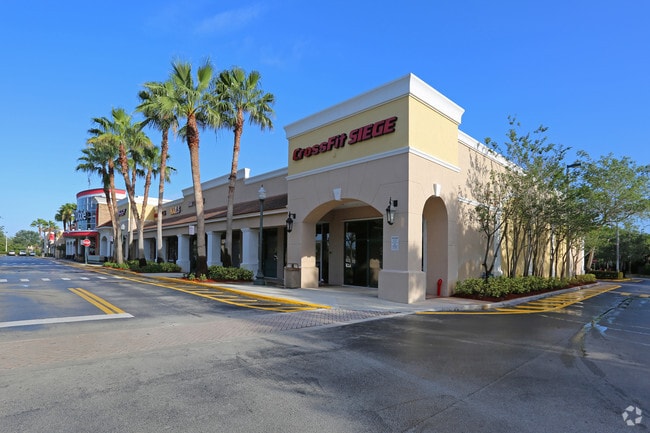
17041 Miramar Pkwy
51-40-29-06-0010
Miramar Plaza 166-25 B
Regionalshoppingcenterormallwithanchorstore
MIRAMAR PLAZA 166-25 B PARCELS A,B & C,LESS CITY OF MIRAMAR LIFT STATION DESC IN OR 36894/1393,LESS OUTPARCELS 2,3 & 4 AKA:PARCEL 1
AE
Broward
12011C0705J
Florida
2024
9.33 AC
2025
Southwest Broward
110360
South Florida
72,256 SF
Fort Lauderdale-Pompano Beach-Deerfield Beach, FL
DEMOGRAPHICS near 17041 Miramar Pkwy
1 Mile
3 Mile
5 Mile
2024 Total Population
12,812
74,198
221,619
2029 Population
12,630
72,826
218,368
Pop Growth 2024-2029
(1.42%)
(1.85%)
(1.47%)
Average Age
38
39
40
2024 Total Households
3,637
21,999
73,161
HH Growth 2024-2029
(1.98%)
(2.41%)
(1.80%)
Median Household Inc
$148,535
$121,392
$88,730
Avg Household Size
3.40
3.20
2.90
2024 Avg HH Vehicles
3.00
2.00
2.00
Median Home Value
$485,271
$463,562
$420,826
Median Year Built
1997
1997
1995
Nearby Places
Map Layers
Map Styles
 Street
 Aerial
- Restaurants
- Banks
- Shops
- Fitness
- Groceries
PUBLIC TRANSPORTATION
AIRPORT
Miami International
DRIVE
WALK
Distance
Miami International
29 min
17.7 mi
Fort Lauderdale/Hollywood International
DRIVE
WALK
Distance
Fort Lauderdale/Hollywood International
34 min
21.3 mi
Nearby Properties
Address
Land Use
TOTAL SIZE
Lot Size
Zoning
Address
Land Use
TOTAL SIZE
Lot Size
Zoning
598,209 SF
20 AC
PID
Address
Land Use
TOTAL SIZE
Lot Size
Zoning
402,526 SF
39.92 AC
(PCD)
Address
Land Use
TOTAL SIZE
Lot Size
Zoning
573,771 SF
59.36 AC
CF
Address
Land Use
TOTAL SIZE
Lot Size
Zoning
428,179 SF
21.50 AC
RM2
Address
Land Use
TOTAL SIZE
Lot Size
Zoning
454,092 SF
6.13 AC
(PD-SL)
Address
Land Use
TOTAL SIZE
Lot Size
Zoning
312,631 SF
40.99 AC
(B-3)
Address
Land Use
TOTAL SIZE
Lot Size
Zoning
8.95 AC
ML
Address
Land Use
TOTAL SIZE
Lot Size
Zoning
302,864 SF
20.08 AC
PID
Address
Land Use
TOTAL SIZE
Lot Size
Zoning
242,189 SF
18.03 AC
PID
Address
Land Use
TOTAL SIZE
Lot Size
Zoning
124,351 SF
13.19 AC
(MXD)
Address
Land Use
TOTAL SIZE
Lot Size
Zoning
268,977 SF
45.01 AC
CF
Address
Land Use
TOTAL SIZE
Lot Size
Zoning
137,254 SF
18.31 AC
(B-3)
Address
Land Use
TOTAL SIZE
Lot Size
Zoning
144,851 SF
8.85 AC
(PCD)
Address
Land Use
TOTAL SIZE
Lot Size
Zoning
323,776 SF
19.31 AC
(B-3)
Address
Land Use
TOTAL SIZE
Lot Size
Zoning
250,900 SF
19.17 AC
PUD
Address
Land Use
TOTAL SIZE
Lot Size
Zoning
177,346 SF
6.58 AC
(PCD)
Address
Land Use
TOTAL SIZE
Lot Size
Zoning
147,281 SF
15.27 AC
B2
Address
Land Use
TOTAL SIZE
Lot Size
Zoning
263,057 SF
12.68 AC
PID
Address
Land Use
TOTAL SIZE
Lot Size
Zoning
243,995 SF
20.01 AC
CF
Address
Land Use
TOTAL SIZE
Lot Size
Zoning
97,644 SF
11.13 AC
(B-3)
Address
Land Use
TOTAL SIZE
Lot Size
Zoning
155,671 SF
10.62 AC
B2
Address
Land Use
TOTAL SIZE
Lot Size
Zoning
133,357 SF
15.42 AC
(PUD)
Address
Land Use
TOTAL SIZE
Lot Size
Zoning
134,786 SF
10.41 AC
PID
Address
Land Use
TOTAL SIZE
Lot Size
Zoning
145,755 SF
12 AC
PUD
Address
Land Use
TOTAL SIZE
Lot Size
Zoning
150,803 SF
11.93 AC
(B-3)
Address
Land Use
TOTAL SIZE
Lot Size
Zoning
89,017 SF
8.49 AC
(B-3)
Address
Land Use
TOTAL SIZE
Lot Size
Zoning
70,529 SF
8.15 AC
EC
Address
Land Use
TOTAL SIZE
Lot Size
Zoning
17,281 SF
55.30 AC
OS
Address
Land Use
TOTAL SIZE
Lot Size
Zoning
91,101 SF
5.32 AC
PID
Address
Land Use
TOTAL SIZE
Lot Size
Zoning
161,408 SF
12 AC
CF
The World's #1 Commercial Real Estate Marketplace
Connect with us
© 2026 CoStar Group
The information above has been obtained from sources believed reliable. While we do not doubt its accuracy we have not verified it and make no guarantee, warranty or representation about it. It is your responsibility to independently confirm its accuracy and completeness. Any projections, opinions, assumptions, or estimates used are for example only and do not represent the current or future performance of the property. The value of this transaction to you depends on tax and other factors which should be evaluated by your tax, financial, and legal advisors. You and your advisors should conduct a careful, independent investigation of the property to determine to your satisfaction the suitability of the property for your needs.