Property Record
1705 Cal Edison Dr, Laughlin, NV 89029
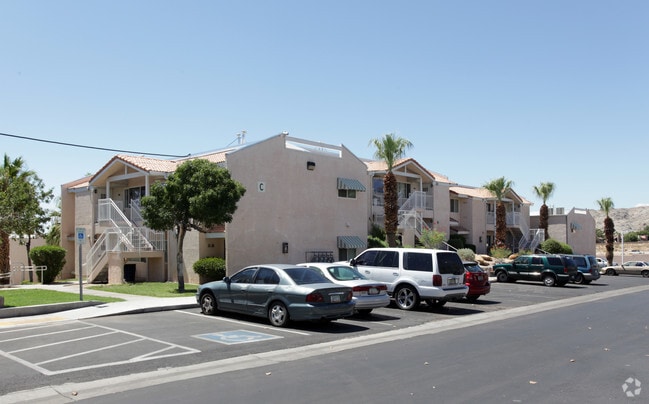

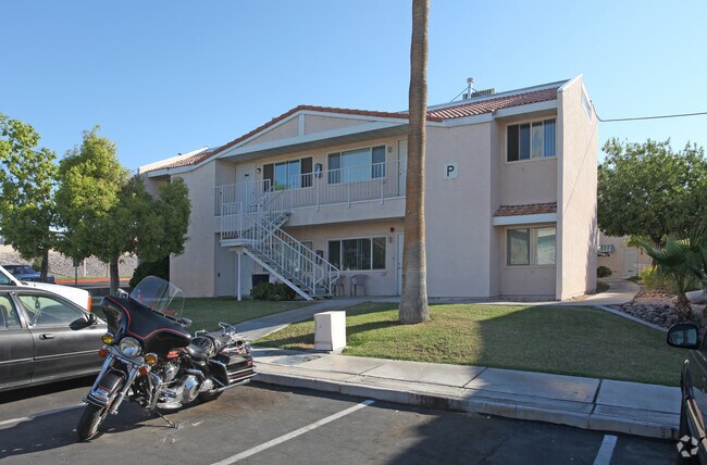
Property Detail
1705 Cal Edison Dr
264-28-602-003
PARCEL MAP FILE 55 PAGE 38 LOT 2
Apartment
Clark
R4
Nevada
C and X Area of minimal flood hazard, usually depicted on FIRMs as above the 500-year flood level.
2
0
4.30 AC
2026
South Outlying Clark County
005702
Las Vegas
82,342 SF
Las Vegas-Henderson-North Las Vegas, NV
NEARBY LISTINGS FOR SALE OR LEASE
DEMOGRAPHICS near 1705 Cal Edison Dr
1 mile
3 mile
5 mile
2024 Total Population
7,720
33,717
44,951
2029 Population
8,209
35,651
47,557
Pop Growth 2024-2029
+ 6.33%
+ 5.74%
+ 5.80%
Average Age
51
48
49
2024 Total Households
3,952
15,034
20,387
HH Growth 2024-2029
+ 6.33%
+ 5.69%
+ 5.74%
Median Household Inc
$46,037
$43,437
$44,690
Avg Household Size
2.00
2.20
2.20
2024 Avg HH Vehicles
1.00
2.00
2.00
Median Home Value
$277,620
$176,964
$198,914
Median Year Built
1989
1987
1989
Nearby Places
Map Layers
Map Styles
 Street
 Aerial
Transit
 Traffic
 Biking
Places
Listings with unknown addresses are not visible on the map
- Restaurants
- Banks
- Shops
- Fitness
- Groceries
Nearby Properties
Address
Land Use
TOTAL SIZE
Lot Size
Zoning
Address
Land Use
TOTAL SIZE
Lot Size
Zoning
235,806 SF
34.57 AC
H1
Address
Land Use
TOTAL SIZE
Lot Size
Zoning
256,872 SF
47.81 AC
Address
Land Use
TOTAL SIZE
Lot Size
Zoning
15,750 SF
27.78 AC
H1
Address
Land Use
TOTAL SIZE
Lot Size
Zoning
152,143 SF
39.95 AC
Address
Land Use
TOTAL SIZE
Lot Size
Zoning
53,240 SF
9.78 AC
Address
Land Use
TOTAL SIZE
Lot Size
Zoning
21,950 SF
7.57 AC
H1
Address
Land Use
TOTAL SIZE
Lot Size
Zoning
55,402 SF
3.24 AC
Address
Land Use
TOTAL SIZE
Lot Size
Zoning
181,040 SF
16.02 AC
Address
Land Use
TOTAL SIZE
Lot Size
Zoning
32,605 SF
33.09 AC
Address
Land Use
TOTAL SIZE
Lot Size
Zoning
80 AC
RU
Address
Land Use
TOTAL SIZE
Lot Size
Zoning
109,753 SF
15.58 AC
Address
Land Use
TOTAL SIZE
Lot Size
Zoning
525,752 SF
7.87 AC
Address
Land Use
TOTAL SIZE
Lot Size
Zoning
2,906 SF
14.24 AC
RU
Address
Land Use
TOTAL SIZE
Lot Size
Zoning
10,583 SF
211.53 AC
Address
Land Use
TOTAL SIZE
Lot Size
Zoning
1,011,986 SF
17.67 AC
H1
Address
Land Use
TOTAL SIZE
Lot Size
Zoning
8,747 SF
320 AC
PF
Address
Land Use
TOTAL SIZE
Lot Size
Zoning
20,792 SF
4.96 AC
Address
Land Use
TOTAL SIZE
Lot Size
Zoning
121,919 SF
13.24 AC
Address
Land Use
TOTAL SIZE
Lot Size
Zoning
89,705 SF
6.42 AC
Address
Land Use
TOTAL SIZE
Lot Size
Zoning
7,861 SF
17 AC
Address
Land Use
TOTAL SIZE
Lot Size
Zoning
52,001 SF
5.70 AC
Address
Land Use
TOTAL SIZE
Lot Size
Zoning
39,927 SF
13.41 AC
Address
Land Use
TOTAL SIZE
Lot Size
Zoning
42,243 SF
1.14 AC
Address
Land Use
TOTAL SIZE
Lot Size
Zoning
49,526 SF
3.50 AC
Address
Land Use
TOTAL SIZE
Lot Size
Zoning
2,189 SF
2.49 AC
Address
Land Use
TOTAL SIZE
Lot Size
Zoning
139,189 SF
5.29 AC
RU
Address
Land Use
TOTAL SIZE
Lot Size
Zoning
24,886 SF
0.77 AC
Address
Land Use
TOTAL SIZE
Lot Size
Zoning
27,921 SF
19.40 AC
Address
Land Use
TOTAL SIZE
Lot Size
Zoning
117,430 SF
5.53 AC
Address
Land Use
TOTAL SIZE
Lot Size
Zoning
25,934 SF
0.47 AC
The World's #1 Commercial Real Estate Marketplace
Connect with us
© 2026 CoStar Group
The information above has been obtained from sources believed reliable. While we do not doubt its accuracy we have not verified it and make no guarantee, warranty or representation about it. It is your responsibility to independently confirm its accuracy and completeness. Any projections, opinions, assumptions, or estimates used are for example only and do not represent the current or future performance of the property. The value of this transaction to you depends on tax and other factors which should be evaluated by your tax, financial, and legal advisors. You and your advisors should conduct a careful, independent investigation of the property to determine to your satisfaction the suitability of the property for your needs.