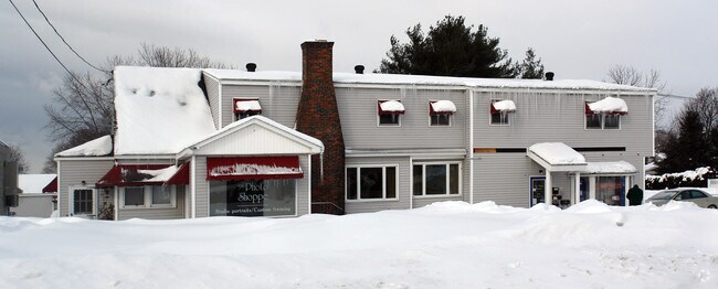
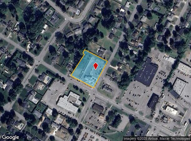
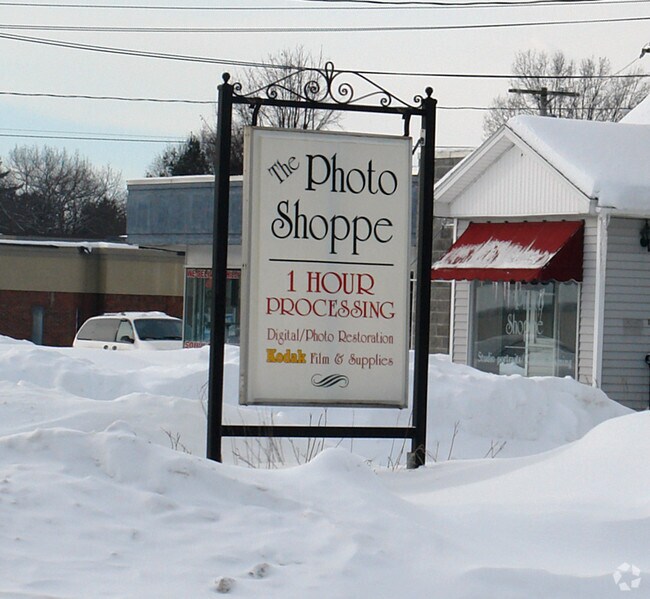
Property Record
1705 N James St, Rome, NY 13440
NEARBY LISTINGS FOR SALE OR LEASE
Property Detail
1705 N James St
223-016-0003-008-000-0000
Oneida
Financialbuilding
New York
X
8.000
36065C0552F
1.42 AC
2025
Downtown Rome
2024
Utica/Rome
022701
Utica-Rome, NY
2,858 SF
DEMOGRAPHICS near 1705 N James St
1 Mile
3 Mile
5 Mile
2024 Total Population
7,267
27,893
37,093
2029 Population
7,229
27,602
36,730
Pop Growth 2024-2029
(0.52%)
(1.04%)
(0.98%)
Average Age
45
41
42
2024 Total Households
3,262
12,244
15,661
HH Growth 2024-2029
(0.52%)
(1.21%)
(1.17%)
Median Household Inc
$65,567
$49,271
$56,791
Avg Household Size
2.10
2.20
2.20
2024 Avg HH Vehicles
2.00
1.00
2.00
Median Home Value
$151,766
$113,527
$137,873
Median Year Built
1954
1953
1956
Nearby Places
Map Layers
Map Styles
 Street
 Aerial
- Restaurants
- Banks
- Shops
- Fitness
- Groceries
PUBLIC TRANSPORTATION
COMMUTER RAIL
DRIVE
WALK
Distance
6 min
2.8 mi
DRIVE
WALK
Distance
6 min
2.8 mi
AIRPORT
Syracuse Hancock International
DRIVE
WALK
Distance
Syracuse Hancock International
62 min
47.3 mi
Nearby Properties
Address
Land Use
TOTAL SIZE
Lot Size
Zoning
Address
Land Use
TOTAL SIZE
Lot Size
Zoning
16,970 SF
1,263.52 AC
GB
Address
Land Use
TOTAL SIZE
Lot Size
Zoning
234,767 SF
7.70 AC
I
Address
Land Use
TOTAL SIZE
Lot Size
Zoning
273,250 SF
78.37 AC
GB
Address
Land Use
TOTAL SIZE
Lot Size
Zoning
70,000 SF
126.93 AC
GB
Address
Land Use
TOTAL SIZE
Lot Size
Zoning
70,000 SF
126.93 AC
GB
Address
Land Use
TOTAL SIZE
Lot Size
Zoning
777,552 SF
63.78 AC
GB
Address
Land Use
TOTAL SIZE
Lot Size
Zoning
11,842 SF
18.34 AC
GB
Address
Land Use
TOTAL SIZE
Lot Size
Zoning
385,216 SF
30.87 AC
GB
Address
Land Use
TOTAL SIZE
Lot Size
Zoning
195,839 SF
22.69 AC
GB
Address
Land Use
TOTAL SIZE
Lot Size
Zoning
77,604 SF
4.34 AC
GB
Address
Land Use
TOTAL SIZE
Lot Size
Zoning
80 AC
GB
Address
Land Use
TOTAL SIZE
Lot Size
Zoning
60,450 SF
2.95 AC
R-P
Address
Land Use
TOTAL SIZE
Lot Size
Zoning
58,560 SF
2.44 AC
R-P
Address
Land Use
TOTAL SIZE
Lot Size
Zoning
112,259 SF
2.59 AC
C-3
Address
Land Use
TOTAL SIZE
Lot Size
Zoning
10,836 SF
11.24 AC
R-3
Address
Land Use
TOTAL SIZE
Lot Size
Zoning
6,104 SF
123.23 AC
GB
Address
Land Use
TOTAL SIZE
Lot Size
Zoning
131,001 SF
14.70 AC
R-2
Address
Land Use
TOTAL SIZE
Lot Size
Zoning
173,579 SF
14.46 AC
R-1-8
Address
Land Use
TOTAL SIZE
Lot Size
Zoning
75,547 SF
12.17 AC
GB
Address
Land Use
TOTAL SIZE
Lot Size
Zoning
41,262 SF
16.30 AC
R-1-8
Address
Land Use
TOTAL SIZE
Lot Size
Zoning
113,024 SF
10.39 AC
GB
Address
Land Use
TOTAL SIZE
Lot Size
Zoning
25,002 SF
6.53 AC
R-3
Address
Land Use
TOTAL SIZE
Lot Size
Zoning
49,643 SF
8 AC
C-1
Address
Land Use
TOTAL SIZE
Lot Size
Zoning
2,630 SF
13.09 AC
R-3
Address
Land Use
TOTAL SIZE
Lot Size
Zoning
3,778 SF
15.52 AC
OS
Address
Land Use
TOTAL SIZE
Lot Size
Zoning
32,156 SF
6.14 AC
GB
Address
Land Use
TOTAL SIZE
Lot Size
Zoning
52,721 SF
4.16 AC
GB
Address
Land Use
TOTAL SIZE
Lot Size
Zoning
Address
Land Use
TOTAL SIZE
Lot Size
Zoning
82,918 SF
3.70 AC
W
Address
Land Use
TOTAL SIZE
Lot Size
Zoning
133,723 SF
9.28 AC
C-2
The World's #1 Commercial Real Estate Marketplace
Connect with us
© 2026 CoStar Group
The information above has been obtained from sources believed reliable. While we do not doubt its accuracy we have not verified it and make no guarantee, warranty or representation about it. It is your responsibility to independently confirm its accuracy and completeness. Any projections, opinions, assumptions, or estimates used are for example only and do not represent the current or future performance of the property. The value of this transaction to you depends on tax and other factors which should be evaluated by your tax, financial, and legal advisors. You and your advisors should conduct a careful, independent investigation of the property to determine to your satisfaction the suitability of the property for your needs.