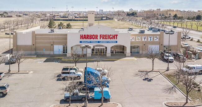
Property Record
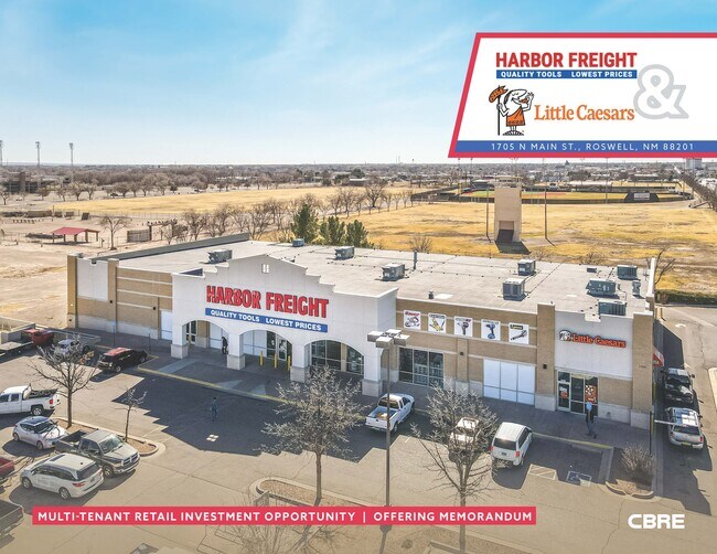
1705 N Main St, Roswell, NM 88201

Property Detail
1705 N Main St
R006413
SUBD: PARKWOOD SUBDIVISION TRACT: 1 QUARTER: SW S: 28 T: 10S R: 24E DOC# 202109137 SWD
Realpropertynec
Chaves
COMMUNITY
New Mexico
B and X Area of moderate flood hazard, usually the area between the limits of the 100-year and 500-year floods.
1.91 AC
2024
New Mexico South Area
2025
Other Market Areas
000302
Roswell, NM
22,500 SF
NEARBY LISTINGS FOR SALE OR LEASE
DEMOGRAPHICS near 1705 N Main St
1 mile
3 mile
5 mile
2025 Total Population
6,426
37,526
49,749
2030 Population
6,435
37,170
49,254
Pop Growth 2025-2030
+ 0.14%
(0.95%)
(0.99%)
Average Age
39
39
38
2025 Total Households
2,594
14,248
18,662
HH Growth 2025-2030
+ 0.12%
(1.06%)
(1.09%)
Median Household Inc
$50,169
$50,869
$52,490
Avg Household Size
2.30
2.50
2.60
2025 Avg HH Vehicles
2.00
2.00
2.00
Median Home Value
$166,343
$176,991
$165,709
Median Year Built
1970
1969
1970
Nearby Places
Map Layers
Map Styles
 Street
 Aerial
Transit
 Traffic
 Biking
Places
Listings with unknown addresses are not visible on the map
- Restaurants
- Banks
- Shops
- Fitness
- Groceries
PUBLIC TRANSPORTATION
AIRPORT
Roswell Air Center
Drive
Walk
Distance
Roswell Air Center
18 min
7.8 mi
SALE & LEASE HISTORY
LISTING DATE
SALE/LEASE

Sep 07, 2018
For Sale
Nov 16, 2016
For Lease
Mar 31, 2021
For Sale
Mar 28, 2019
For Sale
Jun 11, 2020
For Sale
Nearby Properties
Address
Land Use
TOTAL SIZE
Lot Size
Zoning
Address
Land Use
TOTAL SIZE
Lot Size
Zoning
1,829,640 SF
3.68 AC
CENTRAL BU
Address
Land Use
TOTAL SIZE
Lot Size
Zoning
10,644 SF
5.81 AC
COMMUNITY
Address
Land Use
TOTAL SIZE
Lot Size
Zoning
42.76 AC
RESIDENTIA
Address
Land Use
TOTAL SIZE
Lot Size
Zoning
23.93 AC
RESIDENTIA
Address
Land Use
TOTAL SIZE
Lot Size
Zoning
18.18 AC
COMMUNITY
Address
Land Use
TOTAL SIZE
Lot Size
Zoning
230,872 SF
9.40 AC
COMMUNITY
Address
Land Use
TOTAL SIZE
Lot Size
Zoning
10 AC
RESIDENTIA
Address
Land Use
TOTAL SIZE
Lot Size
Zoning
2.54 AC
RESIDENTIA
Address
Land Use
TOTAL SIZE
Lot Size
Zoning
2.58 AC
COMMUNITY
Address
Land Use
TOTAL SIZE
Lot Size
Zoning
150.96 AC
RESIDENTIA
Address
Land Use
TOTAL SIZE
Lot Size
Zoning
1.59 AC
CENTRAL BU
Address
Land Use
TOTAL SIZE
Lot Size
Zoning
56.23 AC
Address
Land Use
TOTAL SIZE
Lot Size
Zoning
11.02 AC
RESIDENTIA
Address
Land Use
TOTAL SIZE
Lot Size
Zoning
18,630 SF
9.10 AC
COMMUNITY
Address
Land Use
TOTAL SIZE
Lot Size
Zoning
17,567 SF
1.24 AC
RESIDENTIA
Address
Land Use
TOTAL SIZE
Lot Size
Zoning
6.47 AC
RESIDENTIA
Address
Land Use
TOTAL SIZE
Lot Size
Zoning
203,209 SF
22.13 AC
COMMUNITY
Address
Land Use
TOTAL SIZE
Lot Size
Zoning
2.36 AC
RESIDENTIA
Address
Land Use
TOTAL SIZE
Lot Size
Zoning
9.52 AC
RESIDENTIA
Address
Land Use
TOTAL SIZE
Lot Size
Zoning
3.58 AC
RESIDENTIA
Address
Land Use
TOTAL SIZE
Lot Size
Zoning
2.10 AC
CENTRAL BU
Address
Land Use
TOTAL SIZE
Lot Size
Zoning
9.05 AC
Address
Land Use
TOTAL SIZE
Lot Size
Zoning
5 AC
RESIDENTIA
Address
Land Use
TOTAL SIZE
Lot Size
Zoning
Address
Land Use
TOTAL SIZE
Lot Size
Zoning
134,448 SF
15.85 AC
COMMUNITY
Address
Land Use
TOTAL SIZE
Lot Size
Zoning
4.91 AC
RESIDENTIA
Address
Land Use
TOTAL SIZE
Lot Size
Zoning
38,671 SF
6.59 AC
COMMUNITY
Address
Land Use
TOTAL SIZE
Lot Size
Zoning
21,500 SF
4.78 AC
COMMUNITY
Address
Land Use
TOTAL SIZE
Lot Size
Zoning
2.61 AC
RESIDENTIA
Address
Land Use
TOTAL SIZE
Lot Size
Zoning
44,153 SF
1.29 AC
CENTRAL BU
The World's #1 Commercial Real Estate Marketplace
Connect with us
© 2026 CoStar Group
The information above has been obtained from sources believed reliable. While we do not doubt its accuracy we have not verified it and make no guarantee, warranty or representation about it. It is your responsibility to independently confirm its accuracy and completeness. Any projections, opinions, assumptions, or estimates used are for example only and do not represent the current or future performance of the property. The value of this transaction to you depends on tax and other factors which should be evaluated by your tax, financial, and legal advisors. You and your advisors should conduct a careful, independent investigation of the property to determine to your satisfaction the suitability of the property for your needs.