Property Record
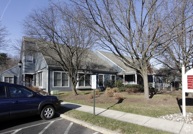
1707 Langhorne Newtown Rd, Langhorne, PA 19047


NEARBY LISTINGS FOR SALE OR LEASE
Property Detail
1707 Langhorne Newtown Rd
20-016-064
1.1914AC S S OF LANGHORNE-YARDLEY RD 370 E OF STONEY HILL RD 412 ON LANGHORNE-YARDLEY RD
Retailwithmorethanonenonretailuse
Bucks
X
Pennsylvania
42017C0451J
1.19 AC
2024
Lower Bucks County
2025
Philadelphia
100809
Philadelphia-Camden-Wilmington, PA-NJ-DE-MD
8,940 SF
DEMOGRAPHICS near 1707 Langhorne Newtown Rd
1 Mile
3 Mile
5 Mile
2024 Total Population
6,557
51,301
138,911
2029 Population
6,499
51,027
138,127
Pop Growth 2024-2029
(0.88%)
(0.53%)
(0.56%)
Average Age
47
46
44
2024 Total Households
2,822
20,123
51,874
HH Growth 2024-2029
(0.89%)
(0.62%)
(0.61%)
Median Household Inc
$118,992
$123,612
$124,011
Avg Household Size
2.20
2.50
2.60
2024 Avg HH Vehicles
2.00
2.00
2.00
Median Home Value
$484,767
$471,225
$443,879
Median Year Built
1982
1984
1980
Nearby Places
Map Layers
Map Styles
 Street
 Aerial
- Restaurants
- Banks
- Shops
- Fitness
- Groceries
PUBLIC TRANSPORTATION
COMMUTER RAIL
Yardley (R3 - Southeastern Pennsylvania Transportation Authority Regional Rail (SEPTA Regional Rail))
DRIVE
WALK
Distance
Yardley (R3 - Southeastern Pennsylvania Transportation Authority Regional Rail (SEPTA Regional Rail))
6 min
3.2 mi
Woodbourne (R3 - Southeastern Pennsylvania Transportation Authority Regional Rail (SEPTA Regional Rail))
DRIVE
WALK
Distance
Woodbourne (R3 - Southeastern Pennsylvania Transportation Authority Regional Rail (SEPTA Regional Rail))
6 min
3.7 mi
AIRPORT
Trenton Mercer
DRIVE
WALK
Distance
Trenton Mercer
12 min
6.8 mi
Freight Ports
Port of Philadelphia
DRIVE
WALK
Distance
Port of Philadelphia
37 min
25.0 mi
SALE & LEASE HISTORY
LISTING DATE
SALE/LEASE

Jun 06, 2019
For Sale
Jan 21, 2019
For Sale
Jan 12, 2019
For Lease
Jan 12, 2019
For Sale
Dec 27, 2017
For Sale
Dec 08, 2022
For Lease
Aug 31, 2020
For Lease
Nearby Properties
Address
Land Use
TOTAL SIZE
Lot Size
Zoning
Address
Land Use
TOTAL SIZE
Lot Size
Zoning
27.82 AC
R-M
Address
Land Use
TOTAL SIZE
Lot Size
Zoning
8.80 AC
R-M
Address
Land Use
TOTAL SIZE
Lot Size
Zoning
356,045 SF
7.67 AC
MOZ1
Address
Land Use
TOTAL SIZE
Lot Size
Zoning
4,982 SF
39 AC
C
Address
Land Use
TOTAL SIZE
Lot Size
Zoning
10,350 SF
35.55 AC
R4
Address
Land Use
TOTAL SIZE
Lot Size
Zoning
58,221 SF
14.42 AC
R1
Address
Land Use
TOTAL SIZE
Lot Size
Zoning
21.78 AC
R4
Address
Land Use
TOTAL SIZE
Lot Size
Zoning
381,016 SF
52.25 AC
OR
Address
Land Use
TOTAL SIZE
Lot Size
Zoning
282,799 SF
24.77 AC
GB
Address
Land Use
TOTAL SIZE
Lot Size
Zoning
730,540 SF
82.69 AC
GB
Address
Land Use
TOTAL SIZE
Lot Size
Zoning
43.54 AC
LI
Address
Land Use
TOTAL SIZE
Lot Size
Zoning
104,466 SF
1.81 AC
OR
Address
Land Use
TOTAL SIZE
Lot Size
Zoning
57,804 SF
20.69 AC
AO
Address
Land Use
TOTAL SIZE
Lot Size
Zoning
3,490 SF
15.80 AC
R1
Address
Land Use
TOTAL SIZE
Lot Size
Zoning
102,348 SF
0.60 AC
RA
Address
Land Use
TOTAL SIZE
Lot Size
Zoning
104,204 SF
12.99 AC
RA3
Address
Land Use
TOTAL SIZE
Lot Size
Zoning
2 SF
22.04 AC
R4
Address
Land Use
TOTAL SIZE
Lot Size
Zoning
100,736 SF
25 AC
C 1
Address
Land Use
TOTAL SIZE
Lot Size
Zoning
162,990 SF
10.75 AC
LI
Address
Land Use
TOTAL SIZE
Lot Size
Zoning
104,466 SF
1.91 AC
OR
Address
Land Use
TOTAL SIZE
Lot Size
Zoning
92,479 SF
11.48 AC
Address
Land Use
TOTAL SIZE
Lot Size
Zoning
131,927 SF
14.73 AC
LI
Address
Land Use
TOTAL SIZE
Lot Size
Zoning
106,250 SF
14.41 AC
OR
Address
Land Use
TOTAL SIZE
Lot Size
Zoning
94,737 SF
1.66 AC
OR
Address
Land Use
TOTAL SIZE
Lot Size
Zoning
16,990 SF
2.83 AC
C
Address
Land Use
TOTAL SIZE
Lot Size
Zoning
11.77 AC
R1
Address
Land Use
TOTAL SIZE
Lot Size
Zoning
151,803 SF
12.54 AC
LI
Address
Land Use
TOTAL SIZE
Lot Size
Zoning
116,120 SF
2.70 AC
MZO1
Address
Land Use
TOTAL SIZE
Lot Size
Zoning
80,071 SF
17.46 AC
R2
Address
Land Use
TOTAL SIZE
Lot Size
Zoning
91,910 SF
6.05 AC
GB
The World's #1 Commercial Real Estate Marketplace
Connect with us
© 2025 CoStar Group
The information above has been obtained from sources believed reliable. While we do not doubt its accuracy we have not verified it and make no guarantee, warranty or representation about it. It is your responsibility to independently confirm its accuracy and completeness. Any projections, opinions, assumptions, or estimates used are for example only and do not represent the current or future performance of the property. The value of this transaction to you depends on tax and other factors which should be evaluated by your tax, financial, and legal advisors. You and your advisors should conduct a careful, independent investigation of the property to determine to your satisfaction the suitability of the property for your needs.