Property Record
1708 Austell Rd Se, Marietta, GA 30008
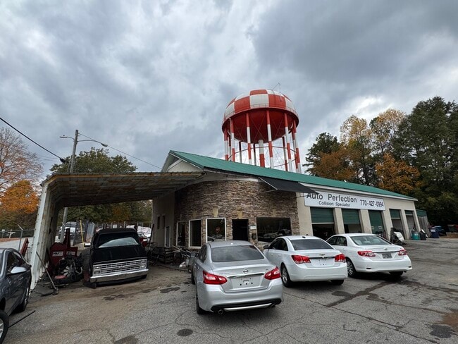
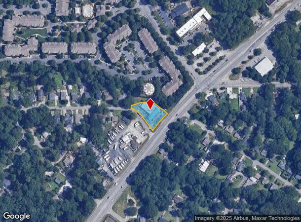
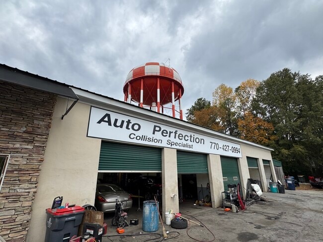
This Property Is For Sale
NEARBY LISTINGS FOR SALE OR LEASE
Property Detail
1708 Austell Rd Se
Autorepair
Cobb
X
Georgia
13067C0116J
0.51 AC
2025
Powder Spring/Austell
2025
Atlanta
031007
Atlanta-Sandy Springs-Roswell, GA
6,589 SF
17-0207-0-091-0
DEMOGRAPHICS near 1708 Austell Rd Se
1 Mile
3 Mile
5 Mile
2024 Total Population
16,309
87,098
226,792
2029 Population
16,766
89,893
233,834
Pop Growth 2024-2029
+ 2.80%
+ 3.21%
+ 3.11%
Average Age
36
37
38
2024 Total Households
5,920
31,542
89,252
HH Growth 2024-2029
+ 2.79%
+ 3.32%
+ 3.14%
Median Household Inc
$57,803
$72,102
$81,309
Avg Household Size
2.60
2.60
2.40
2024 Avg HH Vehicles
2.00
2.00
2.00
Median Home Value
$259,010
$368,841
$402,618
Median Year Built
1982
1981
1984
Nearby Places
- Restaurants
- Banks
- Shops
- Fitness
- Groceries
PUBLIC TRANSPORTATION
AIRPORT
Hartsfield - Jackson Atlanta International
DRIVE
WALK
Distance
Hartsfield - Jackson Atlanta International
42 min
28.2 mi
Freight Ports
Georgia Ports - Savannah
DRIVE
WALK
Distance
Georgia Ports - Savannah
305 min
266.8 mi
Nearby Properties
Address
Land Use
TOTAL SIZE
Lot Size
Zoning
Address
Land Use
TOTAL SIZE
Lot Size
Zoning
357,031 SF
10.69 AC
MU
Address
Land Use
TOTAL SIZE
Lot Size
Zoning
488,748 SF
32.28 AC
RM-12
Address
Land Use
TOTAL SIZE
Lot Size
Zoning
285,190 SF
25.16 AC
RM-12
Address
Land Use
TOTAL SIZE
Lot Size
Zoning
698,904 SF
36.69 AC
HI
Address
Land Use
TOTAL SIZE
Lot Size
Zoning
8,980 SF
51.17 AC
Address
Land Use
TOTAL SIZE
Lot Size
Zoning
225,315 SF
17.10 AC
RM-12
Address
Land Use
TOTAL SIZE
Lot Size
Zoning
236,808 SF
29.38 AC
PRD MF
Address
Land Use
TOTAL SIZE
Lot Size
Zoning
222,906 SF
18.96 AC
RM-12
Address
Land Use
TOTAL SIZE
Lot Size
Zoning
148,612 SF
12.65 AC
RM-12
Address
Land Use
TOTAL SIZE
Lot Size
Zoning
176,350 SF
19.56 AC
PRD MF
Address
Land Use
TOTAL SIZE
Lot Size
Zoning
204,595 SF
15.88 AC
RM-12
Address
Land Use
TOTAL SIZE
Lot Size
Zoning
345,192 SF
22.67 AC
RM-12
Address
Land Use
TOTAL SIZE
Lot Size
Zoning
187,972 SF
11.94 AC
RM-12
Address
Land Use
TOTAL SIZE
Lot Size
Zoning
172,300 SF
15.80 AC
RM-12
Address
Land Use
TOTAL SIZE
Lot Size
Zoning
213,318 SF
19.28 AC
PRD MF
Address
Land Use
TOTAL SIZE
Lot Size
Zoning
160,030 SF
13.38 AC
RM-12
Address
Land Use
TOTAL SIZE
Lot Size
Zoning
217,980 SF
12.61 AC
PRD MF
Address
Land Use
TOTAL SIZE
Lot Size
Zoning
188,789 SF
8.88 AC
PRD MF
Address
Land Use
TOTAL SIZE
Lot Size
Zoning
203,803 SF
14.63 AC
RM-12
Address
Land Use
TOTAL SIZE
Lot Size
Zoning
289,582 SF
21.01 AC
RM-12
Address
Land Use
TOTAL SIZE
Lot Size
Zoning
132,810 SF
9.50 AC
RM-12
Address
Land Use
TOTAL SIZE
Lot Size
Zoning
425,800 SF
32.52 AC
HI
Address
Land Use
TOTAL SIZE
Lot Size
Zoning
133,813 SF
10 AC
RM-12
Address
Land Use
TOTAL SIZE
Lot Size
Zoning
145,185 SF
13.52 AC
RM-12
Address
Land Use
TOTAL SIZE
Lot Size
Zoning
112,766 SF
7.94 AC
RM-12
Address
Land Use
TOTAL SIZE
Lot Size
Zoning
113,652 SF
9.40 AC
RM-12
Address
Land Use
TOTAL SIZE
Lot Size
Zoning
131,802 SF
4.76 AC
RM-12
Address
Land Use
TOTAL SIZE
Lot Size
Zoning
105,892 SF
14.07 AC
NRC/WS
Address
Land Use
TOTAL SIZE
Lot Size
Zoning
74,875 SF
6.36 AC
RM-12
Address
Land Use
TOTAL SIZE
Lot Size
Zoning
128,856 SF
8.31 AC
GC
The World's #1 Commercial Real Estate Marketplace
Connect with us
© 2025 CoStar Group
The information above has been obtained from sources believed reliable. While we do not doubt its accuracy we have not verified it and make no guarantee, warranty or representation about it. It is your responsibility to independently confirm its accuracy and completeness. Any projections, opinions, assumptions, or estimates used are for example only and do not represent the current or future performance of the property. The value of this transaction to you depends on tax and other factors which should be evaluated by your tax, financial, and legal advisors. You and your advisors should conduct a careful, independent investigation of the property to determine to your satisfaction the suitability of the property for your needs.