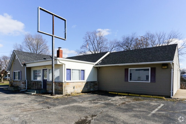
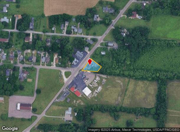
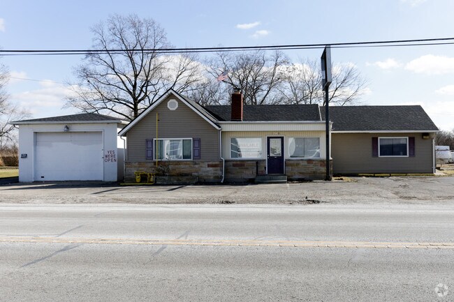
Property Record
1708 Brandt Pike, Dayton, OH 45404
NEARBY LISTINGS FOR SALE OR LEASE
Property Detail
1708 Brandt Pike
I39-00518-0013
8-2-25
Commercialnec
Montgomery
X
Ohio
39113C0167E
13
2023
0.47 AC
2024
Northeast Central Dayton
100301
Cincinnati/Dayton
2,152 SF
Dayton, OH
DEMOGRAPHICS near 1708 Brandt Pike
1 Mile
3 Mile
5 Mile
2024 Total Population
5,468
55,150
201,007
2029 Population
5,433
54,936
202,299
Pop Growth 2024-2029
(0.64%)
(0.39%)
+ 0.64%
Average Age
38
38
38
2024 Total Households
2,263
22,613
83,510
HH Growth 2024-2029
(0.75%)
(0.45%)
+ 0.67%
Median Household Inc
$39,189
$46,707
$47,866
Avg Household Size
2.30
2.30
2.20
2024 Avg HH Vehicles
2.00
2.00
2.00
Median Home Value
$87,582
$99,819
$115,196
Median Year Built
1961
1961
1959
Nearby Places
Map Layers
Map Styles
 Street
 Aerial
- Restaurants
- Banks
- Shops
- Fitness
- Groceries
PUBLIC TRANSPORTATION
AIRPORT
James M Cox Dayton International
DRIVE
WALK
Distance
James M Cox Dayton International
21 min
13.5 mi
SALE & LEASE HISTORY
LISTING DATE
SALE/LEASE

Feb 02, 2017
For Lease
Nearby Properties
Address
Land Use
TOTAL SIZE
Lot Size
Zoning
Address
Land Use
TOTAL SIZE
Lot Size
Zoning
154,360 SF
19.35 AC
Address
Land Use
TOTAL SIZE
Lot Size
Zoning
316.77 AC
Address
Land Use
TOTAL SIZE
Lot Size
Zoning
22,133 SF
47.58 AC
Address
Land Use
TOTAL SIZE
Lot Size
Zoning
5.92 AC
Address
Land Use
TOTAL SIZE
Lot Size
Zoning
133.37 AC
Address
Land Use
TOTAL SIZE
Lot Size
Zoning
144,340 SF
91.38 AC
Address
Land Use
TOTAL SIZE
Lot Size
Zoning
54.85 AC
Address
Land Use
TOTAL SIZE
Lot Size
Zoning
46.32 AC
Address
Land Use
TOTAL SIZE
Lot Size
Zoning
32.30 AC
Address
Land Use
TOTAL SIZE
Lot Size
Zoning
18,087 SF
19.69 AC
Address
Land Use
TOTAL SIZE
Lot Size
Zoning
634,508 SF
24.36 AC
Address
Land Use
TOTAL SIZE
Lot Size
Zoning
99,601 SF
15.58 AC
Address
Land Use
TOTAL SIZE
Lot Size
Zoning
22.70 AC
Address
Land Use
TOTAL SIZE
Lot Size
Zoning
93,360 SF
694.57 AC
Address
Land Use
TOTAL SIZE
Lot Size
Zoning
1,189,046 SF
45.07 AC
Address
Land Use
TOTAL SIZE
Lot Size
Zoning
11.58 AC
Address
Land Use
TOTAL SIZE
Lot Size
Zoning
21.53 AC
Address
Land Use
TOTAL SIZE
Lot Size
Zoning
8.98 AC
Address
Land Use
TOTAL SIZE
Lot Size
Zoning
2,034 SF
23.83 AC
Address
Land Use
TOTAL SIZE
Lot Size
Zoning
55,997 SF
4.20 AC
Address
Land Use
TOTAL SIZE
Lot Size
Zoning
139,400 SF
20.26 AC
Address
Land Use
TOTAL SIZE
Lot Size
Zoning
17.54 AC
Address
Land Use
TOTAL SIZE
Lot Size
Zoning
263,022 SF
19.33 AC
Address
Land Use
TOTAL SIZE
Lot Size
Zoning
11.30 AC
Address
Land Use
TOTAL SIZE
Lot Size
Zoning
230,764 SF
24.05 AC
Address
Land Use
TOTAL SIZE
Lot Size
Zoning
297,000 SF
1.01 AC
Address
Land Use
TOTAL SIZE
Lot Size
Zoning
152,612 SF
93.77 AC
Address
Land Use
TOTAL SIZE
Lot Size
Zoning
66,610 SF
3.90 AC
Address
Land Use
TOTAL SIZE
Lot Size
Zoning
4,200 SF
326.38 AC
Address
Land Use
TOTAL SIZE
Lot Size
Zoning
32,220 SF
1.49 AC
The World's #1 Commercial Real Estate Marketplace
Connect with us
© 2025 CoStar Group
The information above has been obtained from sources believed reliable. While we do not doubt its accuracy we have not verified it and make no guarantee, warranty or representation about it. It is your responsibility to independently confirm its accuracy and completeness. Any projections, opinions, assumptions, or estimates used are for example only and do not represent the current or future performance of the property. The value of this transaction to you depends on tax and other factors which should be evaluated by your tax, financial, and legal advisors. You and your advisors should conduct a careful, independent investigation of the property to determine to your satisfaction the suitability of the property for your needs.