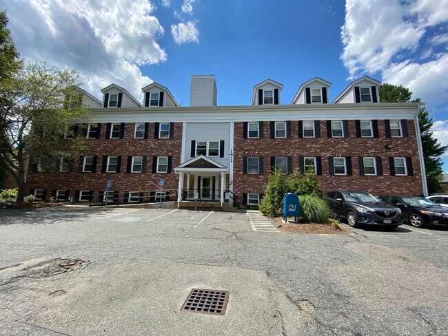
Property Record
171-A Main St, Concord, MA 01742


Property Detail
171-A Main St
CONC-000010C-000000-002692
MIDDLESEX
Nonbuildableland
Massachusetts
C
0.92 AC
AE The base floodplain where base flood elevations are provided. AE Zones are now used on new format FIRMs instead of A1-A30 Zones.
Hopkinton/Holliston
2025
Boston
2025
Boston-Cambridge-Newton, MA-NH
336202
NEARBY LISTINGS FOR SALE OR LEASE
DEMOGRAPHICS near 171-A Main St
1 mile
3 mile
5 mile
2025 Total Population
7,080
54,123
129,249
2030 Population
7,343
56,678
134,869
Pop Growth 2025-2030
+ 3.71%
+ 4.72%
+ 4.35%
Average Age
41
40
40
2025 Total Households
2,657
20,614
48,307
HH Growth 2025-2030
+ 3.84%
+ 4.99%
+ 4.48%
Median Household Inc
$123,946
$117,139
$120,242
Avg Household Size
2.60
2.50
2.60
2025 Avg HH Vehicles
2.00
2.00
2.00
Median Home Value
$714,729
$698,313
$716,155
Median Year Built
1982
1977
1972
Nearby Places
Map Layers
Map Styles
 Street
 Aerial
Layers
 Traffic
 Biking
Places
Listings with unknown addresses are not visible on the map
- Restaurants
- Banks
- Shops
- Fitness
- Groceries
PUBLIC TRANSPORTATION
COMMUTER RAIL
West Concord (Fitchburg/South Acton Line - Massachusetts Bay Transportation Authority Commuter Rail (Purple Line))
Drive
Walk
Distance
West Concord (Fitchburg/South Acton Line - Massachusetts Bay Transportation Authority Commuter Rail (Purple Line))
2 min
1.0 mi
South Acton (Fitchburg/South Acton Line - Massachusetts Bay Transportation Authority Commuter Rail (Purple Line))
Drive
Walk
Distance
South Acton (Fitchburg/South Acton Line - Massachusetts Bay Transportation Authority Commuter Rail (Purple Line))
8 min
3.7 mi
AIRPORT
General Edward Lawrence Logan International
Drive
Walk
Distance
General Edward Lawrence Logan International
39 min
24.4 mi
Worcester Regional
Drive
Walk
Distance
Worcester Regional
53 min
32.3 mi
Freight Ports
Port of Boston
Drive
Walk
Distance
Port of Boston
39 min
24.5 mi
SALE & LEASE HISTORY
LISTING DATE
SALE/LEASE

Oct 31, 2023
For Lease
Aug 12, 2020
For Lease
Nearby Properties
Address
Land Use
TOTAL SIZE
Lot Size
Zoning
Address
Land Use
TOTAL SIZE
Lot Size
Zoning
30.39 AC
I
Address
Land Use
TOTAL SIZE
Lot Size
Zoning
417,293 SF
64.97 AC
I
Address
Land Use
TOTAL SIZE
Lot Size
Zoning
24,540 SF
24.99 AC
B
Address
Land Use
TOTAL SIZE
Lot Size
Zoning
130,529 SF
18.90 AC
A
Address
Land Use
TOTAL SIZE
Lot Size
Zoning
22,927 SF
51 AC
IPA
Address
Land Use
TOTAL SIZE
Lot Size
Zoning
18.78 AC
MP
Address
Land Use
TOTAL SIZE
Lot Size
Zoning
116,968 SF
3.44 AC
WCI
Address
Land Use
TOTAL SIZE
Lot Size
Zoning
25.15 AC
R2
Address
Land Use
TOTAL SIZE
Lot Size
Zoning
77,323 SF
18 AC
C
Address
Land Use
TOTAL SIZE
Lot Size
Zoning
31.29 AC
AA
Address
Land Use
TOTAL SIZE
Lot Size
Zoning
7.88 AC
B
Address
Land Use
TOTAL SIZE
Lot Size
Zoning
67,788 SF
5.61 AC
RD
Address
Land Use
TOTAL SIZE
Lot Size
Zoning
35.99 AC
HI
Address
Land Use
TOTAL SIZE
Lot Size
Zoning
9.56 AC
PM
Address
Land Use
TOTAL SIZE
Lot Size
Zoning
10.34 AC
LB
Address
Land Use
TOTAL SIZE
Lot Size
Zoning
54,892 SF
7.99 AC
AA
Address
Land Use
TOTAL SIZE
Lot Size
Zoning
75,917 SF
28.56 AC
AA
Address
Land Use
TOTAL SIZE
Lot Size
Zoning
50,355 SF
6.38 AC
IPA
Address
Land Use
TOTAL SIZE
Lot Size
Zoning
13.07 AC
RD
Address
Land Use
TOTAL SIZE
Lot Size
Zoning
105,036 SF
6.84 AC
KC
Address
Land Use
TOTAL SIZE
Lot Size
Zoning
4,621 SF
64.80 AC
RD
Address
Land Use
TOTAL SIZE
Lot Size
Zoning
39,250 SF
0.39 AC
R2
Address
Land Use
TOTAL SIZE
Lot Size
Zoning
53,684 SF
3 AC
C
Address
Land Use
TOTAL SIZE
Lot Size
Zoning
9.61 AC
I
Address
Land Use
TOTAL SIZE
Lot Size
Zoning
63.75 AC
A
Address
Land Use
TOTAL SIZE
Lot Size
Zoning
37,309 SF
1.71 AC
B
Address
Land Use
TOTAL SIZE
Lot Size
Zoning
75,182 SF
6.74 AC
IPA
Address
Land Use
TOTAL SIZE
Lot Size
Zoning
78,564 SF
3.43 AC
LB
Address
Land Use
TOTAL SIZE
Lot Size
Zoning
33.05 AC
I
Address
Land Use
TOTAL SIZE
Lot Size
Zoning
0.41 AC
AA
The World's #1 Commercial Real Estate Marketplace
Connect with us
© 2026 CoStar Group
The information above has been obtained from sources believed reliable. While we do not doubt its accuracy we have not verified it and make no guarantee, warranty or representation about it. It is your responsibility to independently confirm its accuracy and completeness. Any projections, opinions, assumptions, or estimates used are for example only and do not represent the current or future performance of the property. The value of this transaction to you depends on tax and other factors which should be evaluated by your tax, financial, and legal advisors. You and your advisors should conduct a careful, independent investigation of the property to determine to your satisfaction the suitability of the property for your needs.