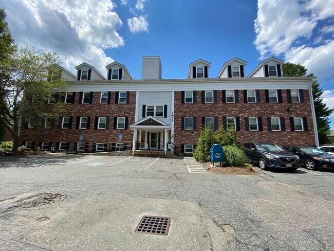
Property Record
171 Main St, Melrose, MA 02176


NEARBY LISTINGS FOR SALE OR LEASE
Property Detail
171 Main St
MELR-000004C-000000-000050
Pasquale Spadafore
Nonbuildableland
Middlesex
X
Massachusetts
25017C0429F
0.09 AC
2025
Hopkinton/Holliston
2025
Boston
336202
Boston-Cambridge-Newton, MA-NH
1,575 SF
DEMOGRAPHICS near 171 Main St
1 mile
3 mile
5 mile
2024 Total Population
6,778
51,316
123,000
2029 Population
6,703
51,144
122,287
Pop Growth 2024-2029
(1.11%)
(0.34%)
(0.58%)
Average Age
41
40
40
2024 Total Households
2,549
19,572
46,021
HH Growth 2024-2029
(1.22%)
(0.27%)
(0.65%)
Median Household Inc
$114,776
$106,394
$110,687
Avg Household Size
2.60
2.50
2.60
2024 Avg HH Vehicles
2.00
2.00
2.00
Median Home Value
$586,315
$566,645
$609,249
Median Year Built
1982
1976
1972
Nearby Places
Map Layers
Map Styles
 Street
 Aerial
Transit
 Traffic
 Biking
Places
Listings with unknown addresses are not visible on the map
- Restaurants
- Banks
- Shops
- Fitness
- Groceries
PUBLIC TRANSPORTATION
TRANSIT/SUBWAY
Oak Grove Station (Orange Line - Massachusetts Bay Transportation Authority Subway (The T))
Drive
Walk
Distance
Oak Grove Station (Orange Line - Massachusetts Bay Transportation Authority Subway (The T))
2 min
16 min
0.8 mi
COMMUTER RAIL
Wyoming Hill (Haverhill Line - Massachusetts Bay Transportation Authority Commuter Rail (Purple Line))
Drive
Walk
Distance
Wyoming Hill (Haverhill Line - Massachusetts Bay Transportation Authority Commuter Rail (Purple Line))
1 min
9 min
0.5 mi
Melrose/Cedar Park (Haverhill Line - Massachusetts Bay Transportation Authority Commuter Rail (Purple Line))
Drive
Walk
Distance
Melrose/Cedar Park (Haverhill Line - Massachusetts Bay Transportation Authority Commuter Rail (Purple Line))
3 min
19 min
1.0 mi
AIRPORT
General Edward Lawrence Logan International
Drive
Walk
Distance
General Edward Lawrence Logan International
16 min
7.6 mi
Freight Ports
Port of Boston
Drive
Walk
Distance
Port of Boston
19 min
9.9 mi
SALE & LEASE HISTORY
LISTING DATE
SALE/LEASE

Oct 31, 2023
For Lease
Aug 12, 2020
For Lease
Nearby Properties
Address
Land Use
TOTAL SIZE
Lot Size
Zoning
Address
Land Use
TOTAL SIZE
Lot Size
Zoning
8 AC
HB
Address
Land Use
TOTAL SIZE
Lot Size
Zoning
386,825 SF
10.67 AC
Address
Land Use
TOTAL SIZE
Lot Size
Zoning
297,396 SF
2.79 AC
CTED
Address
Land Use
TOTAL SIZE
Lot Size
Zoning
Address
Land Use
TOTAL SIZE
Lot Size
Zoning
6.73 AC
HB
Address
Land Use
TOTAL SIZE
Lot Size
Zoning
19,308 SF
82.36 AC
NA
Address
Land Use
TOTAL SIZE
Lot Size
Zoning
254,075 SF
3.70 AC
Address
Land Use
TOTAL SIZE
Lot Size
Zoning
21,024 SF
18.19 AC
Address
Land Use
TOTAL SIZE
Lot Size
Zoning
14.97 AC
C
Address
Land Use
TOTAL SIZE
Lot Size
Zoning
454,752 SF
6.22 AC
Address
Land Use
TOTAL SIZE
Lot Size
Zoning
Address
Land Use
TOTAL SIZE
Lot Size
Zoning
194,880 SF
35.42 AC
NA
Address
Land Use
TOTAL SIZE
Lot Size
Zoning
359,892 SF
9.06 AC
Address
Land Use
TOTAL SIZE
Lot Size
Zoning
292,515 SF
21.61 AC
Address
Land Use
TOTAL SIZE
Lot Size
Zoning
269,070 SF
21.74 AC
NA
Address
Land Use
TOTAL SIZE
Lot Size
Zoning
0.47 AC
M
Address
Land Use
TOTAL SIZE
Lot Size
Zoning
303,034 SF
8.81 AC
Address
Land Use
TOTAL SIZE
Lot Size
Zoning
70,134 SF
2.25 AC
CB
Address
Land Use
TOTAL SIZE
Lot Size
Zoning
11.72 AC
Address
Land Use
TOTAL SIZE
Lot Size
Zoning
319,472 SF
2.34 AC
CB
Address
Land Use
TOTAL SIZE
Lot Size
Zoning
330,020 SF
7.32 AC
NA
Address
Land Use
TOTAL SIZE
Lot Size
Zoning
212,601 SF
3.11 AC
ROD
Address
Land Use
TOTAL SIZE
Lot Size
Zoning
362,970 SF
8.36 AC
BH
Address
Land Use
TOTAL SIZE
Lot Size
Zoning
214,337 SF
1.42 AC
CB
Address
Land Use
TOTAL SIZE
Lot Size
Zoning
208,663 SF
2.56 AC
DD
Address
Land Use
TOTAL SIZE
Lot Size
Zoning
334,150 SF
28 AC
NA
Address
Land Use
TOTAL SIZE
Lot Size
Zoning
236,853 SF
0.86 AC
CB
Address
Land Use
TOTAL SIZE
Lot Size
Zoning
358,501 SF
5.70 AC
ROD
Address
Land Use
TOTAL SIZE
Lot Size
Zoning
144,848 SF
13.85 AC
IP
Address
Land Use
TOTAL SIZE
Lot Size
Zoning
5.15 AC
The World's #1 Commercial Real Estate Marketplace
Connect with us
© 2026 CoStar Group
The information above has been obtained from sources believed reliable. While we do not doubt its accuracy we have not verified it and make no guarantee, warranty or representation about it. It is your responsibility to independently confirm its accuracy and completeness. Any projections, opinions, assumptions, or estimates used are for example only and do not represent the current or future performance of the property. The value of this transaction to you depends on tax and other factors which should be evaluated by your tax, financial, and legal advisors. You and your advisors should conduct a careful, independent investigation of the property to determine to your satisfaction the suitability of the property for your needs.