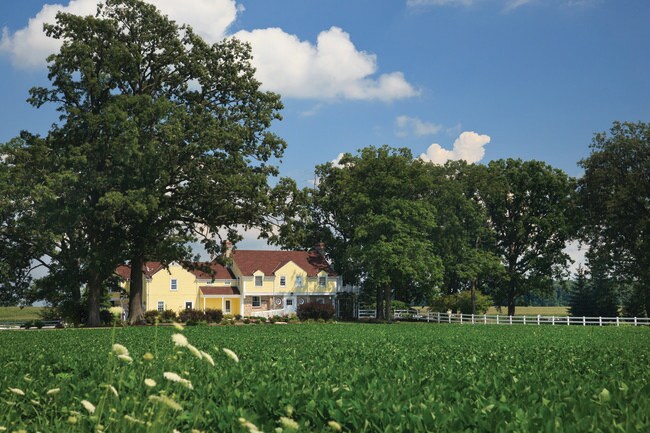
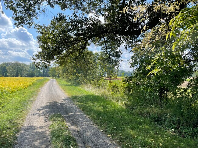
Property Record
171 Old Matlock Rd, Bowling Green, KY 42104

NEARBY LISTINGS FOR SALE OR LEASE
-
-
View all Bowling Green listings for sale on LoopNet.com
Property Detail
171 Old Matlock Rd
Commercialnec
Warren
X
Kentucky
21213C0125C
8.84 AC
2025
Bowling Green Area
2025
Other Market Areas
010702
Bowling Green, KY
930 SF
044A-65
DEMOGRAPHICS near 171 Old Matlock Rd
1 mile
3 mile
5 mile
2024 Total Population
176
1,939
11,508
2029 Population
195
2,150
12,703
Pop Growth 2024-2029
+ 10.80%
+ 10.88%
+ 10.38%
Average Age
39
39
39
2024 Total Households
67
729
4,199
HH Growth 2024-2029
+ 11.94%
+ 11.25%
+ 10.79%
Median Household Inc
$67,500
$68,677
$77,739
Avg Household Size
2.60
2.60
2.70
2024 Avg HH Vehicles
2.00
2.00
2.00
Median Home Value
$240,384
$242,825
$255,253
Median Year Built
1982
1985
1996
Nearby Places
Map Layers
Map Styles
 Street
 Aerial
Transit
 Traffic
 Biking
Places
Listings with unknown addresses are not visible on the map
- Restaurants
- Banks
- Shops
- Fitness
- Groceries
SALE & LEASE HISTORY
LISTING DATE
SALE/LEASE

Sep 24, 2021
For Sale
Nearby Properties
Address
Land Use
TOTAL SIZE
Lot Size
Zoning
Address
Land Use
TOTAL SIZE
Lot Size
Zoning
3,701 SF
783 AC
Address
Land Use
TOTAL SIZE
Lot Size
Zoning
236 AC
Address
Land Use
TOTAL SIZE
Lot Size
Zoning
2,888 SF
218 AC
Address
Land Use
TOTAL SIZE
Lot Size
Zoning
1,956 SF
244 AC
Address
Land Use
TOTAL SIZE
Lot Size
Zoning
Address
Land Use
TOTAL SIZE
Lot Size
Zoning
75.78 AC
Address
Land Use
TOTAL SIZE
Lot Size
Zoning
1,450 SF
163 AC
Address
Land Use
TOTAL SIZE
Lot Size
Zoning
2,610 SF
159 AC
Address
Land Use
TOTAL SIZE
Lot Size
Zoning
Address
Land Use
TOTAL SIZE
Lot Size
Zoning
5.03 AC
Address
Land Use
TOTAL SIZE
Lot Size
Zoning
1,366 SF
108 AC
Address
Land Use
TOTAL SIZE
Lot Size
Zoning
Address
Land Use
TOTAL SIZE
Lot Size
Zoning
1,739 SF
116 AC
Address
Land Use
TOTAL SIZE
Lot Size
Zoning
133 AC
Address
Land Use
TOTAL SIZE
Lot Size
Zoning
Address
Land Use
TOTAL SIZE
Lot Size
Zoning
1,622 SF
40 AC
Address
Land Use
TOTAL SIZE
Lot Size
Zoning
Address
Land Use
TOTAL SIZE
Lot Size
Zoning
Address
Land Use
TOTAL SIZE
Lot Size
Zoning
Address
Land Use
TOTAL SIZE
Lot Size
Zoning
106 AC
Address
Land Use
TOTAL SIZE
Lot Size
Zoning
1,050 SF
41 AC
Address
Land Use
TOTAL SIZE
Lot Size
Zoning
1,072 SF
133 AC
Address
Land Use
TOTAL SIZE
Lot Size
Zoning
Address
Land Use
TOTAL SIZE
Lot Size
Zoning
5,458 SF
70 AC
Address
Land Use
TOTAL SIZE
Lot Size
Zoning
Address
Land Use
TOTAL SIZE
Lot Size
Zoning
2,240 SF
176 AC
Address
Land Use
TOTAL SIZE
Lot Size
Zoning
2,248 SF
150 AC
Address
Land Use
TOTAL SIZE
Lot Size
Zoning
1,020 SF
72 AC
Address
Land Use
TOTAL SIZE
Lot Size
Zoning
1,993 SF
136 AC
Address
Land Use
TOTAL SIZE
Lot Size
Zoning
1,324 SF
85 AC
The World's #1 Commercial Real Estate Marketplace
Connect with us
© 2026 CoStar Group
The information above has been obtained from sources believed reliable. While we do not doubt its accuracy we have not verified it and make no guarantee, warranty or representation about it. It is your responsibility to independently confirm its accuracy and completeness. Any projections, opinions, assumptions, or estimates used are for example only and do not represent the current or future performance of the property. The value of this transaction to you depends on tax and other factors which should be evaluated by your tax, financial, and legal advisors. You and your advisors should conduct a careful, independent investigation of the property to determine to your satisfaction the suitability of the property for your needs.