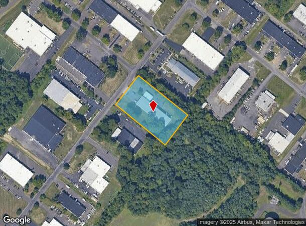
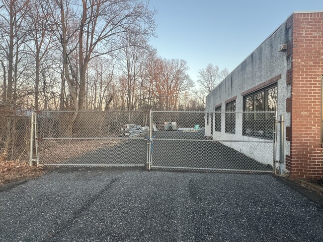
Property Record
171 Railroad Dr, Warminster, PA 18974
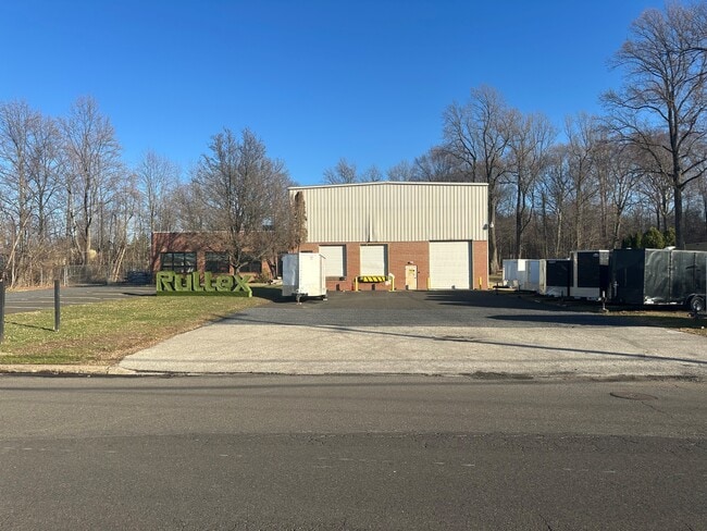
This Property Is For Sale
NEARBY LISTINGS FOR SALE OR LEASE
Property Detail
171 Railroad Dr
Philadelphia-Camden-Wilmington, PA-NJ-DE-MD
Northampton Indl Park 02 Sec 05
31-001-008-011
LOT #32 NORTHAMPTON IND P ARKII SEC 5 228X382
Warehouse
Bucks
X
Pennsylvania
42017C0402J
32
2024
2 AC
2025
Bucks
105008
Philadelphia
14,440 SF
DEMOGRAPHICS near 171 Railroad Dr
1 Mile
3 Mile
5 Mile
2024 Total Population
3,116
52,332
144,828
2029 Population
3,095
52,532
145,884
Pop Growth 2024-2029
(0.67%)
+ 0.38%
+ 0.73%
Average Age
48
45
44
2024 Total Households
1,190
20,115
54,813
HH Growth 2024-2029
(0.67%)
+ 0.57%
+ 0.84%
Median Household Inc
$112,757
$99,125
$101,122
Avg Household Size
2.60
2.50
2.60
2024 Avg HH Vehicles
2.00
2.00
2.00
Median Home Value
$497,726
$392,399
$397,307
Median Year Built
1996
1979
1974
Nearby Places
Map Layers
Map Styles
 Street
 Aerial
- Restaurants
- Banks
- Shops
- Fitness
- Groceries
PUBLIC TRANSPORTATION
AIRPORT
Philadelphia International
DRIVE
WALK
Distance
Philadelphia International
59 min
39.9 mi
Lehigh Valley International
DRIVE
WALK
Distance
Lehigh Valley International
75 min
45.1 mi
Nearby Properties
Address
Land Use
TOTAL SIZE
Lot Size
Zoning
Address
Land Use
TOTAL SIZE
Lot Size
Zoning
257,048 SF
36.13 AC
C
Address
Land Use
TOTAL SIZE
Lot Size
Zoning
29,308 SF
15.96 AC
I
Address
Land Use
TOTAL SIZE
Lot Size
Zoning
25,021 SF
10.82 AC
I
Address
Land Use
TOTAL SIZE
Lot Size
Zoning
249,396 SF
18.70 AC
I
Address
Land Use
TOTAL SIZE
Lot Size
Zoning
56,440 SF
11.55 AC
R2
Address
Land Use
TOTAL SIZE
Lot Size
Zoning
10,000 SF
10.54 AC
MF1
Address
Land Use
TOTAL SIZE
Lot Size
Zoning
140,444 SF
15.31 AC
I
Address
Land Use
TOTAL SIZE
Lot Size
Zoning
73,663 SF
14.84 AC
MF-1
Address
Land Use
TOTAL SIZE
Lot Size
Zoning
110,473 SF
13.96 AC
C
Address
Land Use
TOTAL SIZE
Lot Size
Zoning
12,000 SF
12.57 AC
MF1
Address
Land Use
TOTAL SIZE
Lot Size
Zoning
89,417 SF
13.30 AC
CR
Address
Land Use
TOTAL SIZE
Lot Size
Zoning
10,000 SF
9.10 AC
MF1
Address
Land Use
TOTAL SIZE
Lot Size
Zoning
94,271 SF
8.96 AC
C3
Address
Land Use
TOTAL SIZE
Lot Size
Zoning
94,916 SF
13.98 AC
SC
Address
Land Use
TOTAL SIZE
Lot Size
Zoning
155,000 SF
16.18 AC
I1
Address
Land Use
TOTAL SIZE
Lot Size
Zoning
19.90 AC
Address
Land Use
TOTAL SIZE
Lot Size
Zoning
117,282 SF
12.20 AC
SC
Address
Land Use
TOTAL SIZE
Lot Size
Zoning
61,048 SF
14.62 AC
PK
Address
Land Use
TOTAL SIZE
Lot Size
Zoning
212,642 SF
18.81 AC
I
Address
Land Use
TOTAL SIZE
Lot Size
Zoning
25,500 SF
9 AC
I
Address
Land Use
TOTAL SIZE
Lot Size
Zoning
607 SF
87.56 AC
MF2
Address
Land Use
TOTAL SIZE
Lot Size
Zoning
113,256 SF
12.59 AC
HC
Address
Land Use
TOTAL SIZE
Lot Size
Zoning
222,666 SF
11.95 AC
I
Address
Land Use
TOTAL SIZE
Lot Size
Zoning
97,361 SF
5.62 AC
R2
Address
Land Use
TOTAL SIZE
Lot Size
Zoning
800 SF
147.62 AC
QA
Address
Land Use
TOTAL SIZE
Lot Size
Zoning
92,454 SF
12.48 AC
R1
Address
Land Use
TOTAL SIZE
Lot Size
Zoning
112,412 SF
11.24 AC
I
Address
Land Use
TOTAL SIZE
Lot Size
Zoning
137,592 SF
18.52 AC
LI
Address
Land Use
TOTAL SIZE
Lot Size
Zoning
67,788 SF
5 AC
R2
Address
Land Use
TOTAL SIZE
Lot Size
Zoning
65,195 SF
1.53 AC
SC
The World's #1 Commercial Real Estate Marketplace
Connect with us
© 2026 CoStar Group
The information above has been obtained from sources believed reliable. While we do not doubt its accuracy we have not verified it and make no guarantee, warranty or representation about it. It is your responsibility to independently confirm its accuracy and completeness. Any projections, opinions, assumptions, or estimates used are for example only and do not represent the current or future performance of the property. The value of this transaction to you depends on tax and other factors which should be evaluated by your tax, financial, and legal advisors. You and your advisors should conduct a careful, independent investigation of the property to determine to your satisfaction the suitability of the property for your needs.