Property Record
171 Roper Rd, Inman, SC 29349
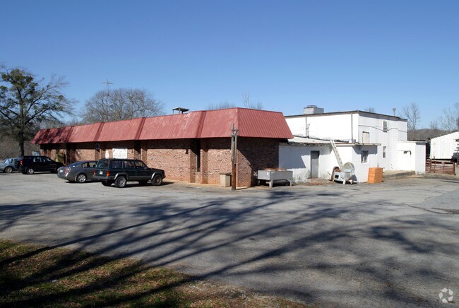

Property Detail
171 Roper Rd
Spartanburg, SC
W SIDE ROPER RD & N OF ASHEVILLE HWY PB 36-211 PB 179-271
2-42-00-035.00
Spartanburg
Commercialnec
South Carolina
AE The base floodplain where base flood elevations are provided. AE Zones are now used on new format FIRMs instead of A1-A30 Zones.
12
2024
5.06 AC
2025
Upper Spartanburg Cty
022804
Greenville/Spartanburg
6,724 SF
NEARBY LISTINGS FOR SALE OR LEASE
DEMOGRAPHICS near 171 Roper Rd
1 mile
3 mile
5 mile
2025 Total Population
2,198
25,081
66,011
2030 Population
2,494
28,046
73,806
Pop Growth 2025-2030
+ 13.47%
+ 11.82%
+ 11.81%
Average Age
41
39
38
2025 Total Households
861
9,272
24,237
HH Growth 2025-2030
+ 13.59%
+ 11.96%
+ 12.06%
Median Household Inc
$71,538
$69,961
$68,302
Avg Household Size
2.40
2.60
2.60
2025 Avg HH Vehicles
2.00
2.00
2.00
Median Home Value
$264,942
$255,534
$253,919
Median Year Built
1994
1995
1997
Nearby Places
Map Layers
Map Styles
 Street
 Aerial
Transit
 Traffic
 Biking
Places
Listings with unknown addresses are not visible on the map
- Restaurants
- Banks
- Shops
- Fitness
- Groceries
PUBLIC TRANSPORTATION
AIRPORT
Greenville Spartanburg International
Drive
Walk
Distance
Greenville Spartanburg International
21 min
19.6 mi
Freight Ports
Georgia Ports - Savannah
Drive
Walk
Distance
Georgia Ports - Savannah
1 min
207.5 mi
SALE & LEASE HISTORY
LISTING DATE
SALE/LEASE

Feb 01, 2018
For Sale
Nearby Properties
Address
Land Use
TOTAL SIZE
Lot Size
Zoning
Address
Land Use
TOTAL SIZE
Lot Size
Zoning
4,172 SF
15.98 AC
Address
Land Use
TOTAL SIZE
Lot Size
Zoning
175,000 SF
17.70 AC
Address
Land Use
TOTAL SIZE
Lot Size
Zoning
239,095 SF
22.41 AC
Address
Land Use
TOTAL SIZE
Lot Size
Zoning
341,895 SF
31.62 AC
Address
Land Use
TOTAL SIZE
Lot Size
Zoning
176,072 SF
13.72 AC
Address
Land Use
TOTAL SIZE
Lot Size
Zoning
7,000 SF
3 AC
Address
Land Use
TOTAL SIZE
Lot Size
Zoning
102,400 SF
25.19 AC
Address
Land Use
TOTAL SIZE
Lot Size
Zoning
17,971 SF
39.35 AC
Address
Land Use
TOTAL SIZE
Lot Size
Zoning
277,152 SF
27.20 AC
Address
Land Use
TOTAL SIZE
Lot Size
Zoning
Address
Land Use
TOTAL SIZE
Lot Size
Zoning
7,600 SF
2.18 AC
Address
Land Use
TOTAL SIZE
Lot Size
Zoning
4,283 SF
0.50 AC
Address
Land Use
TOTAL SIZE
Lot Size
Zoning
131,113 SF
15.34 AC
Address
Land Use
TOTAL SIZE
Lot Size
Zoning
4,751 SF
0.79 AC
Address
Land Use
TOTAL SIZE
Lot Size
Zoning
4,260 SF
0.66 AC
Address
Land Use
TOTAL SIZE
Lot Size
Zoning
5,267 SF
1.18 AC
Address
Land Use
TOTAL SIZE
Lot Size
Zoning
5,190 SF
0.93 AC
Address
Land Use
TOTAL SIZE
Lot Size
Zoning
4,294 SF
0.81 AC
Address
Land Use
TOTAL SIZE
Lot Size
Zoning
2,649 SF
3.62 AC
Address
Land Use
TOTAL SIZE
Lot Size
Zoning
52,719 SF
7.40 AC
Address
Land Use
TOTAL SIZE
Lot Size
Zoning
14.40 AC
Address
Land Use
TOTAL SIZE
Lot Size
Zoning
3,601 SF
0.26 AC
Address
Land Use
TOTAL SIZE
Lot Size
Zoning
4,437 SF
0.63 AC
Address
Land Use
TOTAL SIZE
Lot Size
Zoning
4,491 SF
0.58 AC
Address
Land Use
TOTAL SIZE
Lot Size
Zoning
2,828 SF
2.85 AC
Address
Land Use
TOTAL SIZE
Lot Size
Zoning
4,472 SF
2.96 AC
Address
Land Use
TOTAL SIZE
Lot Size
Zoning
2,941 SF
0.19 AC
Address
Land Use
TOTAL SIZE
Lot Size
Zoning
3,054 SF
25.64 AC
Address
Land Use
TOTAL SIZE
Lot Size
Zoning
148,634 SF
12.81 AC
Address
Land Use
TOTAL SIZE
Lot Size
Zoning
2,807 SF
0.55 AC
The World's #1 Commercial Real Estate Marketplace
Connect with us
© 2026 CoStar Group
The information above has been obtained from sources believed reliable. While we do not doubt its accuracy we have not verified it and make no guarantee, warranty or representation about it. It is your responsibility to independently confirm its accuracy and completeness. Any projections, opinions, assumptions, or estimates used are for example only and do not represent the current or future performance of the property. The value of this transaction to you depends on tax and other factors which should be evaluated by your tax, financial, and legal advisors. You and your advisors should conduct a careful, independent investigation of the property to determine to your satisfaction the suitability of the property for your needs.