Property Record
1710 Brevard Rd, Hendersonville, NC 28791

NEARBY LISTINGS FOR SALE OR LEASE
Property Detail
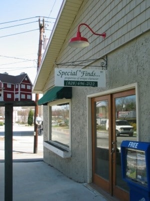
1710 Brevard Rd
Asheville, NC
US64W ON PL2005-5773
9558992540
Henderson
Industrialgeneral
North Carolina
2025
2540
2025
10.73 AC
931802
Henderson County
87,609 SF
Asheville
DEMOGRAPHICS near 1710 Brevard Rd
1 Mile
3 Mile
5 Mile
2024 Total Population
4,379
30,222
60,685
2029 Population
4,608
31,685
63,533
Pop Growth 2024-2029
+ 5.23%
+ 4.84%
+ 4.69%
Average Age
52
49
48
2024 Total Households
2,130
13,760
26,670
HH Growth 2024-2029
+ 5.26%
+ 4.95%
+ 4.81%
Median Household Inc
$68,081
$61,962
$58,357
Avg Household Size
2.00
2.10
2.20
2024 Avg HH Vehicles
2.00
2.00
2.00
Median Home Value
$310,315
$301,874
$302,744
Median Year Built
1978
1978
1983
Nearby Places
Map Layers
Map Styles
 Street
 Aerial
- Restaurants
- Banks
- Shops
- Fitness
- Groceries
PUBLIC TRANSPORTATION
AIRPORT
Asheville Regional
DRIVE
WALK
Distance
Asheville Regional
19 min
11.8 mi
Freight Ports
North Charleston Terminal
DRIVE
WALK
Distance
North Charleston Terminal
270 min
238.8 mi
Nearby Properties
Address
Land Use
TOTAL SIZE
Lot Size
Zoning
Address
Land Use
TOTAL SIZE
Lot Size
Zoning
8,728 SF
8.84 AC
9970930~PC
Address
Land Use
TOTAL SIZE
Lot Size
Zoning
60,582 SF
9.54 AC
10010646~R
Address
Land Use
TOTAL SIZE
Lot Size
Zoning
60,582 SF
9.53 AC
9948805~R-
Address
Land Use
TOTAL SIZE
Lot Size
Zoning
96,084 SF
13.96 AC
1013416~PI
Address
Land Use
TOTAL SIZE
Lot Size
Zoning
97,776 SF
0.92 AC
1009121~MI
Address
Land Use
TOTAL SIZE
Lot Size
Zoning
172,244 SF
18.87 AC
9968664~R-
Address
Land Use
TOTAL SIZE
Lot Size
Zoning
105,179 SF
5.20 AC
1008855~PC
Address
Land Use
TOTAL SIZE
Lot Size
Zoning
102,649 SF
7.08 AC
9904585~PI
Address
Land Use
TOTAL SIZE
Lot Size
Zoning
97,368 SF
6.66 AC
1000569~PI
Address
Land Use
TOTAL SIZE
Lot Size
Zoning
102,737 SF
98.20 AC
9970301~R2
Address
Land Use
TOTAL SIZE
Lot Size
Zoning
92,512 SF
3.38 AC
9968665~PR
Address
Land Use
TOTAL SIZE
Lot Size
Zoning
51,166 SF
5.43 AC
9962201~R1
Address
Land Use
TOTAL SIZE
Lot Size
Zoning
40,975 SF
1.15 AC
9904361~C-
Address
Land Use
TOTAL SIZE
Lot Size
Zoning
72,560 SF
7.23 AC
10000067~P
Address
Land Use
TOTAL SIZE
Lot Size
Zoning
59,072 SF
6.62 AC
10008042~R
Address
Land Use
TOTAL SIZE
Lot Size
Zoning
690,212 SF
105.90 AC
1010645~I-
Address
Land Use
TOTAL SIZE
Lot Size
Zoning
33,419 SF
1.56 AC
10005796~R
Address
Land Use
TOTAL SIZE
Lot Size
Zoning
9,947 SF
1.67 AC
9948806~C-
Address
Land Use
TOTAL SIZE
Lot Size
Zoning
142,987 SF
12.13 AC
9968008~PC
Address
Land Use
TOTAL SIZE
Lot Size
Zoning
79,651 SF
10.24 AC
9928981~C-
Address
Land Use
TOTAL SIZE
Lot Size
Zoning
4,166 SF
9.42 AC
106319~C-3
Address
Land Use
TOTAL SIZE
Lot Size
Zoning
50,573 SF
6.71 AC
10003742~P
Address
Land Use
TOTAL SIZE
Lot Size
Zoning
65,839 SF
3.19 AC
1008569~CM
Address
Land Use
TOTAL SIZE
Lot Size
Zoning
51,624 SF
3.77 AC
9949557~CM
Address
Land Use
TOTAL SIZE
Lot Size
Zoning
74,701 SF
11.22 AC
10004856~P
Address
Land Use
TOTAL SIZE
Lot Size
Zoning
49,869 SF
1.68 AC
10010746~M
Address
Land Use
TOTAL SIZE
Lot Size
Zoning
59,100 SF
0.39 AC
9955527~C-
Address
Land Use
TOTAL SIZE
Lot Size
Zoning
107,500 SF
16.83 AC
9971837~PC
Address
Land Use
TOTAL SIZE
Lot Size
Zoning
43,408 SF
4.56 AC
1014938~MI
Address
Land Use
TOTAL SIZE
Lot Size
Zoning
268,511 SF
24.19 AC
9903898~PC
The World's #1 Commercial Real Estate Marketplace
Connect with us
© 2025 CoStar Group
The information above has been obtained from sources believed reliable. While we do not doubt its accuracy we have not verified it and make no guarantee, warranty or representation about it. It is your responsibility to independently confirm its accuracy and completeness. Any projections, opinions, assumptions, or estimates used are for example only and do not represent the current or future performance of the property. The value of this transaction to you depends on tax and other factors which should be evaluated by your tax, financial, and legal advisors. You and your advisors should conduct a careful, independent investigation of the property to determine to your satisfaction the suitability of the property for your needs.