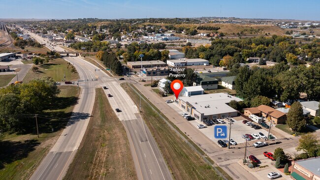
Property Record
1710 E Main St, Mandan, ND 58554


NEARBY LISTINGS FOR SALE OR LEASE
Property Detail
1710 E Main St
Bismarck, ND
Eastwood Acres 4Th
65-0912000
TWN: 0 SCT: 0 RNG: 0 SUB: 126 BLK: 1 E 105' OF LOT 1(LESS N 146') & ALL LOT 2 (820)
Residentialnec
Morton
X
North Dakota
38015C0780E
1-2
2024
0.82 AC
2024
Prairie West
020303
Other Market Areas
DEMOGRAPHICS near 1710 E Main St
1 mile
3 mile
5 mile
2024 Total Population
2,796
31,846
80,169
2029 Population
2,903
33,035
82,813
Pop Growth 2024-2029
+ 3.83%
+ 3.73%
+ 3.30%
Average Age
39
39
40
2024 Total Households
1,190
13,235
34,546
HH Growth 2024-2029
+ 3.70%
+ 3.77%
+ 3.32%
Median Household Inc
$69,999
$77,836
$68,816
Avg Household Size
2.20
2.30
2.20
2024 Avg HH Vehicles
2.00
2.00
2.00
Median Home Value
$219,900
$269,513
$262,210
Median Year Built
1975
1985
1979
Nearby Places
Map Layers
Map Styles
 Street
 Aerial
Transit
 Traffic
 Biking
Places
Listings with unknown addresses are not visible on the map
- Restaurants
- Banks
- Shops
- Fitness
- Groceries
PUBLIC TRANSPORTATION
AIRPORT
Bismarck Municipal
Drive
Walk
Distance
Bismarck Municipal
22 min
8.8 mi
SALE & LEASE HISTORY
LISTING DATE
SALE/LEASE

Sep 24, 2016
For Sale
Nov 14, 2018
For Lease
Jan 22, 2018
For Sale
Nearby Properties
Address
Land Use
TOTAL SIZE
Lot Size
Zoning
Address
Land Use
TOTAL SIZE
Lot Size
Zoning
13.47 AC
PUD
Address
Land Use
TOTAL SIZE
Lot Size
Zoning
12.25 AC
ETZ
Address
Land Use
TOTAL SIZE
Lot Size
Zoning
38,467 SF
13.89 AC
CG
Address
Land Use
TOTAL SIZE
Lot Size
Zoning
17.10 AC
ETZ
Address
Land Use
TOTAL SIZE
Lot Size
Zoning
8.65 AC
ETZ
Address
Land Use
TOTAL SIZE
Lot Size
Zoning
6.01 AC
ETZ
Address
Land Use
TOTAL SIZE
Lot Size
Zoning
13.98 AC
CG
Address
Land Use
TOTAL SIZE
Lot Size
Zoning
57,580 SF
8.85 AC
CG
Address
Land Use
TOTAL SIZE
Lot Size
Zoning
8.64 AC
ETZ
Address
Land Use
TOTAL SIZE
Lot Size
Zoning
7.55 AC
ETZ
Address
Land Use
TOTAL SIZE
Lot Size
Zoning
2.36 AC
ETZ
Address
Land Use
TOTAL SIZE
Lot Size
Zoning
4.06 AC
ETZ
Address
Land Use
TOTAL SIZE
Lot Size
Zoning
1.90 AC
ETZ
Address
Land Use
TOTAL SIZE
Lot Size
Zoning
3.79 AC
ETZ
Address
Land Use
TOTAL SIZE
Lot Size
Zoning
88,263 SF
8.58 AC
CG
Address
Land Use
TOTAL SIZE
Lot Size
Zoning
48,661 SF
4.91 AC
CG
Address
Land Use
TOTAL SIZE
Lot Size
Zoning
68,211 SF
10 AC
RT
Address
Land Use
TOTAL SIZE
Lot Size
Zoning
2.91 AC
ETZ
Address
Land Use
TOTAL SIZE
Lot Size
Zoning
8,280 SF
9.76 AC
RM30
Address
Land Use
TOTAL SIZE
Lot Size
Zoning
35,354 SF
3.75 AC
RT
Address
Land Use
TOTAL SIZE
Lot Size
Zoning
77,477 SF
3.43 AC
RM30
Address
Land Use
TOTAL SIZE
Lot Size
Zoning
4.07 AC
ETZ
Address
Land Use
TOTAL SIZE
Lot Size
Zoning
28,532 SF
4.43 AC
RM30
Address
Land Use
TOTAL SIZE
Lot Size
Zoning
28,802 SF
1.82 AC
CG
Address
Land Use
TOTAL SIZE
Lot Size
Zoning
5.25 AC
ETZ
Address
Land Use
TOTAL SIZE
Lot Size
Zoning
60,141 SF
4.80 AC
RM15
Address
Land Use
TOTAL SIZE
Lot Size
Zoning
55,629 SF
6 AC
CG
Address
Land Use
TOTAL SIZE
Lot Size
Zoning
Address
Land Use
TOTAL SIZE
Lot Size
Zoning
37,611 SF
3.57 AC
RM30
Address
Land Use
TOTAL SIZE
Lot Size
Zoning
3.95 AC
ETZ
The World's #1 Commercial Real Estate Marketplace
Connect with us
© 2026 CoStar Group
The information above has been obtained from sources believed reliable. While we do not doubt its accuracy we have not verified it and make no guarantee, warranty or representation about it. It is your responsibility to independently confirm its accuracy and completeness. Any projections, opinions, assumptions, or estimates used are for example only and do not represent the current or future performance of the property. The value of this transaction to you depends on tax and other factors which should be evaluated by your tax, financial, and legal advisors. You and your advisors should conduct a careful, independent investigation of the property to determine to your satisfaction the suitability of the property for your needs.