Property Record
1710 Red Soils Ct, Oregon City, OR 97045
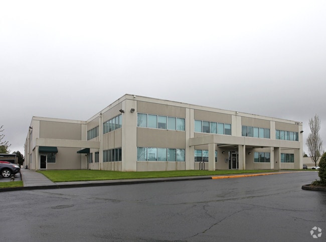


Property Detail
1710 Red Soils Ct
Portland-Vancouver-Hillsboro, OR-WA
2980 RED SOILS LT 7
01507907
Clackamas
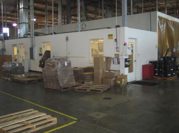
Industrialgeneral
Oregon
MUE
7
B and X Area of moderate flood hazard, usually the area between the limits of the 100-year and 500-year floods.
3 AC
0
Oregon City
2025
Portland
022605
NEARBY LISTINGS FOR SALE OR LEASE
-
-
View all Oregon City listings for sale on LoopNet.com
DEMOGRAPHICS near 1710 Red Soils Ct
1 mile
3 mile
5 mile
2025 Total Population
13,537
50,860
103,904
2030 Population
13,554
50,937
103,698
Pop Growth 2025-2030
+ 0.13%
+ 0.15%
(0.20%)
Average Age
40
41
42
2025 Total Households
4,955
18,650
39,046
HH Growth 2025-2030
+ 0.06%
+ 0.11%
(0.25%)
Median Household Inc
$90,879
$103,177
$105,517
Avg Household Size
2.60
2.70
2.60
2025 Avg HH Vehicles
2.00
2.00
2.00
Median Home Value
$574,136
$631,095
$654,918
Median Year Built
1988
1988
1982
Nearby Places
Map Layers
Map Styles
 Street
 Aerial
Layers
 Traffic
 Biking
Places
Listings with unknown addresses are not visible on the map
- Restaurants
- Banks
- Shops
- Fitness
- Groceries
PUBLIC TRANSPORTATION
COMMUTER RAIL
Oregon City Amtrak (Amtrak Cascades - Amtrak)
Drive
Walk
Distance
Oregon City Amtrak (Amtrak Cascades - Amtrak)
8 min
3.2 mi
AIRPORT
Portland International
Drive
Walk
Distance
Portland International
33 min
21.2 mi
Freight Ports
Port of Portland
Drive
Walk
Distance
Port of Portland
36 min
18.5 mi
Nearby Properties
Address
Land Use
TOTAL SIZE
Lot Size
Zoning
Address
Land Use
TOTAL SIZE
Lot Size
Zoning
58 AC
MUE
Address
Land Use
TOTAL SIZE
Lot Size
Zoning
9,233 SF
8.27 AC
MUE
Address
Land Use
TOTAL SIZE
Lot Size
Zoning
20.28 AC
R2
Address
Land Use
TOTAL SIZE
Lot Size
Zoning
1,408 SF
7.12 AC
MUC2
Address
Land Use
TOTAL SIZE
Lot Size
Zoning
3.11 AC
GC
Address
Land Use
TOTAL SIZE
Lot Size
Zoning
936 SF
10.25 AC
CI
Address
Land Use
TOTAL SIZE
Lot Size
Zoning
11 AC
MUD
Address
Land Use
TOTAL SIZE
Lot Size
Zoning
16.49 AC
MUD
Address
Land Use
TOTAL SIZE
Lot Size
Zoning
9.30 AC
C
Address
Land Use
TOTAL SIZE
Lot Size
Zoning
15.29 AC
R2
Address
Land Use
TOTAL SIZE
Lot Size
Zoning
Address
Land Use
TOTAL SIZE
Lot Size
Zoning
Address
Land Use
TOTAL SIZE
Lot Size
Zoning
Address
Land Use
TOTAL SIZE
Lot Size
Zoning
4 AC
MUE
Address
Land Use
TOTAL SIZE
Lot Size
Zoning
1.67 AC
MUE
Address
Land Use
TOTAL SIZE
Lot Size
Zoning
4.56 AC
MR
Address
Land Use
TOTAL SIZE
Lot Size
Zoning
9.07 AC
GI
Address
Land Use
TOTAL SIZE
Lot Size
Zoning
0.94 AC
MUD
Address
Land Use
TOTAL SIZE
Lot Size
Zoning
4.12 AC
MUC2
Address
Land Use
TOTAL SIZE
Lot Size
Zoning
8 AC
R2
Address
Land Use
TOTAL SIZE
Lot Size
Zoning
17.99 AC
C
Address
Land Use
TOTAL SIZE
Lot Size
Zoning
Address
Land Use
TOTAL SIZE
Lot Size
Zoning
5.38 AC
C
Address
Land Use
TOTAL SIZE
Lot Size
Zoning
1,114 SF
3.11 AC
R2
Address
Land Use
TOTAL SIZE
Lot Size
Zoning
Address
Land Use
TOTAL SIZE
Lot Size
Zoning
1.92 AC
MUC1
Address
Land Use
TOTAL SIZE
Lot Size
Zoning
Address
Land Use
TOTAL SIZE
Lot Size
Zoning
2 AC
GC
Address
Land Use
TOTAL SIZE
Lot Size
Zoning
5.35 AC
R2
The World's #1 Commercial Real Estate Marketplace
Connect with us
© 2026 CoStar Group
The information above has been obtained from sources believed reliable. While we do not doubt its accuracy we have not verified it and make no guarantee, warranty or representation about it. It is your responsibility to independently confirm its accuracy and completeness. Any projections, opinions, assumptions, or estimates used are for example only and do not represent the current or future performance of the property. The value of this transaction to you depends on tax and other factors which should be evaluated by your tax, financial, and legal advisors. You and your advisors should conduct a careful, independent investigation of the property to determine to your satisfaction the suitability of the property for your needs.