Property Record
1710 Upper Balcones Rd, Boerne, TX 78006
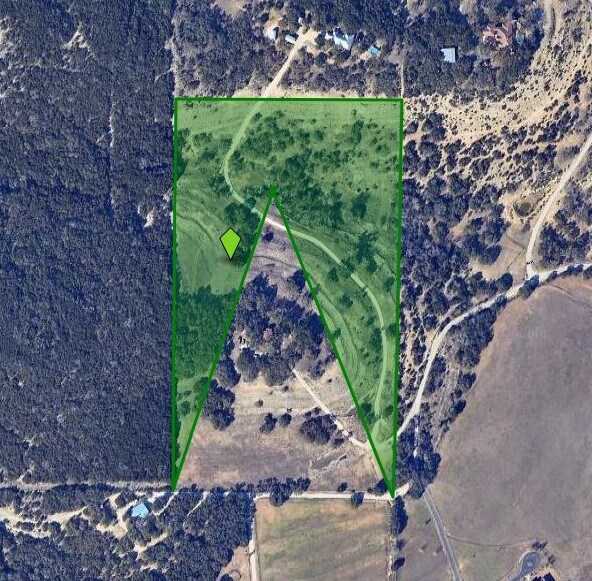

Property Detail
1710 Upper Balcones Rd
San Antonio-New Braunfels, TX
CB 4644 P-4(21.888) ABS 1080 CB 4649 P-1 (.592) ABS 413 REFER TO: 04644-000-0040
04644-000-0042
BEXAR
Privatepreserveopenspacevacantlandforestlandconservation
Texas
B and X Area of moderate flood hazard, usually the area between the limits of the 100-year and 500-year floods.
42
2025
22.48 AC
2025
Far Northwest
182103
San Antonio
NEARBY LISTINGS FOR SALE OR LEASE
-
-
View all Boerne listings for sale on LoopNet.com
DEMOGRAPHICS near 1710 Upper Balcones Rd
1 mile
3 mile
5 mile
2025 Total Population
95
933
15,464
2030 Population
106
1,037
17,246
Pop Growth 2025-2030
+ 11.58%
+ 11.15%
+ 11.52%
Average Age
44
43
41
2025 Total Households
33
318
5,455
HH Growth 2025-2030
+ 9.09%
+ 11.32%
+ 11.88%
Median Household Inc
$149,999
$148,332
$119,684
Avg Household Size
2.50
2.80
2.80
2025 Avg HH Vehicles
3.00
2.00
2.00
Median Home Value
$772,727
$726,851
$588,948
Median Year Built
2009
2010
2009
Nearby Places
Map Layers
Map Styles
 Street
 Aerial
Layers
 Traffic
 Biking
Places
Listings with unknown addresses are not visible on the map
- Restaurants
- Banks
- Shops
- Fitness
- Groceries
PUBLIC TRANSPORTATION
AIRPORT
San Antonio International
Drive
Walk
Distance
San Antonio International
43 min
27.8 mi
Freight Ports
Calhoun Port
Drive
Walk
Distance
Calhoun Port
222 min
179.4 mi
Nearby Properties
Address
Land Use
TOTAL SIZE
Lot Size
Zoning
Address
Land Use
TOTAL SIZE
Lot Size
Zoning
911.63 AC
Address
Land Use
TOTAL SIZE
Lot Size
Zoning
267.45 AC
Address
Land Use
TOTAL SIZE
Lot Size
Zoning
7,537 SF
111.13 AC
Address
Land Use
TOTAL SIZE
Lot Size
Zoning
232.34 AC
Address
Land Use
TOTAL SIZE
Lot Size
Zoning
158.66 AC
Address
Land Use
TOTAL SIZE
Lot Size
Zoning
300 AC
Address
Land Use
TOTAL SIZE
Lot Size
Zoning
280.37 AC
Address
Land Use
TOTAL SIZE
Lot Size
Zoning
8,351 SF
20.60 AC
Address
Land Use
TOTAL SIZE
Lot Size
Zoning
237 AC
Address
Land Use
TOTAL SIZE
Lot Size
Zoning
2,857 SF
150 AC
Address
Land Use
TOTAL SIZE
Lot Size
Zoning
152.30 AC
Address
Land Use
TOTAL SIZE
Lot Size
Zoning
11,704 SF
29 AC
Address
Land Use
TOTAL SIZE
Lot Size
Zoning
38.38 AC
Address
Land Use
TOTAL SIZE
Lot Size
Zoning
67.83 AC
Address
Land Use
TOTAL SIZE
Lot Size
Zoning
Address
Land Use
TOTAL SIZE
Lot Size
Zoning
142.20 AC
Address
Land Use
TOTAL SIZE
Lot Size
Zoning
124.50 AC
Address
Land Use
TOTAL SIZE
Lot Size
Zoning
100.42 AC
Address
Land Use
TOTAL SIZE
Lot Size
Zoning
700 SF
97.23 AC
Address
Land Use
TOTAL SIZE
Lot Size
Zoning
21.21 AC
Address
Land Use
TOTAL SIZE
Lot Size
Zoning
96.34 AC
Address
Land Use
TOTAL SIZE
Lot Size
Zoning
3,936 SF
6.16 AC
Address
Land Use
TOTAL SIZE
Lot Size
Zoning
55.10 AC
Address
Land Use
TOTAL SIZE
Lot Size
Zoning
50.96 AC
Address
Land Use
TOTAL SIZE
Lot Size
Zoning
19.03 AC
Address
Land Use
TOTAL SIZE
Lot Size
Zoning
Address
Land Use
TOTAL SIZE
Lot Size
Zoning
49.66 AC
Address
Land Use
TOTAL SIZE
Lot Size
Zoning
62.06 AC
Address
Land Use
TOTAL SIZE
Lot Size
Zoning
Address
Land Use
TOTAL SIZE
Lot Size
Zoning
14.60 AC
The World's #1 Commercial Real Estate Marketplace
Connect with us
© 2026 CoStar Group
The information above has been obtained from sources believed reliable. While we do not doubt its accuracy we have not verified it and make no guarantee, warranty or representation about it. It is your responsibility to independently confirm its accuracy and completeness. Any projections, opinions, assumptions, or estimates used are for example only and do not represent the current or future performance of the property. The value of this transaction to you depends on tax and other factors which should be evaluated by your tax, financial, and legal advisors. You and your advisors should conduct a careful, independent investigation of the property to determine to your satisfaction the suitability of the property for your needs.