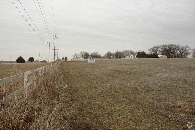
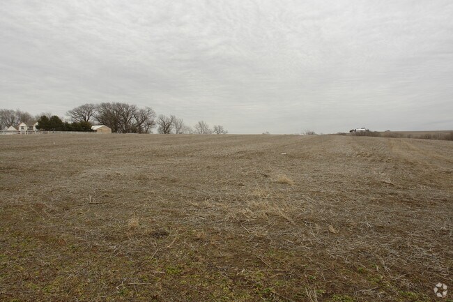
Property Record
17105 S Highway 50, Springfield, NE 68059

NEARBY LISTINGS FOR SALE OR LEASE
-
-
View all Springfield listings for sale on LoopNet.com
Property Detail
17105 S Highway 50
Omaha-Council Bluffs, NE-IA
Meyer Estates
011572178
TAX LOT 3A2B 25-13-11 (19.62 AC)
Commercialnec
Sarpy
AE
Nebraska
31025C0075D
3
2024
6.94 AC
2025
Southwest Omaha
010702
Omaha/Council Bluffs
16,000 SF
DEMOGRAPHICS near 17105 S Highway 50
1 Mile
3 Mile
5 Mile
2024 Total Population
239
3,085
6,085
2029 Population
253
3,292
6,458
Pop Growth 2024-2029
+ 5.86%
+ 6.71%
+ 6.13%
Average Age
42
41
42
2024 Total Households
92
1,169
2,262
HH Growth 2024-2029
+ 6.52%
+ 6.76%
+ 6.15%
Median Household Inc
$87,500
$96,293
$97,946
Avg Household Size
2.50
2.60
2.60
2024 Avg HH Vehicles
2.00
2.00
3.00
Median Home Value
$334,615
$309,113
$333,535
Median Year Built
1975
1979
1982
Nearby Places
Map Layers
Map Styles
 Street
 Aerial
- Restaurants
- Banks
- Shops
- Fitness
- Groceries
PUBLIC TRANSPORTATION
AIRPORT
Eppley Airfield
DRIVE
WALK
Distance
Eppley Airfield
37 min
25.8 mi
Freight Ports
Tulsa Port Of Catoosa
DRIVE
WALK
Distance
Tulsa Port Of Catoosa
461 min
387.4 mi
Nearby Properties
Address
Land Use
TOTAL SIZE
Lot Size
Zoning
Address
Land Use
TOTAL SIZE
Lot Size
Zoning
9.76 AC
Address
Land Use
TOTAL SIZE
Lot Size
Zoning
11.43 AC
Address
Land Use
TOTAL SIZE
Lot Size
Zoning
11.40 AC
Address
Land Use
TOTAL SIZE
Lot Size
Zoning
Address
Land Use
TOTAL SIZE
Lot Size
Zoning
11,340 SF
35.46 AC
Address
Land Use
TOTAL SIZE
Lot Size
Zoning
116.77 AC
Address
Land Use
TOTAL SIZE
Lot Size
Zoning
2,866 SF
36.76 AC
Address
Land Use
TOTAL SIZE
Lot Size
Zoning
1.84 AC
Address
Land Use
TOTAL SIZE
Lot Size
Zoning
2.30 AC
Address
Land Use
TOTAL SIZE
Lot Size
Zoning
8.66 AC
Address
Land Use
TOTAL SIZE
Lot Size
Zoning
3,782 SF
314.41 AC
AG
Address
Land Use
TOTAL SIZE
Lot Size
Zoning
4,710 SF
185.15 AC
Address
Land Use
TOTAL SIZE
Lot Size
Zoning
11,910 SF
1.63 AC
Address
Land Use
TOTAL SIZE
Lot Size
Zoning
13,540 SF
81.34 AC
AG
Address
Land Use
TOTAL SIZE
Lot Size
Zoning
17,565 SF
0.74 AC
Address
Land Use
TOTAL SIZE
Lot Size
Zoning
8.95 AC
Address
Land Use
TOTAL SIZE
Lot Size
Zoning
14,492 SF
20.06 AC
ILFP
Address
Land Use
TOTAL SIZE
Lot Size
Zoning
1,512 SF
221.13 AC
IL
Address
Land Use
TOTAL SIZE
Lot Size
Zoning
2,935 SF
235.22 AC
AG
Address
Land Use
TOTAL SIZE
Lot Size
Zoning
6,790 SF
59.66 AC
AG
Address
Land Use
TOTAL SIZE
Lot Size
Zoning
7,547 SF
73.48 AC
A
Address
Land Use
TOTAL SIZE
Lot Size
Zoning
19.67 AC
AG
Address
Land Use
TOTAL SIZE
Lot Size
Zoning
4,536 SF
1.03 AC
A
Address
Land Use
TOTAL SIZE
Lot Size
Zoning
6,438 SF
163.11 AC
AG
Address
Land Use
TOTAL SIZE
Lot Size
Zoning
6,259 SF
18.60 AC
AG
Address
Land Use
TOTAL SIZE
Lot Size
Zoning
15,038 SF
1.60 AC
Address
Land Use
TOTAL SIZE
Lot Size
Zoning
2,088 SF
156.16 AC
ILFP
Address
Land Use
TOTAL SIZE
Lot Size
Zoning
3,880 SF
123.92 AC
AG
Address
Land Use
TOTAL SIZE
Lot Size
Zoning
5,738 SF
77.17 AC
AG
The World's #1 Commercial Real Estate Marketplace
Connect with us
© 2026 CoStar Group
The information above has been obtained from sources believed reliable. While we do not doubt its accuracy we have not verified it and make no guarantee, warranty or representation about it. It is your responsibility to independently confirm its accuracy and completeness. Any projections, opinions, assumptions, or estimates used are for example only and do not represent the current or future performance of the property. The value of this transaction to you depends on tax and other factors which should be evaluated by your tax, financial, and legal advisors. You and your advisors should conduct a careful, independent investigation of the property to determine to your satisfaction the suitability of the property for your needs.