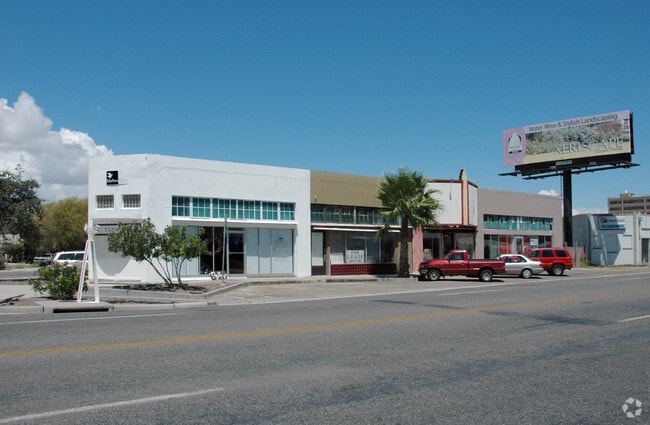
Property Record
1711 S Staples St, Corpus Christi, TX 78404

NEARBY LISTINGS FOR SALE OR LEASE
Property Detail
1711 S Staples St
Corpus Christi, TX
Merchants #4
266492
MERCHANTS #4 FCL LTS 38 THRU 41 & SW/2 LTS 36 & 37 BK 904
Commercialnec
Nueces
X
Texas
48355C0320G
38
2024
0.11 AC
2025
Mid-City
001400
Corpus Christi
4,916 SF
DEMOGRAPHICS near 1711 S Staples St
1 mile
3 mile
5 mile
2024 Total Population
14,163
80,292
138,984
2029 Population
14,082
79,643
137,727
Pop Growth 2024-2029
(0.57%)
(0.81%)
(0.90%)
Average Age
41
39
39
2024 Total Households
5,601
29,185
51,403
HH Growth 2024-2029
(0.61%)
(0.82%)
(0.85%)
Median Household Inc
$42,342
$40,917
$45,085
Avg Household Size
2.40
2.60
2.60
2024 Avg HH Vehicles
1.00
2.00
2.00
Median Home Value
$118,329
$92,715
$121,537
Median Year Built
1956
1956
1963
Nearby Places
Map Layers
Map Styles
 Street
 Aerial
Transit
 Traffic
 Biking
Places
Listings with unknown addresses are not visible on the map
- Restaurants
- Banks
- Shops
- Fitness
- Groceries
PUBLIC TRANSPORTATION
AIRPORT
Corpus Christi International
Drive
Walk
Distance
Corpus Christi International
17 min
8.1 mi
Freight Ports
Port of Corpus Christi
Drive
Walk
Distance
Port of Corpus Christi
6 min
2.7 mi
Nearby Properties
Address
Land Use
TOTAL SIZE
Lot Size
Zoning
Address
Land Use
TOTAL SIZE
Lot Size
Zoning
567,638 SF
18.37 AC
B4
Address
Land Use
TOTAL SIZE
Lot Size
Zoning
382,448 SF
14.98 AC
Address
Land Use
TOTAL SIZE
Lot Size
Zoning
674,927 SF
10.54 AC
B4
Address
Land Use
TOTAL SIZE
Lot Size
Zoning
594,377 SF
29.96 AC
B5
Address
Land Use
TOTAL SIZE
Lot Size
Zoning
1 SF
62.73 AC
III
Address
Land Use
TOTAL SIZE
Lot Size
Zoning
24,217 SF
4.39 AC
B2
Address
Land Use
TOTAL SIZE
Lot Size
Zoning
370,000 SF
1.47 AC
B-2
Address
Land Use
TOTAL SIZE
Lot Size
Zoning
15.10 AC
I3
Address
Land Use
TOTAL SIZE
Lot Size
Zoning
1 SF
13.71 AC
B5
Address
Land Use
TOTAL SIZE
Lot Size
Zoning
302,344 SF
5 AC
Address
Land Use
TOTAL SIZE
Lot Size
Zoning
392,617 SF
2.20 AC
B2
Address
Land Use
TOTAL SIZE
Lot Size
Zoning
176,076 SF
19.84 AC
R1B
Address
Land Use
TOTAL SIZE
Lot Size
Zoning
251,402 SF
7.17 AC
Address
Land Use
TOTAL SIZE
Lot Size
Zoning
131,533 SF
23.24 AC
I3
Address
Land Use
TOTAL SIZE
Lot Size
Zoning
117,000 SF
19.20 AC
R1B
Address
Land Use
TOTAL SIZE
Lot Size
Zoning
1 SF
10.53 AC
I2
Address
Land Use
TOTAL SIZE
Lot Size
Zoning
10,000 SF
35.96 AC
R1B
Address
Land Use
TOTAL SIZE
Lot Size
Zoning
72,106 SF
1.96 AC
B-5
Address
Land Use
TOTAL SIZE
Lot Size
Zoning
11.03 AC
I3
Address
Land Use
TOTAL SIZE
Lot Size
Zoning
278,919 SF
39.27 AC
R1B
Address
Land Use
TOTAL SIZE
Lot Size
Zoning
78,000 SF
6.92 AC
R1B
Address
Land Use
TOTAL SIZE
Lot Size
Zoning
75,120 SF
1.93 AC
B2
Address
Land Use
TOTAL SIZE
Lot Size
Zoning
65,301 SF
7.37 AC
B-4
Address
Land Use
TOTAL SIZE
Lot Size
Zoning
85,871 SF
18.68 AC
R1B
Address
Land Use
TOTAL SIZE
Lot Size
Zoning
149,402 SF
2.91 AC
B5
Address
Land Use
TOTAL SIZE
Lot Size
Zoning
177,545 SF
7.75 AC
B2
Address
Land Use
TOTAL SIZE
Lot Size
Zoning
52,121 SF
27.73 AC
Address
Land Use
TOTAL SIZE
Lot Size
Zoning
194,444 SF
1.34 AC
Address
Land Use
TOTAL SIZE
Lot Size
Zoning
74,261 SF
4.44 AC
R1B
Address
Land Use
TOTAL SIZE
Lot Size
Zoning
361,000 SF
2.20 AC
B6PUD2
The World's #1 Commercial Real Estate Marketplace
Connect with us
© 2026 CoStar Group
The information above has been obtained from sources believed reliable. While we do not doubt its accuracy we have not verified it and make no guarantee, warranty or representation about it. It is your responsibility to independently confirm its accuracy and completeness. Any projections, opinions, assumptions, or estimates used are for example only and do not represent the current or future performance of the property. The value of this transaction to you depends on tax and other factors which should be evaluated by your tax, financial, and legal advisors. You and your advisors should conduct a careful, independent investigation of the property to determine to your satisfaction the suitability of the property for your needs.