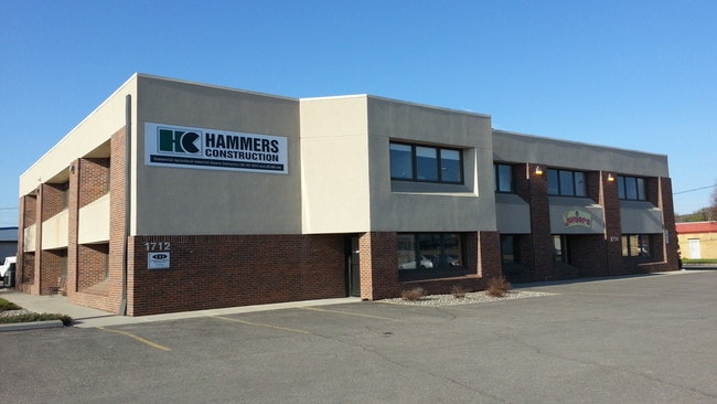
Property Record
1712 Main Ave, Fargo, ND 58103

Property Detail
1712 Main Ave
01-0060-00042-010
LOT: 1 BLOCK: 2 ADDITION: ARNESONS ADDITIONAL: ARNESON'S THE N 187.5' OF LTS 1 & 2, THE ADJ 10.5' OF VAC 18TH ST S BLK 2
Daycare
Cass
LI
North Dakota
C and X Area of minimal flood hazard, usually depicted on FIRMs as above the 500-year flood level.
1-2
2025
0.56 AC
2025
Jefferson
000602
Other Market Areas
13,372 SF
Fargo, ND-MN
NEARBY LISTINGS FOR SALE OR LEASE
DEMOGRAPHICS near 1712 Main Ave
1 mile
3 mile
5 mile
2025 Total Population
15,219
99,451
189,651
2030 Population
16,370
106,015
200,652
Pop Growth 2025-2030
+ 7.56%
+ 6.60%
+ 5.80%
Average Age
37
37
37
2025 Total Households
7,452
44,452
82,439
HH Growth 2025-2030
+ 7.64%
+ 6.97%
+ 6.24%
Median Household Inc
$50,576
$55,741
$63,931
Avg Household Size
1.90
2.00
2.10
2025 Avg HH Vehicles
2.00
2.00
2.00
Median Home Value
$201,777
$239,160
$270,817
Median Year Built
1965
1977
1988
Nearby Places
Map Layers
Map Styles
 Street
 Aerial
Layers
 Traffic
 Biking
Places
Listings with unknown addresses are not visible on the map
- Restaurants
- Banks
- Shops
- Fitness
- Groceries
PUBLIC TRANSPORTATION
COMMUTER RAIL
Fargo Amtrak Station (Empire Builder - Amtrak)
Drive
Walk
Distance
Fargo Amtrak Station (Empire Builder - Amtrak)
4 min
1.6 mi
AIRPORT
Hector International
Drive
Walk
Distance
Hector International
10 min
4.7 mi
Freight Ports
Port Milwaukee
Drive
Walk
Distance
Port Milwaukee
630 min
572.9 mi
SALE & LEASE HISTORY
LISTING DATE
SALE/LEASE

Nov 25, 2020
For Lease
May 02, 2019
For Lease
Apr 27, 2017
For Lease
Nearby Properties
Address
Land Use
TOTAL SIZE
Lot Size
Zoning
Address
Land Use
TOTAL SIZE
Lot Size
Zoning
40.49 AC
Address
Land Use
TOTAL SIZE
Lot Size
Zoning
30.61 AC
Address
Land Use
TOTAL SIZE
Lot Size
Zoning
17.38 AC
Address
Land Use
TOTAL SIZE
Lot Size
Zoning
21.81 AC
Address
Land Use
TOTAL SIZE
Lot Size
Zoning
53.42 AC
Address
Land Use
TOTAL SIZE
Lot Size
Zoning
32.98 AC
Address
Land Use
TOTAL SIZE
Lot Size
Zoning
408,617 SF
9.33 AC
GC
Address
Land Use
TOTAL SIZE
Lot Size
Zoning
14.53 AC
Address
Land Use
TOTAL SIZE
Lot Size
Zoning
175,969 SF
35.10 AC
GI
Address
Land Use
TOTAL SIZE
Lot Size
Zoning
621,097 SF
49.49 AC
LI
Address
Land Use
TOTAL SIZE
Lot Size
Zoning
230,272 SF
21.77 AC
GC
Address
Land Use
TOTAL SIZE
Lot Size
Zoning
121,584 SF
5.64 AC
MR3
Address
Land Use
TOTAL SIZE
Lot Size
Zoning
3.39 AC
Address
Land Use
TOTAL SIZE
Lot Size
Zoning
162,875 SF
12.32 AC
MR3
Address
Land Use
TOTAL SIZE
Lot Size
Zoning
Address
Land Use
TOTAL SIZE
Lot Size
Zoning
107,995 SF
1 AC
DMU
Address
Land Use
TOTAL SIZE
Lot Size
Zoning
5.23 AC
Address
Land Use
TOTAL SIZE
Lot Size
Zoning
2.77 AC
Address
Land Use
TOTAL SIZE
Lot Size
Zoning
0.22 AC
Address
Land Use
TOTAL SIZE
Lot Size
Zoning
3.31 AC
Address
Land Use
TOTAL SIZE
Lot Size
Zoning
0.17 AC
Address
Land Use
TOTAL SIZE
Lot Size
Zoning
303,970 SF
49.72 AC
GI
Address
Land Use
TOTAL SIZE
Lot Size
Zoning
2.91 AC
Address
Land Use
TOTAL SIZE
Lot Size
Zoning
163,398 SF
1.92 AC
LC
Address
Land Use
TOTAL SIZE
Lot Size
Zoning
163,195 SF
11.95 AC
GC
Address
Land Use
TOTAL SIZE
Lot Size
Zoning
60,125 SF
25.37 AC
LI
Address
Land Use
TOTAL SIZE
Lot Size
Zoning
109,174 SF
1.25 AC
UMU
Address
Land Use
TOTAL SIZE
Lot Size
Zoning
6.02 AC
Address
Land Use
TOTAL SIZE
Lot Size
Zoning
45.33 AC
GC
Address
Land Use
TOTAL SIZE
Lot Size
Zoning
2.07 AC
The World's #1 Commercial Real Estate Marketplace
Connect with us
© 2026 CoStar Group
The information above has been obtained from sources believed reliable. While we do not doubt its accuracy we have not verified it and make no guarantee, warranty or representation about it. It is your responsibility to independently confirm its accuracy and completeness. Any projections, opinions, assumptions, or estimates used are for example only and do not represent the current or future performance of the property. The value of this transaction to you depends on tax and other factors which should be evaluated by your tax, financial, and legal advisors. You and your advisors should conduct a careful, independent investigation of the property to determine to your satisfaction the suitability of the property for your needs.