Property Record
1712 Main St, Coventry, CT 06238
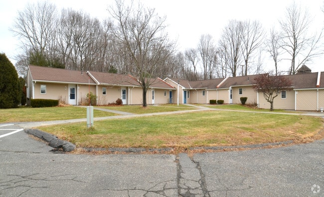
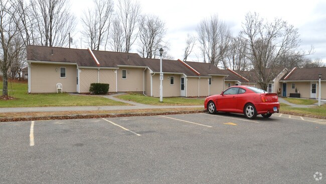
Property Detail
1712 Main St
Hartford-West Hartford-East Hartford, CT
TOLLAND
COVE-000018-000049-A000000-000000-1A
Connecticut
Governmentalpublicusegeneral
111
GR40
30.42 AC
2025
Andover/Coventry
2025
Hartford
850200
NEARBY LISTINGS FOR SALE OR LEASE
-
-
View all Coventry listings for sale on LoopNet.com
DEMOGRAPHICS near 1712 Main St
1 mile
3 mile
5 mile
2025 Total Population
1,645
12,136
39,274
2030 Population
1,685
12,500
40,188
Pop Growth 2025-2030
+ 2.43%
+ 3.00%
+ 2.33%
Average Age
44
40
36
2025 Total Households
702
4,445
11,599
HH Growth 2025-2030
+ 2.42%
+ 3.26%
+ 2.91%
Median Household Inc
$119,970
$98,099
$96,017
Avg Household Size
2.30
2.40
2.40
2025 Avg HH Vehicles
2.00
2.00
2.00
Median Home Value
$320,855
$331,175
$345,708
Median Year Built
1958
1967
1975
Nearby Places
Map Layers
Map Styles
 Street
 Aerial
Transit
 Traffic
 Biking
Places
Listings with unknown addresses are not visible on the map
- Restaurants
- Banks
- Shops
- Fitness
- Groceries
PUBLIC TRANSPORTATION
AIRPORT
Bradley International
Drive
Walk
Distance
Bradley International
59 min
35.8 mi
Freight Ports
Port of New Haven
Drive
Walk
Distance
Port of New Haven
78 min
57.9 mi
Nearby Properties
Address
Land Use
TOTAL SIZE
Lot Size
Zoning
Address
Land Use
TOTAL SIZE
Lot Size
Zoning
35,212 SF
3.20 AC
I
Address
Land Use
TOTAL SIZE
Lot Size
Zoning
Address
Land Use
TOTAL SIZE
Lot Size
Zoning
9.48 AC
DMR
Address
Land Use
TOTAL SIZE
Lot Size
Zoning
98 AC
GR40
Address
Land Use
TOTAL SIZE
Lot Size
Zoning
43,134 SF
1 AC
I
Address
Land Use
TOTAL SIZE
Lot Size
Zoning
23 AC
RAR90
Address
Land Use
TOTAL SIZE
Lot Size
Zoning
35,127 SF
I
Address
Land Use
TOTAL SIZE
Lot Size
Zoning
35,127 SF
I
Address
Land Use
TOTAL SIZE
Lot Size
Zoning
35,127 SF
I
Address
Land Use
TOTAL SIZE
Lot Size
Zoning
35,127 SF
I
Address
Land Use
TOTAL SIZE
Lot Size
Zoning
35,127 SF
I
Address
Land Use
TOTAL SIZE
Lot Size
Zoning
34,014 SF
I
Address
Land Use
TOTAL SIZE
Lot Size
Zoning
24,985 SF
I
Address
Land Use
TOTAL SIZE
Lot Size
Zoning
38,376 SF
Address
Land Use
TOTAL SIZE
Lot Size
Zoning
38,103 SF
8.80 AC
RAR90
Address
Land Use
TOTAL SIZE
Lot Size
Zoning
19.60 AC
RAR90
Address
Land Use
TOTAL SIZE
Lot Size
Zoning
23,136 SF
I
Address
Land Use
TOTAL SIZE
Lot Size
Zoning
22,263 SF
1 AC
I
Address
Land Use
TOTAL SIZE
Lot Size
Zoning
30,480 SF
Address
Land Use
TOTAL SIZE
Lot Size
Zoning
22,263 SF
I
Address
Land Use
TOTAL SIZE
Lot Size
Zoning
22,263 SF
I
Address
Land Use
TOTAL SIZE
Lot Size
Zoning
22,263 SF
I
Address
Land Use
TOTAL SIZE
Lot Size
Zoning
22,263 SF
I
Address
Land Use
TOTAL SIZE
Lot Size
Zoning
29,696 SF
Address
Land Use
TOTAL SIZE
Lot Size
Zoning
62,452 SF
20 AC
GR80
Address
Land Use
TOTAL SIZE
Lot Size
Zoning
13.47 AC
RAR90
Address
Land Use
TOTAL SIZE
Lot Size
Zoning
50,098 SF
16.96 AC
RAR90
Address
Land Use
TOTAL SIZE
Lot Size
Zoning
14.05 AC
DMR
Address
Land Use
TOTAL SIZE
Lot Size
Zoning
Address
Land Use
TOTAL SIZE
Lot Size
Zoning
1,290 SF
200 AC
The World's #1 Commercial Real Estate Marketplace
Connect with us
© 2026 CoStar Group
The information above has been obtained from sources believed reliable. While we do not doubt its accuracy we have not verified it and make no guarantee, warranty or representation about it. It is your responsibility to independently confirm its accuracy and completeness. Any projections, opinions, assumptions, or estimates used are for example only and do not represent the current or future performance of the property. The value of this transaction to you depends on tax and other factors which should be evaluated by your tax, financial, and legal advisors. You and your advisors should conduct a careful, independent investigation of the property to determine to your satisfaction the suitability of the property for your needs.