Property Record
1713 E Patapsco Ave, Curtis Bay, MD 21226
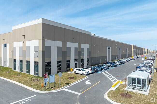

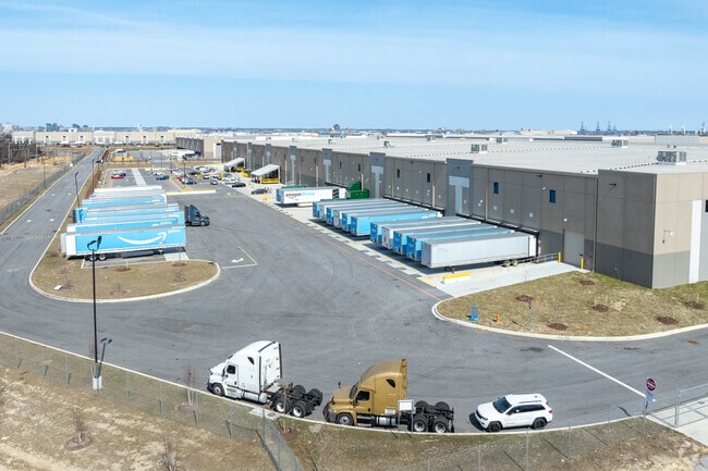
Property Detail
1713 E Patapsco Ave
7335D-009
19.021 ACRES
Lightindustrial
BALTIMORE CITY
MI
Maryland
B and X Area of moderate flood hazard, usually the area between the limits of the 100-year and 500-year floods.
9
2024
19.02 AC
2025
Baltimore SE
250600
Baltimore
239,476 SF
Baltimore-Columbia-Towson, MD
NEARBY LISTINGS FOR SALE OR LEASE
DEMOGRAPHICS near 1713 E Patapsco Ave
1 mile
3 mile
5 mile
2025 Total Population
3,519
36,633
253,841
2030 Population
3,495
36,544
252,947
Pop Growth 2025-2030
(0.68%)
(0.24%)
(0.35%)
Average Age
38
37
37
2025 Total Households
1,361
13,393
105,060
HH Growth 2025-2030
(0.73%)
(0.39%)
(0.46%)
Median Household Inc
$46,521
$58,460
$77,947
Avg Household Size
2.50
2.60
2.30
2025 Avg HH Vehicles
1.00
1.00
1.00
Median Home Value
$178,858
$235,541
$298,577
Median Year Built
1949
1955
1954
Nearby Places
Map Layers
Map Styles
 Street
 Aerial
Layers
 Traffic
 Biking
Places
Listings with unknown addresses are not visible on the map
- Restaurants
- Banks
- Shops
- Fitness
- Groceries
PUBLIC TRANSPORTATION
COMMUTER RAIL
Camden Station Marc (CAMDEN - WASHINGTON - Maryland Transit Administration)
Drive
Walk
Distance
Camden Station Marc (CAMDEN - WASHINGTON - Maryland Transit Administration)
15 min
6.2 mi
Penn Station (PENN - WASHINGTON - Maryland Area Regional Commuter Trains (The MARC), Penn Line - Maryland Area Regional Commuter Trains (The MARC), Penn Station & Camden Yards - Maryland Area Regional Commuter Trains (The MARC))
Drive
Walk
Distance
Penn Station (PENN - WASHINGTON - Maryland Area Regional Commuter Trains (The MARC), Penn Line - Maryland Area Regional Commuter Trains (The MARC), Penn Station & Camden Yards - Maryland Area Regional Commuter Trains (The MARC))
20 min
7.9 mi
AIRPORT
Baltimore/Washington International Thurgood Marshall
Drive
Walk
Distance
Baltimore/Washington International Thurgood Marshall
22 min
11.7 mi
Freight Ports
Port of Baltimore
Drive
Walk
Distance
Port of Baltimore
15 min
5.5 mi
SALE & LEASE HISTORY
LISTING DATE
SALE/LEASE

Dec 17, 2020
For Lease
Nearby Properties
Address
Land Use
TOTAL SIZE
Lot Size
Zoning
Address
Land Use
TOTAL SIZE
Lot Size
Zoning
467.03 AC
W2
Address
Land Use
TOTAL SIZE
Lot Size
Zoning
520,407 SF
16.85 AC
H
Address
Land Use
TOTAL SIZE
Lot Size
Zoning
263 AC
0M030
Address
Land Use
TOTAL SIZE
Lot Size
Zoning
12.90 AC
R15
Address
Land Use
TOTAL SIZE
Lot Size
Zoning
263,024 SF
6.87 AC
C3
Address
Land Use
TOTAL SIZE
Lot Size
Zoning
111.20 AC
W3
Address
Land Use
TOTAL SIZE
Lot Size
Zoning
173,735 SF
17.31 AC
PC-4
Address
Land Use
TOTAL SIZE
Lot Size
Zoning
552,387 SF
88.86 AC
MI
Address
Land Use
TOTAL SIZE
Lot Size
Zoning
12 AC
C3
Address
Land Use
TOTAL SIZE
Lot Size
Zoning
190,650 SF
20.80 AC
I-2
Address
Land Use
TOTAL SIZE
Lot Size
Zoning
304,404 SF
16.74 AC
W3
Address
Land Use
TOTAL SIZE
Lot Size
Zoning
119,220 SF
6.99 AC
W1
Address
Land Use
TOTAL SIZE
Lot Size
Zoning
265,423 SF
22.26 AC
MI
Address
Land Use
TOTAL SIZE
Lot Size
Zoning
518,536 SF
136.14 AC
MI
Address
Land Use
TOTAL SIZE
Lot Size
Zoning
674,828 SF
167.04 AC
W3
Address
Land Use
TOTAL SIZE
Lot Size
Zoning
344,254 SF
20.82 AC
W3
Address
Land Use
TOTAL SIZE
Lot Size
Zoning
6.35 AC
PC-4
Address
Land Use
TOTAL SIZE
Lot Size
Zoning
155,608 SF
18.68 AC
C3
Address
Land Use
TOTAL SIZE
Lot Size
Zoning
482,600 SF
26.50 AC
I-2
Address
Land Use
TOTAL SIZE
Lot Size
Zoning
28,137 SF
43.61 AC
OS
Address
Land Use
TOTAL SIZE
Lot Size
Zoning
64,880 SF
5.47 AC
C-2
Address
Land Use
TOTAL SIZE
Lot Size
Zoning
34 AC
R-5
Address
Land Use
TOTAL SIZE
Lot Size
Zoning
126,300 SF
18.81 AC
C3
Address
Land Use
TOTAL SIZE
Lot Size
Zoning
223,932 SF
19.87 AC
MI
Address
Land Use
TOTAL SIZE
Lot Size
Zoning
252,000 SF
23.02 AC
I-2
Address
Land Use
TOTAL SIZE
Lot Size
Zoning
336,216 SF
19.99 AC
W1
Address
Land Use
TOTAL SIZE
Lot Size
Zoning
669,945 SF
22.45 AC
OIC
Address
Land Use
TOTAL SIZE
Lot Size
Zoning
371,145 SF
17.41 AC
W1
Address
Land Use
TOTAL SIZE
Lot Size
Zoning
143,040 SF
18.17 AC
PC-4
The World's #1 Commercial Real Estate Marketplace
Connect with us
© 2026 CoStar Group
The information above has been obtained from sources believed reliable. While we do not doubt its accuracy we have not verified it and make no guarantee, warranty or representation about it. It is your responsibility to independently confirm its accuracy and completeness. Any projections, opinions, assumptions, or estimates used are for example only and do not represent the current or future performance of the property. The value of this transaction to you depends on tax and other factors which should be evaluated by your tax, financial, and legal advisors. You and your advisors should conduct a careful, independent investigation of the property to determine to your satisfaction the suitability of the property for your needs.