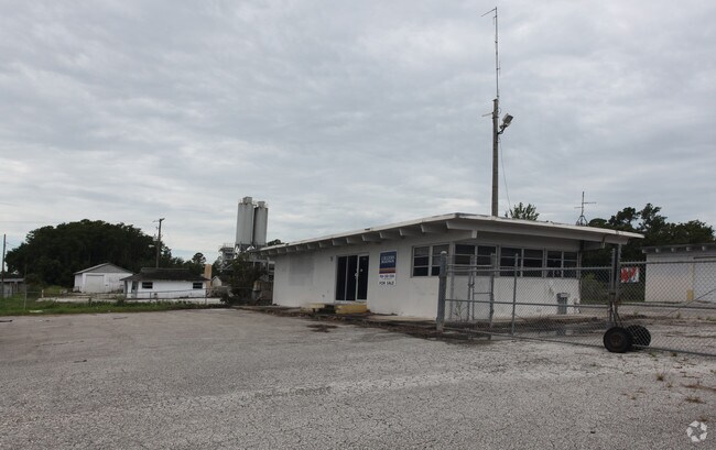
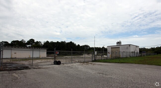
Property Record
1713 N State St, Bunnell, FL 32110

NEARBY LISTINGS FOR SALE OR LEASE
Property Detail
1713 N State St
Deltona-Daytona Beach-Ormond Beach, FL
Bunnell Dev Co
10-12-30-0650-000B0-0200
BUNNELL DEV CO SUBD BLOCK B TRACTS 2,3,8&9 WEST OF US #1 & E OR RR & EAST 50 FEET OF RR ROW ADJOINING TRACT 8 BLOCK B OR 147 PG 157 OR 148 PG 343 ANNEXED INTO CITY 2006-24 OR 1469 PG 1751 OR 2099/1837
Vehiclerentalsvehiclesales
Flagler
X
Florida
12035C0207E
20
2024
8.02 AC
2025
Daytona Area
060206
Other Market Areas
8,498 SF
DEMOGRAPHICS near 1713 N State St
1 Mile
3 Mile
5 Mile
2024 Total Population
1,215
17,724
49,545
2029 Population
1,473
21,634
60,562
Pop Growth 2024-2029
+ 21.23%
+ 22.06%
+ 22.24%
Average Age
47
45
46
2024 Total Households
543
6,869
19,649
HH Growth 2024-2029
+ 20.44%
+ 21.31%
+ 21.50%
Median Household Inc
$53,088
$60,756
$60,787
Avg Household Size
2.20
2.50
2.50
2024 Avg HH Vehicles
2.00
2.00
2.00
Median Home Value
$261,666
$264,878
$254,775
Median Year Built
1997
2003
2002
Nearby Places
Map Layers
Map Styles
 Street
 Aerial
- Restaurants
- Banks
- Shops
- Fitness
- Groceries
PUBLIC TRANSPORTATION
AIRPORT
Daytona Beach International
DRIVE
WALK
Distance
Daytona Beach International
37 min
27.4 mi
Freight Ports
Jacksonville Port
DRIVE
WALK
Distance
Jacksonville Port
83 min
69.2 mi
Nearby Properties
Address
Land Use
TOTAL SIZE
Lot Size
Zoning
Address
Land Use
TOTAL SIZE
Lot Size
Zoning
320,259 SF
83.19 AC
P
Address
Land Use
TOTAL SIZE
Lot Size
Zoning
236,316 SF
61.38 AC
PSP
Address
Land Use
TOTAL SIZE
Lot Size
Zoning
138,991 SF
18.66 AC
P
Address
Land Use
TOTAL SIZE
Lot Size
Zoning
121,173 SF
10 AC
AC
Address
Land Use
TOTAL SIZE
Lot Size
Zoning
64,208 SF
8.41 AC
PSP
Address
Land Use
TOTAL SIZE
Lot Size
Zoning
220,314 SF
17.41 AC
MPD
Address
Land Use
TOTAL SIZE
Lot Size
Zoning
68,684 SF
9.68 AC
MPD
Address
Land Use
TOTAL SIZE
Lot Size
Zoning
89,590 SF
9.90 AC
B-1
Address
Land Use
TOTAL SIZE
Lot Size
Zoning
59,889 SF
0.75 AC
R-3A
Address
Land Use
TOTAL SIZE
Lot Size
Zoning
67,008 SF
5.34 AC
B-1
Address
Land Use
TOTAL SIZE
Lot Size
Zoning
32,679 SF
101.42 AC
L-1
Address
Land Use
TOTAL SIZE
Lot Size
Zoning
112,200 SF
49.38 AC
L-1
Address
Land Use
TOTAL SIZE
Lot Size
Zoning
163,592 SF
10 AC
IND-1
Address
Land Use
TOTAL SIZE
Lot Size
Zoning
41,710 SF
11.97 AC
L-1
Address
Land Use
TOTAL SIZE
Lot Size
Zoning
4,158 SF
3.73 AC
P
Address
Land Use
TOTAL SIZE
Lot Size
Zoning
43,990 SF
4.84 AC
P
Address
Land Use
TOTAL SIZE
Lot Size
Zoning
18,852 SF
3.23 AC
COM-2
Address
Land Use
TOTAL SIZE
Lot Size
Zoning
38,420 SF
4.83 AC
C-2(F)
Address
Land Use
TOTAL SIZE
Lot Size
Zoning
76,339 SF
4 AC
B-1
Address
Land Use
TOTAL SIZE
Lot Size
Zoning
66,485 SF
28.20 AC
Address
Land Use
TOTAL SIZE
Lot Size
Zoning
17,901 SF
1.72 AC
COM-2
Address
Land Use
TOTAL SIZE
Lot Size
Zoning
41,293 SF
4.92 AC
B-1
Address
Land Use
TOTAL SIZE
Lot Size
Zoning
65,787 SF
11.88 AC
B-1
Address
Land Use
TOTAL SIZE
Lot Size
Zoning
55,468 SF
7.25 AC
O-1
Address
Land Use
TOTAL SIZE
Lot Size
Zoning
49,785 SF
1.35 AC
B-2
Address
Land Use
TOTAL SIZE
Lot Size
Zoning
4,539 SF
1.16 AC
COM-2
Address
Land Use
TOTAL SIZE
Lot Size
Zoning
31,452 SF
7.83 AC
B-1
Address
Land Use
TOTAL SIZE
Lot Size
Zoning
29,371 SF
18.32 AC
B-1
Address
Land Use
TOTAL SIZE
Lot Size
Zoning
14,850 SF
2.09 AC
COM-2
Address
Land Use
TOTAL SIZE
Lot Size
Zoning
35.41 AC
MFR-1
The World's #1 Commercial Real Estate Marketplace
Connect with us
© 2026 CoStar Group
The information above has been obtained from sources believed reliable. While we do not doubt its accuracy we have not verified it and make no guarantee, warranty or representation about it. It is your responsibility to independently confirm its accuracy and completeness. Any projections, opinions, assumptions, or estimates used are for example only and do not represent the current or future performance of the property. The value of this transaction to you depends on tax and other factors which should be evaluated by your tax, financial, and legal advisors. You and your advisors should conduct a careful, independent investigation of the property to determine to your satisfaction the suitability of the property for your needs.