Property Record
1713 Williamson Rd, Griffin, GA 30224

Property Detail
1713 Williamson Rd
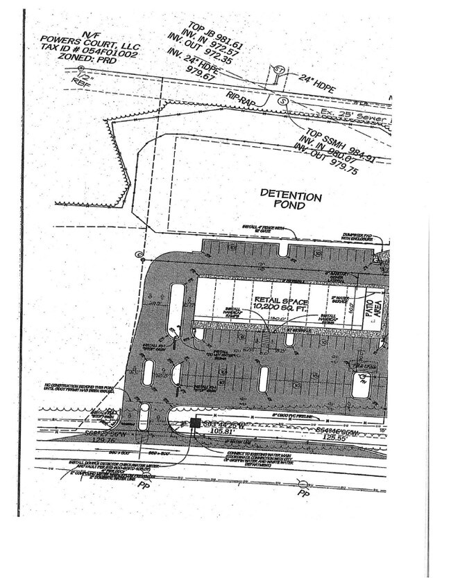
054F-01-003-B
1.55 AC GA SR 92 SURVEY IN DEED 3416/130
Storebuilding
Spalding
PCD
Georgia
B and X Area of moderate flood hazard, usually the area between the limits of the 100-year and 500-year floods.
76
2025
1.55 AC
2025
Spalding County
160702
Atlanta
9,100 SF
Atlanta-Sandy Springs-Roswell, GA
NEARBY LISTINGS FOR SALE OR LEASE
-
-
-
-
-
-
-
No Photo
-
View all Griffin listings for sale on LoopNet.com
DEMOGRAPHICS near 1713 Williamson Rd
1 mile
3 mile
5 mile
2025 Total Population
2,874
19,585
47,908
2030 Population
2,969
20,420
50,105
Pop Growth 2025-2030
+ 3.31%
+ 4.26%
+ 4.59%
Average Age
36
38
39
2025 Total Households
1,078
7,362
18,081
HH Growth 2025-2030
+ 3.43%
+ 4.39%
+ 4.62%
Median Household Inc
$62,720
$56,722
$56,971
Avg Household Size
2.50
2.50
2.60
2025 Avg HH Vehicles
2.00
2.00
2.00
Median Home Value
$221,666
$235,242
$239,469
Median Year Built
1991
1985
1979
Nearby Places
Map Layers
Map Styles
 Street
 Aerial
Layers
 Traffic
 Biking
Places
Listings with unknown addresses are not visible on the map
- Restaurants
- Banks
- Shops
- Fitness
- Groceries
PUBLIC TRANSPORTATION
AIRPORT
Hartsfield - Jackson Atlanta International
Drive
Walk
Distance
Hartsfield - Jackson Atlanta International
53 min
33.4 mi
Nearby Properties
Address
Land Use
TOTAL SIZE
Lot Size
Zoning
Address
Land Use
TOTAL SIZE
Lot Size
Zoning
210,196 SF
14.92 AC
PCD
Address
Land Use
TOTAL SIZE
Lot Size
Zoning
112,554 SF
40.27 AC
C2
Address
Land Use
TOTAL SIZE
Lot Size
Zoning
46,074 SF
30.36 AC
OI
Address
Land Use
TOTAL SIZE
Lot Size
Zoning
56,415 SF
0.56 AC
PCD
Address
Land Use
TOTAL SIZE
Lot Size
Zoning
31,328 SF
58.43 AC
PID
Address
Land Use
TOTAL SIZE
Lot Size
Zoning
31,328 SF
58.43 AC
PID
Address
Land Use
TOTAL SIZE
Lot Size
Zoning
305,123 SF
37 AC
C2
Address
Land Use
TOTAL SIZE
Lot Size
Zoning
89.45 AC
INST
Address
Land Use
TOTAL SIZE
Lot Size
Zoning
96,787 SF
13.42 AC
LDRB
Address
Land Use
TOTAL SIZE
Lot Size
Zoning
99,469 SF
12.51 AC
AR-1
Address
Land Use
TOTAL SIZE
Lot Size
Zoning
2,374 SF
38.28 AC
HDRB
Address
Land Use
TOTAL SIZE
Lot Size
Zoning
16 AC
PCD
Address
Land Use
TOTAL SIZE
Lot Size
Zoning
118,410 SF
15.42 AC
LDRB
Address
Land Use
TOTAL SIZE
Lot Size
Zoning
3,069 SF
15 AC
HDR-B
Address
Land Use
TOTAL SIZE
Lot Size
Zoning
3,716 SF
12.03 AC
PRD
Address
Land Use
TOTAL SIZE
Lot Size
Zoning
74,910 SF
25 AC
AR-1
Address
Land Use
TOTAL SIZE
Lot Size
Zoning
20,383 SF
2.93 AC
HDRA/PCD
Address
Land Use
TOTAL SIZE
Lot Size
Zoning
57,929 SF
11.90 AC
Address
Land Use
TOTAL SIZE
Lot Size
Zoning
1,537 SF
7 AC
HDRA
Address
Land Use
TOTAL SIZE
Lot Size
Zoning
43,440 SF
23.20 AC
AR-1
Address
Land Use
TOTAL SIZE
Lot Size
Zoning
102,102 SF
10.84 AC
PCD
Address
Land Use
TOTAL SIZE
Lot Size
Zoning
41,194 SF
25.19 AC
C-1
Address
Land Use
TOTAL SIZE
Lot Size
Zoning
14,680 SF
1.89 AC
PCD
Address
Land Use
TOTAL SIZE
Lot Size
Zoning
39,777 SF
10.23 AC
INST
Address
Land Use
TOTAL SIZE
Lot Size
Zoning
44,749 SF
4.53 AC
INST
Address
Land Use
TOTAL SIZE
Lot Size
Zoning
21,352 SF
0.74 AC
PCD
Address
Land Use
TOTAL SIZE
Lot Size
Zoning
56,516 SF
28.30 AC
C1
Address
Land Use
TOTAL SIZE
Lot Size
Zoning
65,702 SF
7.19 AC
PCD
Address
Land Use
TOTAL SIZE
Lot Size
Zoning
5,640 SF
86.60 AC
C2
Address
Land Use
TOTAL SIZE
Lot Size
Zoning
111,214 SF
6.01 AC
PCD
The World's #1 Commercial Real Estate Marketplace
Connect with us
© 2026 CoStar Group
The information above has been obtained from sources believed reliable. While we do not doubt its accuracy we have not verified it and make no guarantee, warranty or representation about it. It is your responsibility to independently confirm its accuracy and completeness. Any projections, opinions, assumptions, or estimates used are for example only and do not represent the current or future performance of the property. The value of this transaction to you depends on tax and other factors which should be evaluated by your tax, financial, and legal advisors. You and your advisors should conduct a careful, independent investigation of the property to determine to your satisfaction the suitability of the property for your needs.