Property Record
1715 Bruce B Downs Blvd, Wesley Chapel, FL 33544


NEARBY LISTINGS FOR SALE OR LEASE
-
-
View all Wesley Chapel listings for sale on LoopNet.com
Property Detail
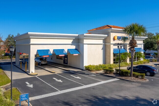
1715 Bruce B Downs Blvd
Tampa-St. Petersburg-Clearwater, FL
Northwood Village
36-26-19-0180-00000-0100
NORTHWOOD VILLAGE PB 60 PG 001 LOT 10 & THE SOUTH 36.73 FT OF LOT 9; LESS THE EAST 20 FT THEREOF OR 8251 PG 1616
Financialbuilding
Pasco
X
Florida
12101C0436F
1
2024
1.46 AC
2026
Pasco County
032109
Tampa/St Petersburg
4,519 SF
DEMOGRAPHICS near 1715 Bruce B Downs Blvd
1 Mile
3 Mile
5 Mile
2024 Total Population
8,426
56,933
142,080
2029 Population
10,068
65,683
164,793
Pop Growth 2024-2029
+ 19.49%
+ 15.37%
+ 15.99%
Average Age
37
38
38
2024 Total Households
3,021
20,363
50,702
HH Growth 2024-2029
+ 19.43%
+ 15.44%
+ 16.02%
Median Household Inc
$102,131
$106,680
$103,117
Avg Household Size
2.80
2.80
2.80
2024 Avg HH Vehicles
2.00
2.00
2.00
Median Home Value
$360,354
$348,824
$342,109
Median Year Built
2002
2004
2004
Nearby Places
Map Layers
Map Styles
 Street
 Aerial
- Restaurants
- Banks
- Shops
- Fitness
- Groceries
PUBLIC TRANSPORTATION
AIRPORT
Tampa International
DRIVE
WALK
Distance
Tampa International
40 min
28.4 mi
St Pete-Clearwater International
DRIVE
WALK
Distance
St Pete-Clearwater International
57 min
37.7 mi
Freight Ports
Port of Tampa Bay
DRIVE
WALK
Distance
Port of Tampa Bay
36 min
24.1 mi
Nearby Properties
Address
Land Use
TOTAL SIZE
Lot Size
Zoning
Address
Land Use
TOTAL SIZE
Lot Size
Zoning
455,090 SF
52.24 AC
MPUD
Address
Land Use
TOTAL SIZE
Lot Size
Zoning
548,616 SF
138.97 AC
PD-A
Address
Land Use
TOTAL SIZE
Lot Size
Zoning
603,350 SF
28.81 AC
MPUD
Address
Land Use
TOTAL SIZE
Lot Size
Zoning
425,346 SF
19.60 AC
MPUD
Address
Land Use
TOTAL SIZE
Lot Size
Zoning
380,937 SF
13.58 AC
MPUD
Address
Land Use
TOTAL SIZE
Lot Size
Zoning
306,559 SF
34.59 AC
MPUD
Address
Land Use
TOTAL SIZE
Lot Size
Zoning
293,253 SF
51.11 AC
MPUD
Address
Land Use
TOTAL SIZE
Lot Size
Zoning
413,002 SF
39.67 AC
PD-A
Address
Land Use
TOTAL SIZE
Lot Size
Zoning
425,129 SF
12.72 AC
MPUD
Address
Land Use
TOTAL SIZE
Lot Size
Zoning
347,708 SF
43.40 AC
MPUD
Address
Land Use
TOTAL SIZE
Lot Size
Zoning
346,880 SF
20.01 AC
MPUD
Address
Land Use
TOTAL SIZE
Lot Size
Zoning
237,598 SF
8.61 AC
PD
Address
Land Use
TOTAL SIZE
Lot Size
Zoning
324,184 SF
19.12 AC
MPUD
Address
Land Use
TOTAL SIZE
Lot Size
Zoning
263,289 SF
26.30 AC
MPUD
Address
Land Use
TOTAL SIZE
Lot Size
Zoning
251,831 SF
15.66 AC
PD-A
Address
Land Use
TOTAL SIZE
Lot Size
Zoning
299,792 SF
73.98 AC
AS-1
Address
Land Use
TOTAL SIZE
Lot Size
Zoning
279,167 SF
14.75 AC
MPUD
Address
Land Use
TOTAL SIZE
Lot Size
Zoning
199,740 SF
12.56 AC
PD
Address
Land Use
TOTAL SIZE
Lot Size
Zoning
175,877 SF
7.64 AC
PD
Address
Land Use
TOTAL SIZE
Lot Size
Zoning
192,698 SF
19.31 AC
MPUD
Address
Land Use
TOTAL SIZE
Lot Size
Zoning
50,016 SF
14.04 AC
MPUD
Address
Land Use
TOTAL SIZE
Lot Size
Zoning
138,613 SF
10.71 AC
PD
Address
Land Use
TOTAL SIZE
Lot Size
Zoning
113,513 SF
42.35 AC
PD-A
Address
Land Use
TOTAL SIZE
Lot Size
Zoning
198,276 SF
60.64 AC
AC
Address
Land Use
TOTAL SIZE
Lot Size
Zoning
175,978 SF
29.19 AC
AC
Address
Land Use
TOTAL SIZE
Lot Size
Zoning
153,330 SF
16.99 AC
PUD
Address
Land Use
TOTAL SIZE
Lot Size
Zoning
62,553 SF
43.31 AC
PD
Address
Land Use
TOTAL SIZE
Lot Size
Zoning
147,238 SF
13.89 AC
MPUD
Address
Land Use
TOTAL SIZE
Lot Size
Zoning
206,368 SF
27.78 AC
PD-A
Address
Land Use
TOTAL SIZE
Lot Size
Zoning
121,727 SF
48.75 AC
MPUD
The World's #1 Commercial Real Estate Marketplace
Connect with us
© 2026 CoStar Group
The information above has been obtained from sources believed reliable. While we do not doubt its accuracy we have not verified it and make no guarantee, warranty or representation about it. It is your responsibility to independently confirm its accuracy and completeness. Any projections, opinions, assumptions, or estimates used are for example only and do not represent the current or future performance of the property. The value of this transaction to you depends on tax and other factors which should be evaluated by your tax, financial, and legal advisors. You and your advisors should conduct a careful, independent investigation of the property to determine to your satisfaction the suitability of the property for your needs.