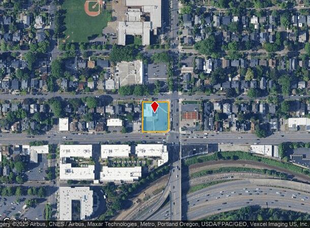
Property Record
1715 Ne 33Rd Ave, Portland, OR 97212
NEARBY LISTINGS FOR SALE OR LEASE
Property Detail
1715 Ne 33Rd Ave
Portland-Vancouver-Hillsboro, OR-WA
Fernwood
R162219
FERNWOOD, LOT 13 TL 8200
Commercialnec
Multnomah
ARE
Oregon
41067C0400E
13
2025
0.51 AC
2025
NE Close-In
002502
Portland
2,145 SF
DEMOGRAPHICS near 1715 Ne 33Rd Ave
1 Mile
3 Mile
5 Mile
2024 Total Population
28,451
232,419
437,602
2029 Population
27,950
228,604
430,626
Pop Growth 2024-2029
(1.76%)
(1.64%)
(1.59%)
Average Age
42
40
40
2024 Total Households
13,193
111,370
200,768
HH Growth 2024-2029
(1.75%)
(1.64%)
(1.62%)
Median Household Inc
$95,568
$85,975
$83,331
Avg Household Size
2.10
2.00
2.10
2024 Avg HH Vehicles
1.00
1.00
1.00
Median Home Value
$764,201
$659,315
$589,378
Median Year Built
1948
1954
1958
Nearby Places
Map Layers
Map Styles
 Street
 Aerial
- Restaurants
- Banks
- Shops
- Fitness
- Groceries
PUBLIC TRANSPORTATION
COMMUTER RAIL
DRIVE
WALK
Distance
7 min
3.5 mi
AIRPORT
Portland International
DRIVE
WALK
Distance
Portland International
17 min
6.3 mi
Freight Ports
Port of Portland
DRIVE
WALK
Distance
Port of Portland
10 min
5.7 mi
SALE & LEASE HISTORY
LISTING DATE
SALE/LEASE

Jun 09, 2017
For Sale
Jan 23, 2020
For Sale
Nearby Properties
Address
Land Use
TOTAL SIZE
Lot Size
Zoning
Address
Land Use
TOTAL SIZE
Lot Size
Zoning
395,815 SF
2.66 AC
IRD
Address
Land Use
TOTAL SIZE
Lot Size
Zoning
627,500 SF
16.60 AC
CX
Address
Land Use
TOTAL SIZE
Lot Size
Zoning
560,000 SF
0.15 AC
CX
Address
Land Use
TOTAL SIZE
Lot Size
Zoning
1.09 AC
EX
Address
Land Use
TOTAL SIZE
Lot Size
Zoning
2.24 AC
CX
Address
Land Use
TOTAL SIZE
Lot Size
Zoning
417,324 SF
0.68 AC
CX
Address
Land Use
TOTAL SIZE
Lot Size
Zoning
257,700 SF
2.89 AC
EX
Address
Land Use
TOTAL SIZE
Lot Size
Zoning
178,785 SF
10.20 AC
R5
Address
Land Use
TOTAL SIZE
Lot Size
Zoning
460,000 SF
0.92 AC
CX
Address
Land Use
TOTAL SIZE
Lot Size
Zoning
689,840 SF
0.92 AC
CX
Address
Land Use
TOTAL SIZE
Lot Size
Zoning
125,217 SF
0.23 AC
CX
Address
Land Use
TOTAL SIZE
Lot Size
Zoning
296,039 SF
11.70 AC
R5
Address
Land Use
TOTAL SIZE
Lot Size
Zoning
7.78 AC
EX
Address
Land Use
TOTAL SIZE
Lot Size
Zoning
183,664 SF
8.96 AC
R5
Address
Land Use
TOTAL SIZE
Lot Size
Zoning
426,742 SF
0.53 AC
RXD
Address
Land Use
TOTAL SIZE
Lot Size
Zoning
243,371 SF
0.67 AC
CI2
Address
Land Use
TOTAL SIZE
Lot Size
Zoning
584,483 SF
0.90 AC
CX
Address
Land Use
TOTAL SIZE
Lot Size
Zoning
280,069 SF
18.31 AC
IR
Address
Land Use
TOTAL SIZE
Lot Size
Zoning
247,520 SF
7.74 AC
CX
Address
Land Use
TOTAL SIZE
Lot Size
Zoning
306,000 SF
1.21 AC
NULL
Address
Land Use
TOTAL SIZE
Lot Size
Zoning
596,161 SF
0.92 AC
CX
Address
Land Use
TOTAL SIZE
Lot Size
Zoning
456,760 SF
0.53 AC
EX
Address
Land Use
TOTAL SIZE
Lot Size
Zoning
193,898 SF
2.50 AC
IRD
Address
Land Use
TOTAL SIZE
Lot Size
Zoning
134,398 SF
3.17 AC
CG
Address
Land Use
TOTAL SIZE
Lot Size
Zoning
387,000 SF
0.88 AC
CXD
Address
Land Use
TOTAL SIZE
Lot Size
Zoning
262,645 SF
1 AC
CX
Address
Land Use
TOTAL SIZE
Lot Size
Zoning
354,677 SF
0.79 AC
CX
Address
Land Use
TOTAL SIZE
Lot Size
Zoning
2,218,439 SF
21.88 AC
CX
Address
Land Use
TOTAL SIZE
Lot Size
Zoning
477,636 SF
0.90 AC
CXD
Address
Land Use
TOTAL SIZE
Lot Size
Zoning
265,110 SF
1.32 AC
EX
The World's #1 Commercial Real Estate Marketplace
Connect with us
© 2026 CoStar Group
The information above has been obtained from sources believed reliable. While we do not doubt its accuracy we have not verified it and make no guarantee, warranty or representation about it. It is your responsibility to independently confirm its accuracy and completeness. Any projections, opinions, assumptions, or estimates used are for example only and do not represent the current or future performance of the property. The value of this transaction to you depends on tax and other factors which should be evaluated by your tax, financial, and legal advisors. You and your advisors should conduct a careful, independent investigation of the property to determine to your satisfaction the suitability of the property for your needs.