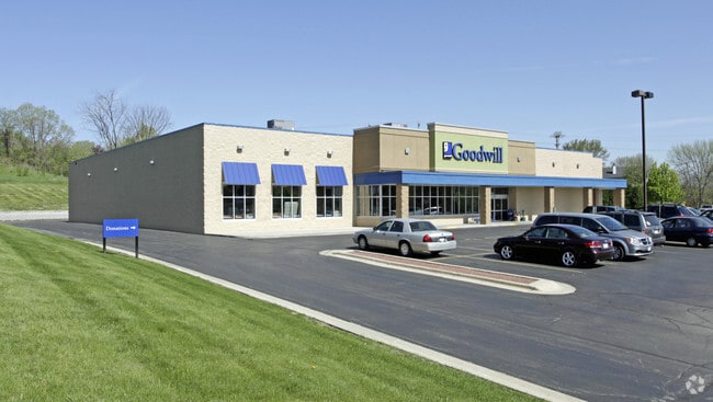
Property Record
1715 Wisconsin Ave, Grafton, WI 53024


NEARBY LISTINGS FOR SALE OR LEASE
Property Detail
1715 Wisconsin Ave
Milwaukee-Waukesha, WI
1138622 1053741 1053736 PART LOT 4 BLOCK 3 COMM 892 FT W 980 FT NE & 60 FT NW OF SE COR SE SW SEC 24 BEING #2883 CSM LOT 1 VOL 20/318 ASSESSOR'S PLAT
100500304013
Ozaukee
Commercialnec
Wisconsin
X
1,4
55089C0187G
2.79 AC
2024
North Ozaukee
2024
Milwaukee/Madison
640101
DEMOGRAPHICS near 1715 Wisconsin Ave
1 Mile
3 Mile
5 Mile
2024 Total Population
9,590
28,263
43,984
2029 Population
9,939
29,128
45,630
Pop Growth 2024-2029
+ 3.64%
+ 3.06%
+ 3.74%
Average Age
44
43
43
2024 Total Households
4,352
11,855
17,636
HH Growth 2024-2029
+ 3.65%
+ 2.94%
+ 3.65%
Median Household Inc
$67,740
$82,959
$87,993
Avg Household Size
2.20
2.30
2.40
2024 Avg HH Vehicles
2.00
2.00
2.00
Median Home Value
$263,785
$323,916
$338,012
Median Year Built
1974
1977
1977
Nearby Places
Map Layers
Map Styles
 Street
 Aerial
- Restaurants
- Banks
- Shops
- Fitness
- Groceries
PUBLIC TRANSPORTATION
AIRPORT
General Mitchell International
DRIVE
WALK
Distance
General Mitchell International
43 min
29.4 mi
SALE & LEASE HISTORY
LISTING DATE
SALE/LEASE

Jun 02, 2017
For Sale
Jul 28, 2017
For Sale
Nearby Properties
Address
Land Use
TOTAL SIZE
Lot Size
Zoning
Address
Land Use
TOTAL SIZE
Lot Size
Zoning
Address
Land Use
TOTAL SIZE
Lot Size
Zoning
14.07 AC
Address
Land Use
TOTAL SIZE
Lot Size
Zoning
Address
Land Use
TOTAL SIZE
Lot Size
Zoning
Address
Land Use
TOTAL SIZE
Lot Size
Zoning
Address
Land Use
TOTAL SIZE
Lot Size
Zoning
Address
Land Use
TOTAL SIZE
Lot Size
Zoning
23.51 AC
Address
Land Use
TOTAL SIZE
Lot Size
Zoning
21.24 AC
Address
Land Use
TOTAL SIZE
Lot Size
Zoning
Address
Land Use
TOTAL SIZE
Lot Size
Zoning
13.19 AC
Address
Land Use
TOTAL SIZE
Lot Size
Zoning
7.64 AC
Address
Land Use
TOTAL SIZE
Lot Size
Zoning
Address
Land Use
TOTAL SIZE
Lot Size
Zoning
65.65 AC
Address
Land Use
TOTAL SIZE
Lot Size
Zoning
Address
Land Use
TOTAL SIZE
Lot Size
Zoning
Address
Land Use
TOTAL SIZE
Lot Size
Zoning
Address
Land Use
TOTAL SIZE
Lot Size
Zoning
9.01 AC
Address
Land Use
TOTAL SIZE
Lot Size
Zoning
Address
Land Use
TOTAL SIZE
Lot Size
Zoning
27.88 AC
Address
Land Use
TOTAL SIZE
Lot Size
Zoning
3.02 AC
Address
Land Use
TOTAL SIZE
Lot Size
Zoning
Address
Land Use
TOTAL SIZE
Lot Size
Zoning
Address
Land Use
TOTAL SIZE
Lot Size
Zoning
9.80 AC
Address
Land Use
TOTAL SIZE
Lot Size
Zoning
9.30 AC
Address
Land Use
TOTAL SIZE
Lot Size
Zoning
Address
Land Use
TOTAL SIZE
Lot Size
Zoning
18.54 AC
Address
Land Use
TOTAL SIZE
Lot Size
Zoning
9.83 AC
Address
Land Use
TOTAL SIZE
Lot Size
Zoning
2.03 AC
Address
Land Use
TOTAL SIZE
Lot Size
Zoning
3.44 AC
Address
Land Use
TOTAL SIZE
Lot Size
Zoning
5.83 AC
The World's #1 Commercial Real Estate Marketplace
Connect with us
© 2026 CoStar Group
The information above has been obtained from sources believed reliable. While we do not doubt its accuracy we have not verified it and make no guarantee, warranty or representation about it. It is your responsibility to independently confirm its accuracy and completeness. Any projections, opinions, assumptions, or estimates used are for example only and do not represent the current or future performance of the property. The value of this transaction to you depends on tax and other factors which should be evaluated by your tax, financial, and legal advisors. You and your advisors should conduct a careful, independent investigation of the property to determine to your satisfaction the suitability of the property for your needs.