Property Record
17150 Meyers Rd, Detroit, MI 48235


NEARBY LISTINGS FOR SALE OR LEASE
Property Detail
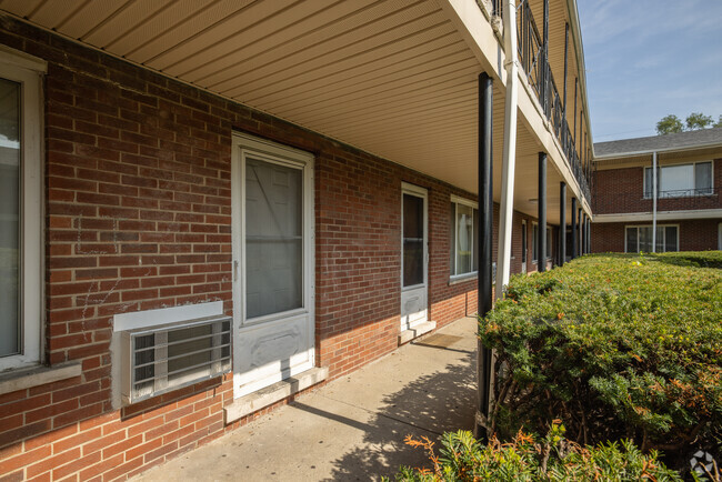
17150 Meyers Rd
16-00828-990
Mcnichols Meyers
Multifamilydwelling
S SANTA MARIA 7 THRU 1 MCNICHOLS MEYERS SUB L82 P80-1 PLATS, W C R 16/474 675.94 IRREG 242,114 SQ FT
X
Wayne
26163C0100E
Michigan
2025
5.56 AC
2025
Bagley
538700
Detroit
165,829 SF
Detroit-Warren-Dearborn, MI
DEMOGRAPHICS near 17150 Meyers Rd
1 Mile
3 Mile
5 Mile
2024 Total Population
24,179
162,639
420,173
2029 Population
23,470
160,287
418,134
Pop Growth 2024-2029
(2.93%)
(1.45%)
(0.49%)
Average Age
39
39
39
2024 Total Households
9,091
64,968
171,756
HH Growth 2024-2029
(2.97%)
(1.42%)
(0.43%)
Median Household Inc
$39,699
$39,769
$42,445
Avg Household Size
2.60
2.40
2.40
2024 Avg HH Vehicles
1.00
1.00
1.00
Median Home Value
$89,558
$92,215
$111,690
Median Year Built
1948
1949
1949
Nearby Places
Map Layers
Map Styles
 Street
 Aerial
- Restaurants
- Banks
- Shops
- Fitness
- Groceries
PUBLIC TRANSPORTATION
COMMUTER RAIL
Royal Oak Amtrak (Wolverine - Amtrak)
DRIVE
WALK
Distance
Royal Oak Amtrak (Wolverine - Amtrak)
16 min
7.1 mi
Detroit (Wolverine - Amtrak)
DRIVE
WALK
Distance
Detroit (Wolverine - Amtrak)
12 min
7.1 mi
AIRPORT
Windsor International
DRIVE
WALK
Distance
Windsor International
37 min
19.5 mi
Detroit Metro Wayne County
DRIVE
WALK
Distance
Detroit Metro Wayne County
39 min
23.7 mi
Freight Ports
Port of Toledo
DRIVE
WALK
Distance
Port of Toledo
84 min
66.9 mi
SALE & LEASE HISTORY
LISTING DATE
SALE/LEASE

Sep 24, 2016
For Sale
Feb 20, 2023
For Sale
Nearby Properties
Address
Land Use
TOTAL SIZE
Lot Size
Zoning
Address
Land Use
TOTAL SIZE
Lot Size
Zoning
925,367 SF
12.82 AC
R6
Address
Land Use
TOTAL SIZE
Lot Size
Zoning
300,830 SF
54 AC
LI
Address
Land Use
TOTAL SIZE
Lot Size
Zoning
97.05 AC
RS
Address
Land Use
TOTAL SIZE
Lot Size
Zoning
273,000 SF
17.31 AC
LI
Address
Land Use
TOTAL SIZE
Lot Size
Zoning
11.11 AC
RS
Address
Land Use
TOTAL SIZE
Lot Size
Zoning
10.32 AC
LI
Address
Land Use
TOTAL SIZE
Lot Size
Zoning
163,661 SF
8.92 AC
PD
Address
Land Use
TOTAL SIZE
Lot Size
Zoning
14.10 AC
RS
Address
Land Use
TOTAL SIZE
Lot Size
Zoning
54,672 SF
1.37 AC
R6
Address
Land Use
TOTAL SIZE
Lot Size
Zoning
116,790 SF
5.86 AC
R4
Address
Land Use
TOTAL SIZE
Lot Size
Zoning
90,958 SF
11.78 AC
R5
Address
Land Use
TOTAL SIZE
Lot Size
Zoning
153,007 SF
7.74 AC
II
Address
Land Use
TOTAL SIZE
Lot Size
Zoning
181,798 SF
10.48 AC
B4
Address
Land Use
TOTAL SIZE
Lot Size
Zoning
63,216 SF
2.87 AC
R5
Address
Land Use
TOTAL SIZE
Lot Size
Zoning
66,870 SF
2.77 AC
Address
Land Use
TOTAL SIZE
Lot Size
Zoning
100,373 SF
5.65 AC
R4
Address
Land Use
TOTAL SIZE
Lot Size
Zoning
23,852 SF
130.56 AC
R1
Address
Land Use
TOTAL SIZE
Lot Size
Zoning
315,973 SF
12.18 AC
M4
Address
Land Use
TOTAL SIZE
Lot Size
Zoning
81,031 SF
8.15 AC
PD
Address
Land Use
TOTAL SIZE
Lot Size
Zoning
64,566 SF
3.64 AC
PD
Address
Land Use
TOTAL SIZE
Lot Size
Zoning
128,759 SF
8.85 AC
LI
Address
Land Use
TOTAL SIZE
Lot Size
Zoning
248,737 SF
22.02 AC
AI
Address
Land Use
TOTAL SIZE
Lot Size
Zoning
84,453 SF
4.58 AC
Address
Land Use
TOTAL SIZE
Lot Size
Zoning
101,568 SF
8.67 AC
B-3
Address
Land Use
TOTAL SIZE
Lot Size
Zoning
76,554 SF
3.51 AC
PD
Address
Land Use
TOTAL SIZE
Lot Size
Zoning
94,920 SF
Address
Land Use
TOTAL SIZE
Lot Size
Zoning
46,292 SF
2.76 AC
R1
Address
Land Use
TOTAL SIZE
Lot Size
Zoning
71.22 AC
PUD
Address
Land Use
TOTAL SIZE
Lot Size
Zoning
87,232 SF
53.99 AC
R1
The World's #1 Commercial Real Estate Marketplace
Connect with us
© 2026 CoStar Group
The information above has been obtained from sources believed reliable. While we do not doubt its accuracy we have not verified it and make no guarantee, warranty or representation about it. It is your responsibility to independently confirm its accuracy and completeness. Any projections, opinions, assumptions, or estimates used are for example only and do not represent the current or future performance of the property. The value of this transaction to you depends on tax and other factors which should be evaluated by your tax, financial, and legal advisors. You and your advisors should conduct a careful, independent investigation of the property to determine to your satisfaction the suitability of the property for your needs.