Property Record
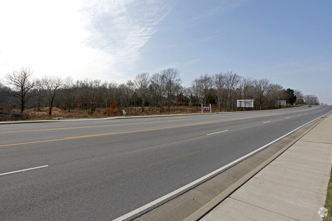
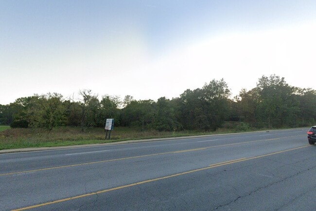
W Main St, Lebanon, TN 37087
This Property Is For Sale
NEARBY LISTINGS FOR SALE OR LEASE
Property Detail
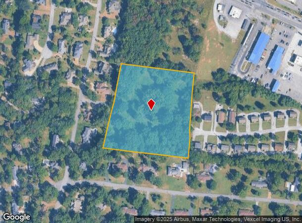
W Main St
Nashville-Davidson--Murfreesboro--Franklin, TN
Lot 5
057-100.00
LOT 5
Residentialacreage
Wilson
X
Tennessee
47189C0176D
5
2024
6 AC
2024
Wilson County
030500
Nashville
DEMOGRAPHICS near W Main St
1 Mile
3 Mile
5 Mile
2024 Total Population
5,295
27,545
55,446
2029 Population
6,277
32,771
66,073
Pop Growth 2024-2029
+ 18.55%
+ 18.97%
+ 19.17%
Average Age
41
41
40
2024 Total Households
1,982
10,751
21,426
HH Growth 2024-2029
+ 18.37%
+ 18.88%
+ 19.15%
Median Household Inc
$68,755
$67,306
$65,462
Avg Household Size
2.60
2.50
2.50
2024 Avg HH Vehicles
2.00
2.00
2.00
Median Home Value
$388,149
$357,069
$330,747
Median Year Built
1998
2002
1999
Nearby Places
- Restaurants
- Banks
- Shops
- Fitness
- Groceries
PUBLIC TRANSPORTATION
COMMUTER RAIL
Hamilton Springs Station (WEGO STAR - WeGo Public Transit)
DRIVE
WALK
Distance
Hamilton Springs Station (WEGO STAR - WeGo Public Transit)
5 min
1.9 mi
Lebanon (East Corridor Line - Tennessee Regional Transportation Authority Music City Star (Music City Star))
DRIVE
WALK
Distance
Lebanon (East Corridor Line - Tennessee Regional Transportation Authority Music City Star (Music City Star))
7 min
3.7 mi
AIRPORT
Nashville International
DRIVE
WALK
Distance
Nashville International
33 min
26.0 mi
Freight Ports
Port of Mobile
DRIVE
WALK
Distance
Port of Mobile
516 min
472.6 mi
Nearby Properties
Address
Land Use
TOTAL SIZE
Lot Size
Zoning
Address
Land Use
TOTAL SIZE
Lot Size
Zoning
265,283 SF
25 AC
Address
Land Use
TOTAL SIZE
Lot Size
Zoning
456,048 SF
22.65 AC
Address
Land Use
TOTAL SIZE
Lot Size
Zoning
438,956 SF
35.78 AC
Address
Land Use
TOTAL SIZE
Lot Size
Zoning
365,012 SF
10.77 AC
Address
Land Use
TOTAL SIZE
Lot Size
Zoning
290,607 SF
30.54 AC
Address
Land Use
TOTAL SIZE
Lot Size
Zoning
309,940 SF
34 AC
Address
Land Use
TOTAL SIZE
Lot Size
Zoning
29,168 SF
304.39 AC
Address
Land Use
TOTAL SIZE
Lot Size
Zoning
184,871 SF
9.53 AC
Address
Land Use
TOTAL SIZE
Lot Size
Zoning
159,700 SF
9.83 AC
Address
Land Use
TOTAL SIZE
Lot Size
Zoning
197,178 SF
73.06 AC
Address
Land Use
TOTAL SIZE
Lot Size
Zoning
159,256 SF
11.40 AC
Address
Land Use
TOTAL SIZE
Lot Size
Zoning
118,152 SF
5.72 AC
Address
Land Use
TOTAL SIZE
Lot Size
Zoning
41,168 SF
10.10 AC
Address
Land Use
TOTAL SIZE
Lot Size
Zoning
501,391 SF
97.50 AC
Address
Land Use
TOTAL SIZE
Lot Size
Zoning
104,219 SF
14.52 AC
Address
Land Use
TOTAL SIZE
Lot Size
Zoning
37,400 SF
3.42 AC
Address
Land Use
TOTAL SIZE
Lot Size
Zoning
46,742 SF
10.25 AC
Address
Land Use
TOTAL SIZE
Lot Size
Zoning
68,037 SF
2.89 AC
Address
Land Use
TOTAL SIZE
Lot Size
Zoning
124,632 SF
129 AC
Address
Land Use
TOTAL SIZE
Lot Size
Zoning
50,313 SF
3.47 AC
Address
Land Use
TOTAL SIZE
Lot Size
Zoning
113,072 SF
12.42 AC
Address
Land Use
TOTAL SIZE
Lot Size
Zoning
37,191 SF
13.62 AC
CG
Address
Land Use
TOTAL SIZE
Lot Size
Zoning
92,213 SF
9.90 AC
Address
Land Use
TOTAL SIZE
Lot Size
Zoning
121,101 SF
9.07 AC
R2
Address
Land Use
TOTAL SIZE
Lot Size
Zoning
151,904 SF
16.50 AC
Address
Land Use
TOTAL SIZE
Lot Size
Zoning
64,371 SF
8.85 AC
B4
Address
Land Use
TOTAL SIZE
Lot Size
Zoning
150,717 SF
155 AC
Address
Land Use
TOTAL SIZE
Lot Size
Zoning
59,599 SF
2.13 AC
CS
Address
Land Use
TOTAL SIZE
Lot Size
Zoning
74,180 SF
3.57 AC
Address
Land Use
TOTAL SIZE
Lot Size
Zoning
27,443 SF
10.04 AC
The World's #1 Commercial Real Estate Marketplace
Connect with us
© 2025 CoStar Group
The information above has been obtained from sources believed reliable. While we do not doubt its accuracy we have not verified it and make no guarantee, warranty or representation about it. It is your responsibility to independently confirm its accuracy and completeness. Any projections, opinions, assumptions, or estimates used are for example only and do not represent the current or future performance of the property. The value of this transaction to you depends on tax and other factors which should be evaluated by your tax, financial, and legal advisors. You and your advisors should conduct a careful, independent investigation of the property to determine to your satisfaction the suitability of the property for your needs.