No Photo
Property Record
1717 Catlin Dr, Barnhart, MO 63012


NEARBY LISTINGS FOR SALE OR LEASE
-
-
View all Barnhart listings for lease on LoopNet.com
Property Detail
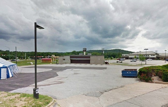
1717 Catlin Dr
08-7.0-25.0-1-001-001.23
Us Surv 893
Officebuilding
PT US SURVEY 893
AE
Jefferson
29099C0232F
Missouri
2024
0.94 AC
2025
Jefferson County
700603
St. Louis
5,828 SF
St. Louis, MO-IL
DEMOGRAPHICS near 1717 Catlin Dr
1 Mile
3 Mile
5 Mile
2024 Total Population
3,811
19,386
48,984
2029 Population
3,908
19,880
50,325
Pop Growth 2024-2029
+ 2.55%
+ 2.55%
+ 2.74%
Average Age
39
39
39
2024 Total Households
1,358
6,909
18,164
HH Growth 2024-2029
+ 2.72%
+ 2.69%
+ 2.84%
Median Household Inc
$84,257
$87,176
$79,025
Avg Household Size
2.70
2.80
2.70
2024 Avg HH Vehicles
2.00
2.00
2.00
Median Home Value
$202,799
$242,198
$225,978
Median Year Built
1982
1990
1990
Nearby Places
Map Layers
Map Styles
 Street
 Aerial
- Restaurants
- Banks
- Shops
- Fitness
- Groceries
PUBLIC TRANSPORTATION
AIRPORT
St Louis Lambert International
DRIVE
WALK
Distance
St Louis Lambert International
45 min
39.7 mi
Freight Ports
Port of Shreveport
DRIVE
WALK
Distance
Port of Shreveport
1 min
452.1 mi
SALE & LEASE HISTORY
LISTING DATE
SALE/LEASE

Sep 25, 2016
For Lease
Sep 24, 2016
For Sale
Nearby Properties
Address
Land Use
TOTAL SIZE
Lot Size
Zoning
Address
Land Use
TOTAL SIZE
Lot Size
Zoning
67,628 SF
9.17 AC
CC2
Address
Land Use
TOTAL SIZE
Lot Size
Zoning
15.10 AC
CC2
Address
Land Use
TOTAL SIZE
Lot Size
Zoning
33,734 SF
5.61 AC
CC2
Address
Land Use
TOTAL SIZE
Lot Size
Zoning
51,103 SF
10.83 AC
CC2
Address
Land Use
TOTAL SIZE
Lot Size
Zoning
160,840 SF
11.19 AC
PI
Address
Land Use
TOTAL SIZE
Lot Size
Zoning
11,113 SF
1.03 AC
CC2
Address
Land Use
TOTAL SIZE
Lot Size
Zoning
81,590 SF
5.36 AC
CC2
Address
Land Use
TOTAL SIZE
Lot Size
Zoning
33,802 SF
5.07 AC
CC2
Address
Land Use
TOTAL SIZE
Lot Size
Zoning
69,807 SF
5.38 AC
CC2
Address
Land Use
TOTAL SIZE
Lot Size
Zoning
7,395 SF
4.75 AC
CC2
Address
Land Use
TOTAL SIZE
Lot Size
Zoning
15,035 SF
2.06 AC
CC2
Address
Land Use
TOTAL SIZE
Lot Size
Zoning
77,283 SF
111.18 AC
Address
Land Use
TOTAL SIZE
Lot Size
Zoning
64,760 SF
5.91 AC
CC2
Address
Land Use
TOTAL SIZE
Lot Size
Zoning
8,365 SF
2.05 AC
Address
Land Use
TOTAL SIZE
Lot Size
Zoning
10,820 SF
1.37 AC
CC2
Address
Land Use
TOTAL SIZE
Lot Size
Zoning
5,274 SF
1.54 AC
CC2
Address
Land Use
TOTAL SIZE
Lot Size
Zoning
76,210 SF
23.97 AC
R20
Address
Land Use
TOTAL SIZE
Lot Size
Zoning
8,152 SF
1.97 AC
CC2
Address
Land Use
TOTAL SIZE
Lot Size
Zoning
27,018 SF
2.53 AC
CC2
Address
Land Use
TOTAL SIZE
Lot Size
Zoning
5,160 SF
1.04 AC
CC2
Address
Land Use
TOTAL SIZE
Lot Size
Zoning
5,606 SF
1.45 AC
CC2
Address
Land Use
TOTAL SIZE
Lot Size
Zoning
60,100 SF
5.42 AC
PI
Address
Land Use
TOTAL SIZE
Lot Size
Zoning
5,228 SF
2 AC
Address
Land Use
TOTAL SIZE
Lot Size
Zoning
15,393 SF
94.18 AC
R40
Address
Land Use
TOTAL SIZE
Lot Size
Zoning
30,693 SF
4.16 AC
CC2
Address
Land Use
TOTAL SIZE
Lot Size
Zoning
16,875 SF
2.56 AC
CC2
Address
Land Use
TOTAL SIZE
Lot Size
Zoning
23,400 SF
36 AC
CC2
Address
Land Use
TOTAL SIZE
Lot Size
Zoning
26,520 SF
3.21 AC
CC2
The World's #1 Commercial Real Estate Marketplace
Connect with us
© 2025 CoStar Group
The information above has been obtained from sources believed reliable. While we do not doubt its accuracy we have not verified it and make no guarantee, warranty or representation about it. It is your responsibility to independently confirm its accuracy and completeness. Any projections, opinions, assumptions, or estimates used are for example only and do not represent the current or future performance of the property. The value of this transaction to you depends on tax and other factors which should be evaluated by your tax, financial, and legal advisors. You and your advisors should conduct a careful, independent investigation of the property to determine to your satisfaction the suitability of the property for your needs.