Property Record
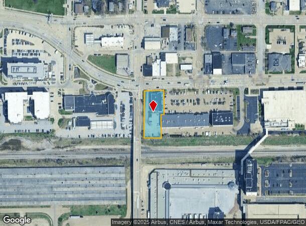
1717 State St, Bettendorf, IA 52722


NEARBY LISTINGS FOR SALE OR LEASE
Property Detail
1717 State St
Davenport-Moline-Rock Island, IA-IL
River's Edge Add
842862401
RIVER'S EDGE ADD LOT: 001 RIVER'S EDGE ADD LOT1
Professionalbldglegalinsurancerealestateetc
Scott
X
Iowa
19163C0369G
1
2025
0.68 AC
2025
Outlying Scott County
013300
Davenport/Moline/Rock Island
12,486 SF
DEMOGRAPHICS near 1717 State St
1 Mile
3 Mile
5 Mile
2024 Total Population
6,004
75,043
192,794
2029 Population
5,954
73,907
190,459
Pop Growth 2024-2029
(0.83%)
(1.51%)
(1.21%)
Average Age
41
40
40
2024 Total Households
2,721
31,465
80,648
HH Growth 2024-2029
(0.92%)
(1.56%)
(1.26%)
Median Household Inc
$56,474
$60,087
$59,824
Avg Household Size
2.20
2.30
2.30
2024 Avg HH Vehicles
2.00
2.00
2.00
Median Home Value
$171,101
$156,992
$159,383
Median Year Built
1957
1956
1960
Nearby Places
Map Layers
Map Styles
 Street
 Aerial
- Restaurants
- Banks
- Shops
- Fitness
- Groceries
PUBLIC TRANSPORTATION
AIRPORT
Quad Cities International
DRIVE
WALK
Distance
Quad Cities International
25 min
13.9 mi
Freight Ports
Port Milwaukee
DRIVE
WALK
Distance
Port Milwaukee
238 min
208.4 mi
SALE & LEASE HISTORY
LISTING DATE
SALE/LEASE

Apr 13, 2020
For Lease
Nearby Properties
Address
Land Use
TOTAL SIZE
Lot Size
Zoning
Address
Land Use
TOTAL SIZE
Lot Size
Zoning
7,934 SF
8.41 AC
Address
Land Use
TOTAL SIZE
Lot Size
Zoning
157,798 SF
25.37 AC
Address
Land Use
TOTAL SIZE
Lot Size
Zoning
157,587 SF
33.92 AC
Address
Land Use
TOTAL SIZE
Lot Size
Zoning
9,000 SF
408.98 AC
Address
Land Use
TOTAL SIZE
Lot Size
Zoning
5,296 SF
67.13 AC
Address
Land Use
TOTAL SIZE
Lot Size
Zoning
1,800 SF
60.86 AC
Address
Land Use
TOTAL SIZE
Lot Size
Zoning
4,944 SF
17.91 AC
Address
Land Use
TOTAL SIZE
Lot Size
Zoning
26,472 SF
17.67 AC
Address
Land Use
TOTAL SIZE
Lot Size
Zoning
76,808 SF
1.94 AC
Address
Land Use
TOTAL SIZE
Lot Size
Zoning
111,979 SF
6.86 AC
Address
Land Use
TOTAL SIZE
Lot Size
Zoning
64,661 SF
147.01 AC
Address
Land Use
TOTAL SIZE
Lot Size
Zoning
3,543 SF
14.79 AC
Address
Land Use
TOTAL SIZE
Lot Size
Zoning
65,958 SF
15.04 AC
Address
Land Use
TOTAL SIZE
Lot Size
Zoning
115,968 SF
2.93 AC
Address
Land Use
TOTAL SIZE
Lot Size
Zoning
67,813 SF
2.56 AC
Address
Land Use
TOTAL SIZE
Lot Size
Zoning
54,606 SF
7.68 AC
Address
Land Use
TOTAL SIZE
Lot Size
Zoning
15,353 SF
3.73 AC
Address
Land Use
TOTAL SIZE
Lot Size
Zoning
61,794 SF
8.83 AC
Address
Land Use
TOTAL SIZE
Lot Size
Zoning
159,973 SF
0.87 AC
Address
Land Use
TOTAL SIZE
Lot Size
Zoning
71,108 SF
8.99 AC
Address
Land Use
TOTAL SIZE
Lot Size
Zoning
80,337 SF
3 AC
Address
Land Use
TOTAL SIZE
Lot Size
Zoning
172,320 SF
32.46 AC
Address
Land Use
TOTAL SIZE
Lot Size
Zoning
40,307 SF
1.25 AC
Address
Land Use
TOTAL SIZE
Lot Size
Zoning
67,439 SF
2.02 AC
Address
Land Use
TOTAL SIZE
Lot Size
Zoning
114,160 SF
2.97 AC
Address
Land Use
TOTAL SIZE
Lot Size
Zoning
8,870 SF
8.01 AC
Address
Land Use
TOTAL SIZE
Lot Size
Zoning
73,353 SF
3.45 AC
Address
Land Use
TOTAL SIZE
Lot Size
Zoning
110,300 SF
1.10 AC
Address
Land Use
TOTAL SIZE
Lot Size
Zoning
79,949 SF
2.63 AC
The World's #1 Commercial Real Estate Marketplace
Connect with us
© 2025 CoStar Group
The information above has been obtained from sources believed reliable. While we do not doubt its accuracy we have not verified it and make no guarantee, warranty or representation about it. It is your responsibility to independently confirm its accuracy and completeness. Any projections, opinions, assumptions, or estimates used are for example only and do not represent the current or future performance of the property. The value of this transaction to you depends on tax and other factors which should be evaluated by your tax, financial, and legal advisors. You and your advisors should conduct a careful, independent investigation of the property to determine to your satisfaction the suitability of the property for your needs.