Property Record
1718 Arlington Ave, Pittsburgh, PA 15210
NEARBY LISTINGS FOR SALE OR LEASE
Property Detail
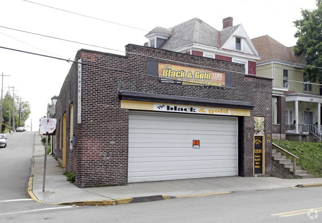
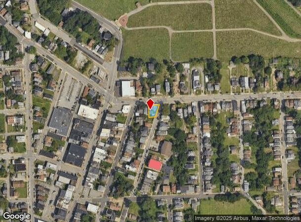
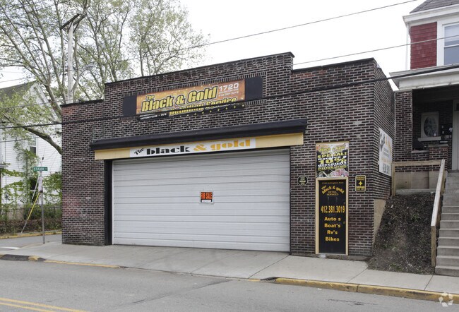
1718 Arlington Ave
Pittsburgh, PA
C Foerster Plan
0014-M-00241-0000-00
C FOERSTER PLAN PTS 9-10-11 LOT 65.17X70.59X39 .83 RR IN ALL ARLINGTON COR STAMM AVE 1 STY BRK GAR 1720
Autorepair
Allegheny
X
Pennsylvania
42003C0361H
241
2024
0.09 AC
2025
South Pittsburgh/Rte 51
481000
Pittsburgh
2,484 SF
DEMOGRAPHICS near 1718 Arlington Ave
1 mile
3 mile
5 mile
2024 Total Population
24,587
157,339
394,666
2029 Population
24,381
155,819
388,831
Pop Growth 2024-2029
(0.84%)
(0.97%)
(1.48%)
Average Age
38
38
40
2024 Total Households
11,378
71,342
180,757
HH Growth 2024-2029
(1.02%)
(0.95%)
(1.54%)
Median Household Inc
$44,141
$54,264
$62,771
Avg Household Size
2.10
1.90
2.00
2024 Avg HH Vehicles
1.00
1.00
1.00
Median Home Value
$95,321
$153,015
$184,680
Median Year Built
1947
1950
1950
Nearby Places
Map Layers
Map Styles
 Street
 Aerial
Transit
 Traffic
 Biking
Places
Listings with unknown addresses are not visible on the map
- Restaurants
- Banks
- Shops
- Fitness
- Groceries
PUBLIC TRANSPORTATION
COMMUTER RAIL
Drive
Walk
Distance
6 min
2.8 mi
AIRPORT
Pittsburgh International
Drive
Walk
Distance
Pittsburgh International
30 min
19.1 mi
Arnold Palmer Regional
Drive
Walk
Distance
Arnold Palmer Regional
69 min
43.1 mi
Nearby Properties
Address
Land Use
TOTAL SIZE
Lot Size
Zoning
Address
Land Use
TOTAL SIZE
Lot Size
Zoning
10.41 AC
Address
Land Use
TOTAL SIZE
Lot Size
Zoning
Address
Land Use
TOTAL SIZE
Lot Size
Zoning
14.70 AC
Address
Land Use
TOTAL SIZE
Lot Size
Zoning
Address
Land Use
TOTAL SIZE
Lot Size
Zoning
3.86 AC
Address
Land Use
TOTAL SIZE
Lot Size
Zoning
13.75 AC
Address
Land Use
TOTAL SIZE
Lot Size
Zoning
10.14 AC
Address
Land Use
TOTAL SIZE
Lot Size
Zoning
31.36 AC
Address
Land Use
TOTAL SIZE
Lot Size
Zoning
13.53 AC
Address
Land Use
TOTAL SIZE
Lot Size
Zoning
3.35 AC
Address
Land Use
TOTAL SIZE
Lot Size
Zoning
5.11 AC
Address
Land Use
TOTAL SIZE
Lot Size
Zoning
10.55 AC
Address
Land Use
TOTAL SIZE
Lot Size
Zoning
13.85 AC
Address
Land Use
TOTAL SIZE
Lot Size
Zoning
3.91 AC
Address
Land Use
TOTAL SIZE
Lot Size
Zoning
2.68 AC
Address
Land Use
TOTAL SIZE
Lot Size
Zoning
5.77 AC
Address
Land Use
TOTAL SIZE
Lot Size
Zoning
4.05 AC
Address
Land Use
TOTAL SIZE
Lot Size
Zoning
19.39 AC
Address
Land Use
TOTAL SIZE
Lot Size
Zoning
12.80 AC
Address
Land Use
TOTAL SIZE
Lot Size
Zoning
0.92 AC
Address
Land Use
TOTAL SIZE
Lot Size
Zoning
3.78 AC
Address
Land Use
TOTAL SIZE
Lot Size
Zoning
2.46 AC
Address
Land Use
TOTAL SIZE
Lot Size
Zoning
8.97 AC
Address
Land Use
TOTAL SIZE
Lot Size
Zoning
2.52 AC
Address
Land Use
TOTAL SIZE
Lot Size
Zoning
1.20 AC
Address
Land Use
TOTAL SIZE
Lot Size
Zoning
0.85 AC
Address
Land Use
TOTAL SIZE
Lot Size
Zoning
2.31 AC
Address
Land Use
TOTAL SIZE
Lot Size
Zoning
1.43 AC
Address
Land Use
TOTAL SIZE
Lot Size
Zoning
Address
Land Use
TOTAL SIZE
Lot Size
Zoning
The World's #1 Commercial Real Estate Marketplace
Connect with us
© 2026 CoStar Group
The information above has been obtained from sources believed reliable. While we do not doubt its accuracy we have not verified it and make no guarantee, warranty or representation about it. It is your responsibility to independently confirm its accuracy and completeness. Any projections, opinions, assumptions, or estimates used are for example only and do not represent the current or future performance of the property. The value of this transaction to you depends on tax and other factors which should be evaluated by your tax, financial, and legal advisors. You and your advisors should conduct a careful, independent investigation of the property to determine to your satisfaction the suitability of the property for your needs.